
Online training: Learn how to add easy-to-use SAR processing to your remote sensing applications
8th June 2020
Online training: Learn how to add easy-to-use SAR processing to your remote sensing applications
8th June 2020
Online training: Learn how to add easy-to-use SAR processing to your remote sensing applications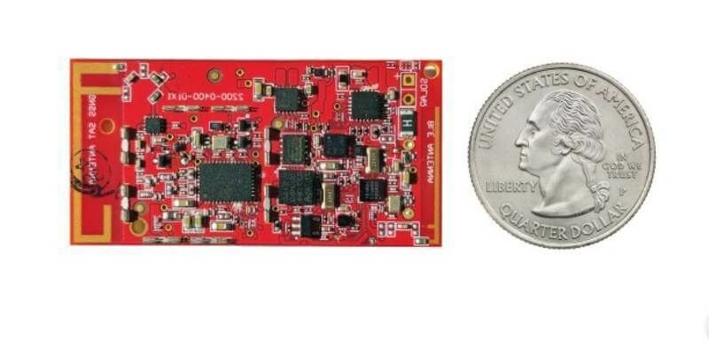
8th June 2020
Globalstar Launches New ST100 Satellite Transmitter4th June 2020
Tersus Introduces BX40C RTK Board, A Compact GNSS Board with Full Constellation Tracking
2nd June 2020
Mitsubishi Corporation and NTT complete acquisition of 30% stake in HERE Technologies
2nd June 2020
Integrated Skills Limited joins forces with Yotta to help councils drive down service route costs and build up public trust25th May 2020
New quad-band receiver delivers ultra-precise position for demanding marine operations21st May 2020
Garmin GFC 500 and GFC 600 autopilots approved for additional aircraft models19th May 2020
Garmin Autoland achieves FAA certification for general aviation aircraft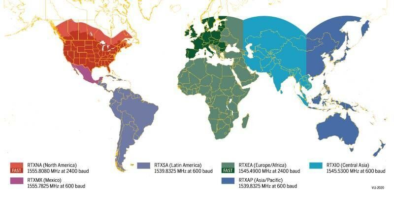
12th May 2020
Coast-to-Coast U.S. Coverage Now Deployed for Trimble's CenterPoint RTX Fast Correction Service
5th May 2020
Qinertia, SBG Systems’ PPK software now supports third-party IMUs and offers a GNSS post-processing license covering all major GNSS receivers16th April 2020
De Boer Marine to Deliver Managed Data Services
14th April 2020
Agency develops software to estimate areas of degraded GNSS service
25th March 2020
GPS III SV02 Satellite Control Authority Transferred to 2 SOPS23rd March 2020
mosaic-X5 opens the door to ultra-precise positioning for high-volume applications3rd March 2020
GNSS heading just got more efficient with Septentrio's AsteRx SB ProDirect18th February 2020
ESA and Galileo Services to Discuss European GNSS at Military PNT 202016th February 2020
Septentrio launches web shop for high-accuracy GNSS receiver modules12th February 2020
Mesa 3 Rugged Tablet Now Available Running Android11th February 2020
New GPS III Satellite Delivered to Cape Canaveral10th January 2020
Septentrio introduces a new GNSS/INS system in a rugged housing10th January 2020
Septentrio PPK gets a boost with BaseFinder10th January 2020
Septentrio mosaic enables NXP's V2X solution10th January 2020
Septentrio and Analog Devices Collaborate13th December 2019
Geoscience Packages Reveal Prospectivity of North West Shelf and Banda Arc12th December 2019
Extending the Reach of GNSS with LTI Laser Rangefinders11th December 2019
Kinesis Telematics Keeps Canoeists on Track8th December 2019
Trimble Acquires Can-Net and iBase Networks21st November 2019
Exploring the Use of Autonomous Robots in Construction11th November 2019
SSTL ships Target satellite for Astroscale's ELSA-d mission11th November 2019
Hemisphere debuts All-New GNSS OEM Boards6th November 2019
New Trimble R12 GNSS Receiver Boosts Surveying Performance
25th October 2019
Purple WiFi acquires indoor navigation specialist18th October 2019
Vice Admiral Robert Sharp to Keynote the 2019 AGS Fall Symposium17th October 2019
The winners of the 2019 IoT Global Awards are …16th October 2019
Latest Update Of The “GIS Surveyor” Mobile Application Is Out
9th October 2019
Septentrio and Core announce a GNSS receiver which uses Japan's CLAS
7th October 2019
SXblue Launches SXblue ToolBox Application on iOS27th September 2019
Esri ArcGIS QuickCapture supports Eos Arrow GNSS25th September 2019
Juniper Systems Announces New Geode GNS2 Sub-meter GPS Receiver20th September 2019
Hemisphere GNSS Announces Next-Generation S621 GNSS Survey Smart Antenna18th September 2019
Trimble Pivot Platform and Alloy GNSS Reference Receiver Now Support BeiDou Generation III Signals16th September 2019
GeoMax demonstrates its unrivalled GNSS portfolio at Intergeo (hall3, stand F3.043)
11th September 2019
Septentrio unveils a new GNSS/INS receiver for Unmanned Aerial Systems5th September 2019
Garmin G1000H NXi-equipped Bell 407GXi helicopter achieves IFR certification