public comment on major revision to OGC Abstract SpecificationTopic 0
21st May 2019
public comment on major revision to OGC Abstract SpecificationTopic 021st May 2019
public comment on major revision to OGC Abstract SpecificationTopic 021st May 2019
Space Flight Laboratory to Highlight ‘Gray Jay’
21st May 2019
New Open Payload version of Delair DT26 UAV allows custom configuration_enabling_tru.jpg)
21st May 2019
Introducing Multipurpose Autonomous sub-surface Training Target21st May 2019
Airbus signs MOU with Hellenic Space Agency for future space cooperation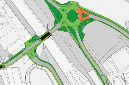
21st May 2019
Gaist’s mapping solution could boost efficiency for utilities market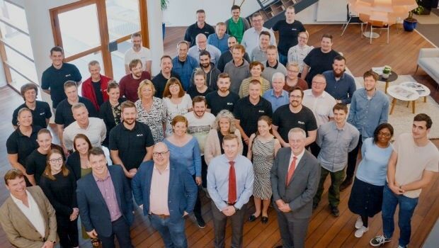
21st May 2019
Sonardyne acquires maritime survey software and construction specialist EIVA20th May 2019
Hemisphere GNSS Announces All-New OEM Positioning & Heading Boards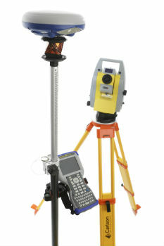
20th May 2019
Carlson NR3: New compact, lightweight GNSS Receiver20th May 2019
AEC Next and SPAR 3D Expo & Conference Gets Underway Tomorrow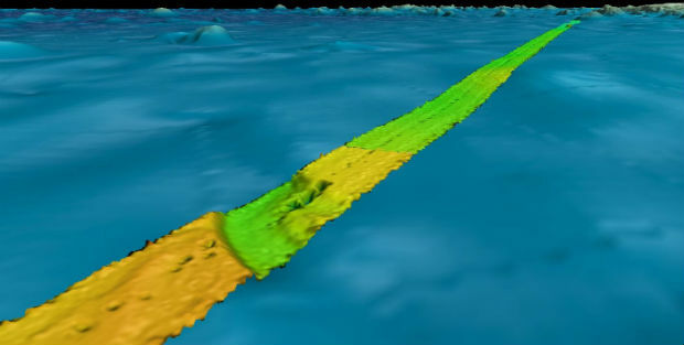
20th May 2019
Fugro supports two ocean mapping initiatives20th May 2019
Topcon accepts John Deere Supplier Innovation Award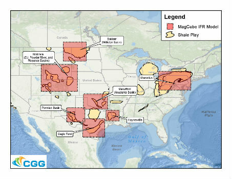
20th May 2019
ERM Advanced Telematics Enters the Rapidly Expanding Electric Vehicle Market19th May 2019
Get Kids Into Survey comes to GEO Business 2019
18th May 2019
Maptitude 2019 Adds Enhanced MapPoint and Streets & Trips Features
17th May 2019
Orbit GT to exhibit and present at GeoBusiness, London, UK17th May 2019
Participation Invited on GIS Management Practices Survey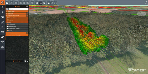
17th May 2019
Western Distribution selects Fugro to unlock value from airborne survey data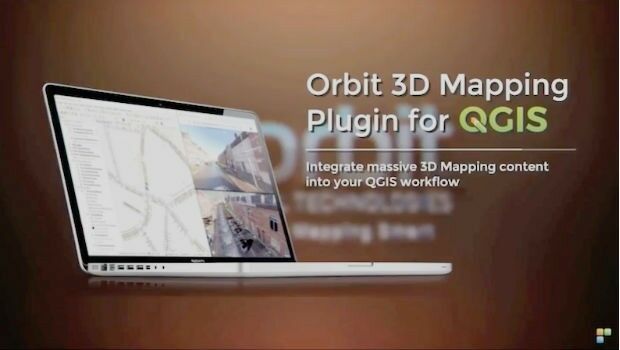
17th May 2019
Orbit GT launches 3D Mapping portfolio v19.5 and QGIS plugin update.
16th May 2019
SITECO's System for the Emilia Romagna Railways Inspection16th May 2019
Elsevier supports the American Association of Petroleum Geologists’16th May 2019
OGC seeks public comment on candidate Sensor Model Language (SensorML) v2.1 standard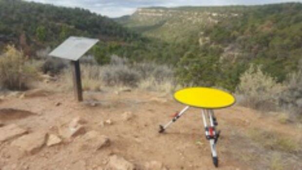
16th May 2019
Routescene's improved approach to quantifying accuracy
16th May 2019
360-degree camera provides ground-based imaging following weather disasters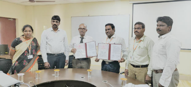
16th May 2019
Terra Drone India and Vignan University set up drone lab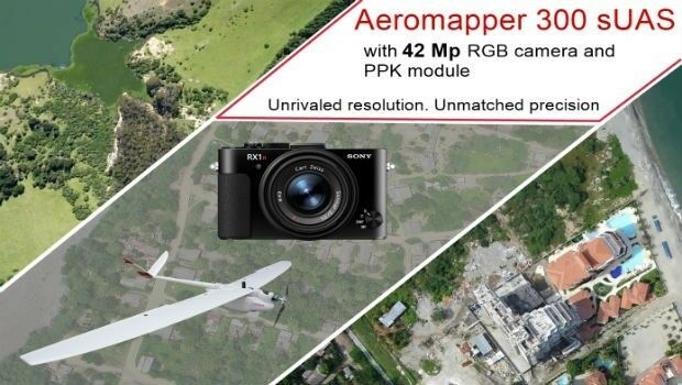
15th May 2019
AEROMAPPER 300 & 42Mp camera with PPK bundle
15th May 2019
Jesse Norman MP conveyed need for high quality data for transport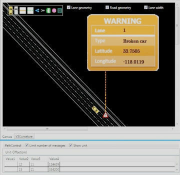
15th May 2019
Mitsubishi Electric and HERE develop road hazard alert system
15th May 2019
Geodata – the currency of the future centre stage at INTERGEO 2019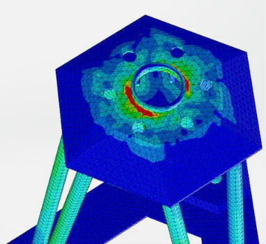
15th May 2019
Putting a revolutionary new offshore wind foundation to the test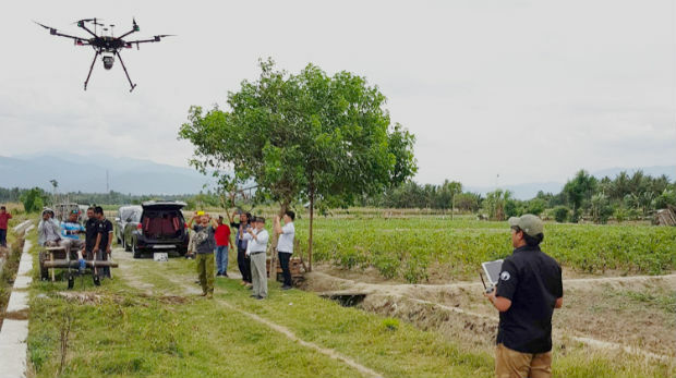
15th May 2019
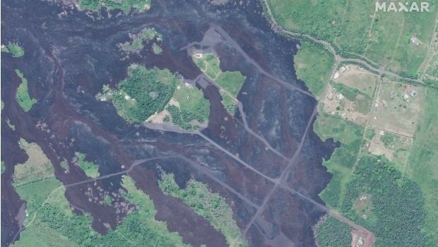
Satellite Imagery: Hawaii One Year After Kilauea Eruption
14th May 2019
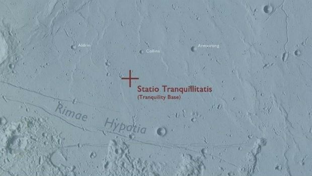
Ordnance Survey map commemorates 1969 moon landing
14th May 2019
OGC seeks public comment on update to GeoTIFF standard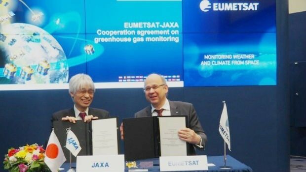
14th May 2019
EUMETSAT, Japanese space agency to cooperate on greenhouse gas monitoring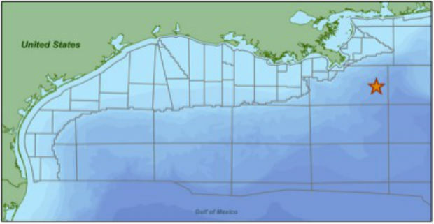
14th May 2019
CGG Begins First Multi-Client Ocean Bottom Node Survey
14th May 2019
IQGeo launches ‘reality-centric’ geospatial platform_dipping_sonar_onboard_Seagull.jpg)
14th May 2019
The Israeli Navy Deployed its HELRAS equipped Seagull
14th May 2019
Bentley Systems Announces the Acquisition of Keynetix14th May 2019
Future of Mining EMEA arrives in London with the focus on technology,