
Blue Marble's Latest Innovations in the Global Mapper LiDAR Module
9th February 2017
Blue Marble's Latest Innovations in the Global Mapper LiDAR Module9th February 2017
Blue Marble's Latest Innovations in the Global Mapper LiDAR Module
8th February 2017
Commercial UAV Expo Europe Announces Early Backers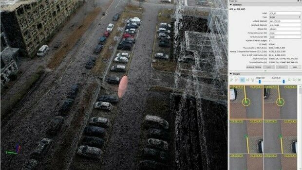
8th February 2017
Achieving best accuracy with error ellipsoid in Pix4Dmapper rayCloud8th February 2017
CSA Presents Advanced Coastal Aerial Image Analysis Techniques
6th February 2017
GAF AG and Partners to Investigate the Future Evolution of Copernicus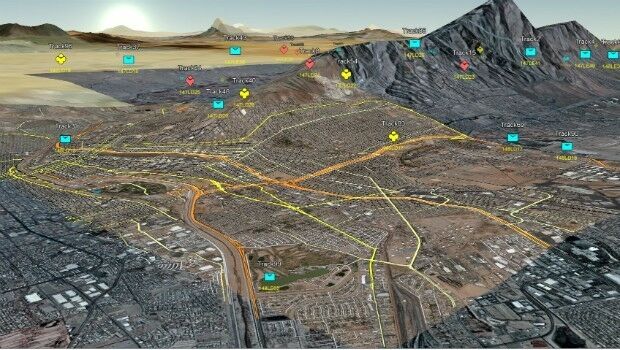
2nd February 2017
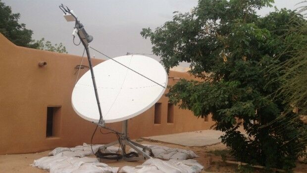
Satcom for EU security missions in Mali, Niger and Somalia
1st February 2017
The 2nd generation Meteosat-8 satellite takes over Meteosat-7
1st February 2017
East View Expands South China Sea Imaging Capabilities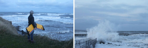
31st January 2017
A Case Study on Long-Term Erosion Mapping in Northeast England31st January 2017
Blue Marble Teams Up with Pointerra to Provide Cloud-Based LiDAR Data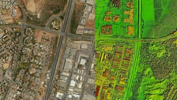
25th January 2017
PCI Selects Sole Authorized Reseller in Ecuador25th January 2017
COSMO-SkyMed data and services for the Japanese government
25th January 2017
Pix4D speaks at UN Panel on Food Security
24th January 2017
Airport GIS | LiDAR, imagery and feature extraction for airport operations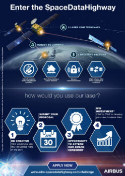
12th January 2017
Airbus Launches “Enter the SpaceDataHighway” Challenge
11th January 2017
Collaboration with Deimos Imaging to Support the PanGeo Alliance
9th January 2017
Ecometrica secures breakthrough £14.2m UK Space Agency contract6th January 2017
Sky’s the limit for DJI and HERE’s global drone mapping partnership5th January 2017
Earth-i has Quality at the Heart of Operations
28th December 2016
Collaboration on Miniature Hyperspectral Ultraspectral Camera System
23rd December 2016
DigitalGlobe Releases “20 Iconic Satellite Images from 2016” Gallery22nd December 2016
exactEarth Awarded Project with UK Space Agency21st December 2016
exactEarth to Provide India's Navy with Satellite AIS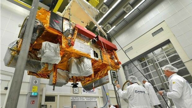
21st December 2016
Revised Global Mapper Training Curriculum and Schedule for 2017
19th December 2016
Copernicus Sentinel-3 Marine Data flow to users in Africa19th December 2016
Five Years of the First Pléiades Satellite Launch Celebrated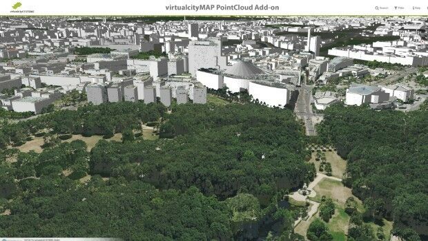
16th December 2016
virtualcitySYSTEMS simplifies handling of massive geodata
15th December 2016
Major contract award from the Government of Queensland, Australia
14th December 2016
GAF, GeoVille, SIRS and e-GEOS contracted by the EEA14th December 2016
Lossless Compression of Harris Geiger-Mode LiDAR Data in GeoExpress13th December 2016
Geosoft announces technology partnership with Corescan3rd December 2016
DigitalGlobe Releases First Image from WorldView-4 Satellite2nd December 2016
Scientists’ weather predictions stop farmers losing crop2nd December 2016
Satellite Imagery: Gatlinburg, Tennessee Wildfire30th November 2016
LIDARUSA Chooses Global Mapper for Erosion Control29th November 2016
Uncommon Information and Technology Leaders Form Partnership16th November 2016
Successful Controls with Remote Sensing Campaign15th November 2016
Copernicus´ Second Eye is ready to meet its Launcher14th November 2016
Orbit GT and CycloMedia join forces with product integration.