
Bluesky Appoints Dr Simon Schuffert to Lead Software Innovation
7th June 2016
Bluesky Appoints Dr Simon Schuffert to Lead Software Innovation
7th June 2016
Bluesky Appoints Dr Simon Schuffert to Lead Software Innovation
6th June 2016
Hexagon Software Aids Emergency Response in Gotthard Base Tunnel
6th June 2016
Final reminder about the Early Careers Network webinar - 8th June 20163rd June 2016
Esri Brings GIS to Young Developers for National Day of Civic Hacking
3rd June 2016
Topcon and Bentley integration between MAGNET 4.0 and ProjectWise2nd June 2016
Trimble Unity Enables Sutton and East Surrey Water1st June 2016
Topcon announces increased integration with Autodesk scanning software1st June 2016
PDF3D's New PowerPoint Plugin Brings Interactive 3D to Presentations
1st June 2016
Allies announces partnership with what3words
1st June 2016
Handheld Adds eTicketing Capabilities to its ALGIZ RT7 Rugged Tablet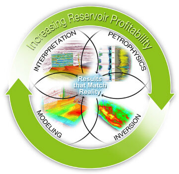
1st June 2016
CGG GeoSoftware Integrates Geoscience Disciplines
1st June 2016
The Bureau of Land Management Uses Esri Story Maps
1st June 2016
Esri to Host Imaging and Mapping Forum at Esri User Conference1st June 2016
Learn to Start Working with ArcGIS Earth from Esri.jpg)
31st May 2016
Unique Mapping Solution from ScientificAerospace and DroneMetrex28th May 2016
Stories on historical battle shared through innovative technology28th May 2016
Learn How to Use ArcGIS Pro from Esri for Dynamic Image Processing27th May 2016
FARO® announces the release of PointSense & VirtuSurv 17.0
27th May 2016
Juniper Systems Announces New Windows 10 Rugged Tablet: Mesa 2™27th May 2016
Strategic cooperation: BARTHAUER software installed at RIWA27th May 2016
PCI Delivers High Volume Production System to Skymap Global Singapore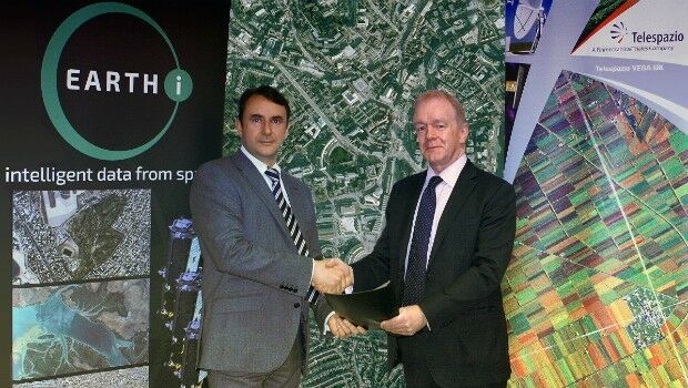
26th May 2016
Earth-i and Telespazio Vega Sign Memorandum of Understanding26th May 2016
Bentley Calls for Submissions to the 2016 Be Inspired Awards26th May 2016
Esri's Marcella Cavallaro to Lead DATA Act Discussion Panel26th May 2016
OGC® invites Proposals for an Arctic Spatial Data Pilot project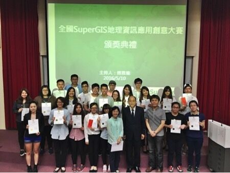
26th May 2016
Shih Hsin University wins SuperGIS Youth Award 2016
26th May 2016
CV. Gunapris Elecom Selects SuperPad as GIS Solution25th May 2016
Nation's Largest Geography Department Honors Esri Education Team25th May 2016
CPH and AICP-CM Credits and Important GIS and Health Topics25th May 2016
OceanWise grows Distributor Network in South East Asia
24th May 2016
OGC and SIBA sign Memorandum of Understanding
24th May 2016
Cadcorp provides support for latest OS OpenData™ products and OS MasterMap® styling.24th May 2016
3D Laser Mapping Launches New Multiplatform Mapping System
23rd May 2016
FOCUS 35 Total Station Monitors Dam For Movement20th May 2016
Esri Will Showcase Dedicated Winter Maintenance Solutions20th May 2016
Luciad Set to Disrupt at 2016 Geospatial World Forum20th May 2016
Advancing Digital Strategy through GIS Technology19th May 2016
Learn to Model Spatial Data and Quantify Uncertainty Using Esri ArcGIS19th May 2016
LizardTech to Demo Latest Version of Express Server19th May 2016
ABACO is awarded the 2016 Geospatial Intelligence Award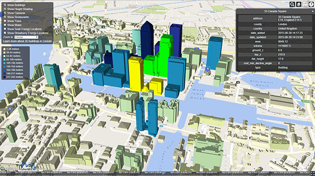
19th May 2016
CartoConsult delivers instant Smart City models with web streaming
19th May 2016
OGC requests comment on revision of its GWML2 specification