

Leica Geosystems announces world’s first fused airborne sensor
5th July 2016
Leica Geosystems announces world’s first fused airborne sensor

WYG appointed on United Utilities AMP6 Geospatial Services Framework
4th July 2016
WYG appointed on United Utilities AMP6 Geospatial Services Framework
Bentley and Shell Announce Global Framework Agreement
1st July 2016
Bentley and Shell Announce Global Framework Agreement
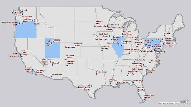
Esri Fosters Industry Innovation with Unique Startup Program
1st July 2016
Esri Fosters Industry Innovation with Unique Startup Program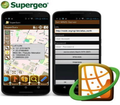
SuperSurv Helps French Environment Department in Alsace
1st July 2016
SuperSurv Helps French Environment Department in Alsace
SuperGIS Desktop helps Public Works Department in Serang, Indonesia
1st July 2016
SuperGIS Desktop helps Public Works Department in Serang, Indonesia
Esri Pledging $500,000 to White House Data Driven Justice Initiative
1st July 2016
Esri Pledging $500,000 to White House Data Driven Justice Initiative
Faster Access to More Video Formats in New Release of ArcGIS
1st July 2016
Faster Access to More Video Formats in New Release of ArcGIS
Innovators, Scholars, and Storytellers Celebrated at the Esri Awards
1st July 2016
Innovators, Scholars, and Storytellers Celebrated at the Esri Awards
Trimble R2 GNSS Receiver Now Available for Data Collection
30th June 2016
Trimble R2 GNSS Receiver Now Available for Data Collection
SAP® Geographical Enablement Framework Simplifies Spatial Processing
30th June 2016
SAP® Geographical Enablement Framework Simplifies Spatial Processing
New dataset of accessible greenspace for Scotland
30th June 2016
New dataset of accessible greenspace for Scotland
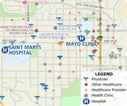
Free Healthcare Data for Use with Maptitude
30th June 2016
Free Healthcare Data for Use with Maptitude
Esri Launches National Green Infrastructure Initiative for Planning
29th June 2016
Esri Launches National Green Infrastructure Initiative for Planning
what3words partners with global logistics giant Aramex
29th June 2016
what3words partners with global logistics giant Aramex
Pinellas County Receives Esri Enterprise GIS Award
29th June 2016
Pinellas County Receives Esri Enterprise GIS Award

Septentrio Announces Upgrades for Altus NR2 and PinPoint-GIS
29th June 2016
Septentrio Announces Upgrades for Altus NR2 and PinPoint-GIS
Arun District Council grasps opportunities by migrating to Cadcorp GIS
29th June 2016
Arun District Council grasps opportunities by migrating to Cadcorp GIS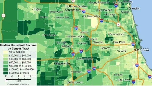

TomTom and sensewhere Team Up to Bring Location Based Service Indoors
29th June 2016
TomTom and sensewhere Team Up to Bring Location Based Service Indoors
1Spatial’s 1Integrate for ArcGIS Goes Mobile with Collector for ArcGIS
29th June 2016
1Spatial’s 1Integrate for ArcGIS Goes Mobile with Collector for ArcGIS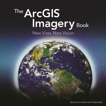
The ArcGIS Imagery Book: New View. New Vision.
28th June 2016
The ArcGIS Imagery Book: New View. New Vision.
DigitalGlobe and Esri Announce New Long-Term Partnership
28th June 2016
DigitalGlobe and Esri Announce New Long-Term Partnership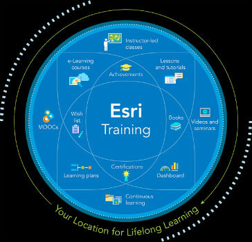
Esri Offers Free Self-Paced E-Learning to Customers
28th June 2016
Esri Offers Free Self-Paced E-Learning to Customers
Charlotte Uses Cityworks across Entire City
27th June 2016
Charlotte Uses Cityworks across Entire City
Bentley Announces Global Framework Agreement with Shell
27th June 2016
Bentley Announces Global Framework Agreement with Shell
Mapillary Awarded as Technology Pioneer by World Economic Forum
27th June 2016
Mapillary Awarded as Technology Pioneer by World Economic Forum

Arun District Council grasps opportunities by migrating to Cadcorp GIS
24th June 2016
Arun District Council grasps opportunities by migrating to Cadcorp GIS
MapAction and World Food Programme help Sri Lankan Government
24th June 2016
MapAction and World Food Programme help Sri Lankan Government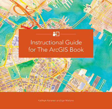
Learn GIS with Esri's Handy, New Companion Guide to The ArcGIS Book
24th June 2016
Learn GIS with Esri's Handy, New Companion Guide to The ArcGIS Book

Airbus Defense and Space Partners with AMREL
24th June 2016
Airbus Defense and Space Partners with AMREL
Maptitude Now Has 14+ Million Australian Address Points
23rd June 2016
Maptitude Now Has 14+ Million Australian Address Points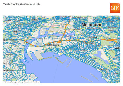
GfK releases new geodata for Australia and New Zealand
23rd June 2016
GfK releases new geodata for Australia and New Zealand
1Spatial Solves Data Problems at Esri User Conference
23rd June 2016
1Spatial Solves Data Problems at Esri User Conference