GeoPlace announces the winners of the 2016 Exemplar Awards
4th May 2016
GeoPlace announces the winners of the 2016 Exemplar Awards4th May 2016
GeoPlace announces the winners of the 2016 Exemplar Awards3rd May 2016
OGC requests comment for Land Administration Domain Working Group
2nd May 2016
indoo.rs Named a 2016 Cool Vendor in Mobile and Wireless by Gartner
29th April 2016
Mallorca hosts the fourteenth day of Smartcities29th April 2016
CGG Enters into Agreement for the Sale of its Multi-Physics Business29th April 2016
UNITAR and Esri Host Annual Conference in Geneva28th April 2016
Merrick Awarded Contract with Southern Nevada Water Authority
28th April 2016
Announcing Bentley OpenRoads Navigator App28th April 2016
DigitalGlobe to Provide WorldView-4 Access for a New Customer28th April 2016
DigitalGlobe Reports First Quarter 2016 Results
27th April 2016
Aligned Assets are pleased to announce partnership with what3words
27th April 2016
Bluesky Aerial Photomap Definitive Information Resource for Irish Council
27th April 2016
Latest SuperGIS Desktop 3.3 Is Now Available!
27th April 2016
Local Community in France Selects SuperPad for River Management
27th April 2016
SuperSurv Assists the Bird Survey in France
27th April 2016
Esri Announces Winners of the Visualize Your Water Quality Challenge27th April 2016
RAC’s New Canadian Rail Portal is powered by K2 Geospatial’s JMap
26th April 2016
BaSYS User Conference: A valuable benefit to every user!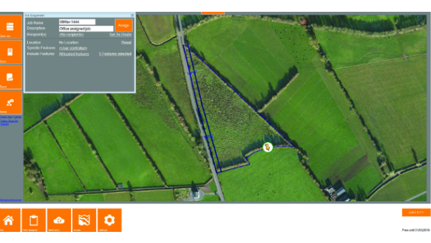
26th April 2016
KOREC partners with Cadcorp to integrate field data capture26th April 2016
SimActive Achieves Breakthrough with Latest Correlator3D™ Release
25th April 2016
GAF implement Geological Data Management Information System in Malawi
23rd April 2016
First Bentley ContextCapture Workshop in Madrid, Spain
22nd April 2016
Mesa 2™ Rugged Tablet Helps Law Enforcement Professionals22nd April 2016
Jane Goodall Celebrates Earth Day with Esri and University of Redlands21st April 2016
OGC requests comment on charter for Coordinate Reference System21st April 2016
Intergraph® Damage Assessment for Electric Utility Companies21st April 2016
Itron’s OpenWay Riva™ IoT Solution Receives Grid Edge 2016 Award
21st April 2016
Bluesky 3D Photomaps Help Manage City’s Green Space
21st April 2016
Leica Geosystems wins 2 Red Dot Design Awards21st April 2016
Program Details Announced for 2016 URISA GIS and Health Symposium20th April 2016
Global maps from Europa helps to define no-fly zones for drones20th April 2016
Unlocking Unlimited Potential for Utilities19th April 2016
Yotta Helps Wigan Council Optimise Highways Asset Management19th April 2016
MobileMapper 300 Now Driven by DigiTerra Explorer v719th April 2016
South Australia Water Ensures Customer Supply using Bentley's Amulet19th April 2016
Esri UK Receives Prestigious Geographical Association Publishers Award19th April 2016
European retail in 2016: Slow but real-value growth
19th April 2016
Over 50% off Trimble Business Center. It’s a Big Deal.18th April 2016
Learn to Extend Esri ArcGIS Pro Functionality with Add-ins18th April 2016
Final Stage of SPOT Gen3® Messenger Rollout18th April 2016
Emapsite launches postcode-level UK windstorm peril model18th April 2016
Yotta Heralds European Expansion with Raft of New Appointments