
1Spatial & National Trust Streamline Agricultural Grant Process
19th January 2017
1Spatial & National Trust Streamline Agricultural Grant ProcessThe compilation, reproduction and dissemination of maps and charts by means of manual (analogue) or digital techniques, tools and workflows. This topic covers the compilation, reproduction, dissemination and use of both analogue (paper) and digital maps, charts and atlases. As well as the science of cartography, including georeferencing and geocoding, digital techniques for compiling and generating various types of raster and vector maps and charts are covered, as are the digital mapping tools and Geographic Information Systems available for this purpose. The application of cartography for aeronautical, terrestrial and marine purposes is also covered
19th January 2017
1Spatial & National Trust Streamline Agricultural Grant Process
19th January 2017
Global Telesat Communications sold 10,000 SPOT Satellite Devices
19th January 2017
New CT5 Rugged Smartphone Launched from Cedar by Juniper Systems
18th January 2017
Abstract Submissions for 10th National GIS in Transit Conference18th January 2017
OGC seeks public comment on OGC WaterML 2 - Part 318th January 2017
Elsevier Adds More Than One Million Figures and Tables to Geofacets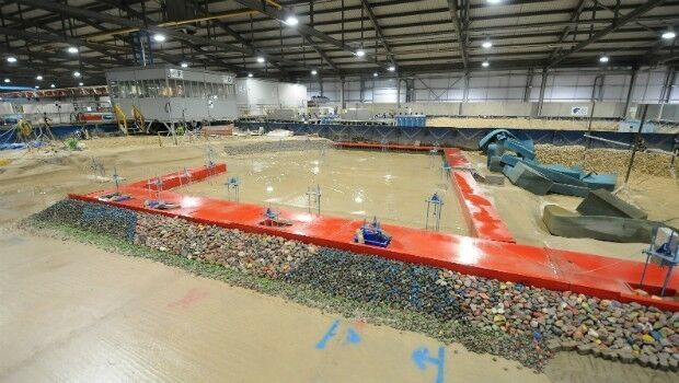
18th January 2017
Optimising the design for the Aberdeen Harbour expansion18th January 2017
PTV Group opens its first branch office in Africa
18th January 2017
TomTom acquires Autonomos, a Berlin-based autonomous driving start-up18th January 2017
RICS Geomatics Evening Lectures 2016-17 sessions18th January 2017
Esri Releases Advanced Analytics to Increase Retail Sales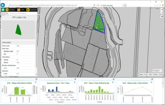
17th January 2017
Hexagon Mining acquires mine production management firm17th January 2017
Accurate Location from Smartphone Callers17th January 2017
PCI Geomatics Marks Milestone in Cloud-Based Image Processing
17th January 2017
GSSI LineTrac™ to Detect AC Power and RF Energy in Conduits
17th January 2017
The new FARO® FocusM 70 Laser Scanner Sets New Standards17th January 2017
Sint Maarten adopts what3words as postal addressing system17th January 2017
OGC seeks public comment on candidate InfraGML encoding standards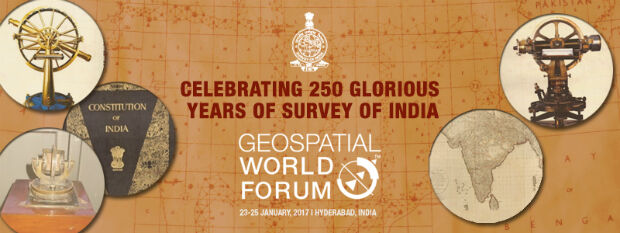
17th January 2017
Survey of India Welcomes you to Celebrate 250 Years of its Legacy
17th January 2017
FREQUENTIS’ location information supports NASA UAS test in Nevada
17th January 2017
GeoMax names Gottlieb Nestle GmbH master dealer17th January 2017
OceanWise chosen for its Environmental Monitoring and Display System17th January 2017
SimActive Used for Coastal Erosion Assessment with UAVs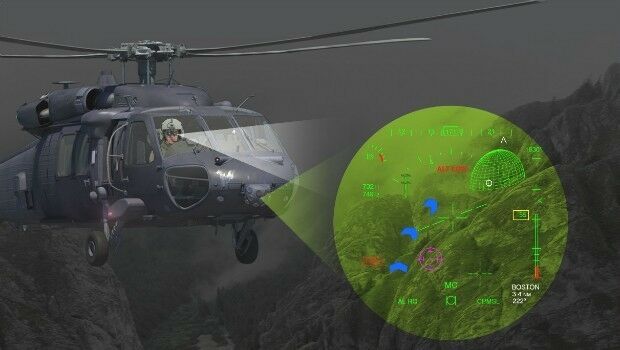
17th January 2017
Elbit to Supply BrightNite™ Systems to an Air Force in a NATO Country
17th January 2017
Fugro Attains Authorised Economic Operator Status
17th January 2017
Juniper Systems Launches New CT7G Rugged Tablet
17th January 2017
Seafloor's Dockside Demo at Ocean Business '17, Southampton:16th January 2017
The key to flying drones safely is education16th January 2017
HERE supports rollout of Baidu Maps to rest of world
16th January 2017
exactEarth Adds 4 Payloads to Second Generation Constellation16th January 2017
Successful Initial Launch for Second Generation Real-Time Constellation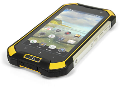
16th January 2017
Juniper Systems has a new rugged Android smartphone available
16th January 2017
Juniper Systems has a new rugged Android® tablet available16th January 2017
How IoT and Data Science are creating Smart Transportation in Europe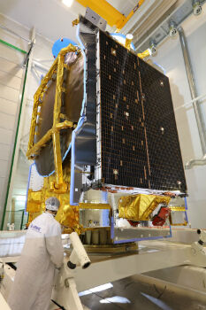
16th January 2017
Airbus Defence and Space ships SES-10 telecom satellite to launch site
16th January 2017
£2.3m investment sets standard for North West DCs16th January 2017
Infinera Transforms Subsea Networks to Cloud Scale13th January 2017
USGIF CEO Reappointed as Vice Chair of the NGAC
13th January 2017
ARBOR Wins 4 Taiwan Excellence Awards, that's a begin for 2017
13th January 2017
TomTom Traffic increases global footprint to 54 countries13th January 2017
Esri Takes the Stage at the NRF Convention12th January 2017
CGG GeoSoftware donates HampsonRussell software12th January 2017
Airbus sells its shares in Atlas Elektronik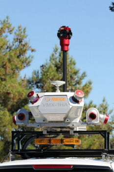
12th January 2017
Caltrans Takes Delivery of the RIEGL VMX-1HA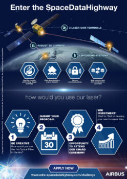
12th January 2017
Airbus Launches “Enter the SpaceDataHighway” Challenge