
Telit Introduces New Family of Industry’s Smallest GNSS Modules
17th March 2017
Telit Introduces New Family of Industry’s Smallest GNSS ModulesThe compilation, reproduction and dissemination of maps and charts by means of manual (analogue) or digital techniques, tools and workflows. This topic covers the compilation, reproduction, dissemination and use of both analogue (paper) and digital maps, charts and atlases. As well as the science of cartography, including georeferencing and geocoding, digital techniques for compiling and generating various types of raster and vector maps and charts are covered, as are the digital mapping tools and Geographic Information Systems available for this purpose. The application of cartography for aeronautical, terrestrial and marine purposes is also covered
17th March 2017
Telit Introduces New Family of Industry’s Smallest GNSS Modules
16th March 2017
The Getech Group Delivers Insights into African Lakes from Space
16th March 2017
Paul McMann appointed to British Drilling Association head committee
16th March 2017
Why desktop is essential for drone mapping in agriculture16th March 2017
AND International Publishers NV 2016 Results16th March 2017
Global Mapper SDK and LiDAR Module SDK v18.1 Released15th March 2017
Cityworks Celebrates Long-Time Partnership with Esri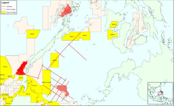
15th March 2017
CGG Completes Processing of Carabao Regional Multi-Client Study15th March 2017
OGC approves new standard for geological science data15th March 2017
House of Lords Heeds RazorSecure Warning On Future of Self-Drive Cars15th March 2017
First high-power all-electric EUTESAT 172B satellite shipped to Kourou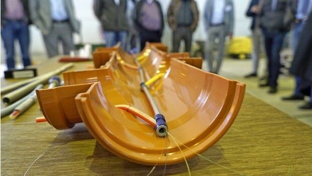
15th March 2017
Cables and sewers: cross-sector line management with BaSYS

15th March 2017
Esri Will Donate Software to Fight Drug Addiction
15th March 2017
Drones Save Almost One Life Per Week on Average14th March 2017
Egis and Camas are creating an aviation academy in Abidjan14th March 2017
On-the-Fly Earth Observation Imagery Analytics in Your Browser14th March 2017
RICS unveils plans to get tough on conflicts of interest:
14th March 2017
OGC announces kickoff of major innovation testbed – Testbed 1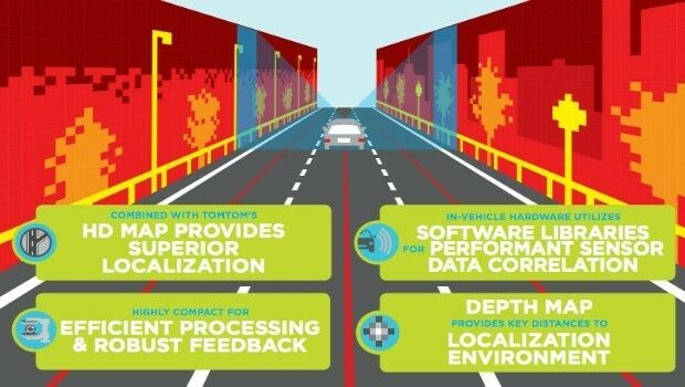
14th March 2017
TomTom HD Map for Autonomous Driving Covers US Interstate Road Network
14th March 2017
New Alfa Romeo STELVIO launches with TomTom Navigation and Maps14th March 2017
OS and Trimble collaborate to aid geospatial industry innovation.jpg)
14th March 2017
Spatial Startup Companies to Share the Latest Innovations
13th March 2017
Orbit GT and LiDAR USA upgrade ScanLook and Snoopy interoperability
13th March 2017
InterDrone Acquired by Emerald Expositions LLC
13th March 2017
Highways England renews Trimble VRS Now license13th March 2017
Cadcorp SIS service release supports latest OS products
13th March 2017
ABPmer develops NW Europe tide and surge database
13th March 2017
VSTEP and SMR Links team up to bring simulator solutions to UAE
13th March 2017
Wärtsilä launches SmartPredict for safer ship manoeuvring guidance13th March 2017
OGC publishes Moving Features Access specification10th March 2017
Comment on proposed Unmanned Systems Domain Working Group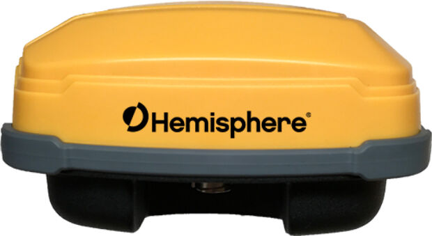
10th March 2017
Rugged GNSS Smart Antenna for Machine Control Applications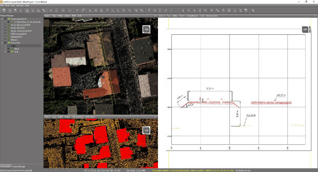
10th March 2017
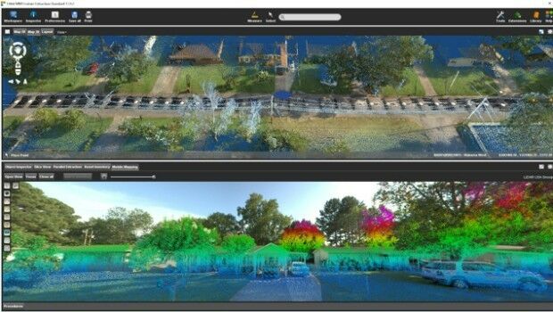
Fast LiDAR data viewer streamlines work of local governments
10th March 2017
NCTech announce ColourCloud processing hosted on Google Cloud Platform10th March 2017
DFS and Unifly cooperate on the development of drone app10th March 2017
1Spatial Enables Northumbrian Water to Save £8.75m10th March 2017
Topcon announces update to 2D indicate system for excavation10th March 2017
Topcon announces new Wi-Fi capability for imaging station10th March 2017
Oak Ridge National Laboratory Selects Esri
10th March 2017
Esri President Jack Dangermond to Talk at ASPRS IGTF 20179th March 2017
New remote job site support service with bundled cellular data