.jpg)
Lovell Johns, wins new GIS contract with European Commission
27th March 2017
Lovell Johns, wins new GIS contract with European CommissionThe compilation, reproduction and dissemination of maps and charts by means of manual (analogue) or digital techniques, tools and workflows. This topic covers the compilation, reproduction, dissemination and use of both analogue (paper) and digital maps, charts and atlases. As well as the science of cartography, including georeferencing and geocoding, digital techniques for compiling and generating various types of raster and vector maps and charts are covered, as are the digital mapping tools and Geographic Information Systems available for this purpose. The application of cartography for aeronautical, terrestrial and marine purposes is also covered
27th March 2017
Lovell Johns, wins new GIS contract with European Commission27th March 2017
Charter rate reduction of CGG’s operated fleet:

24th March 2017
Challenging the Zeitgeist of Digital:: WSA-mobile Winners Announcement
24th March 2017
Every Emerging Technology. One Digital Transformation Journey24th March 2017
OceanWise to host Marine Data Management & GIS Workshop in Edinburgh24th March 2017
Driver App to Improve Driver Behavior and Save Additional Costs

24th March 2017
5 Valuable Lessons Learned About Drones in Construction23rd March 2017
TCarta Marine, DHI and DigitalGlobe to Unveil Bathymetric Data Portal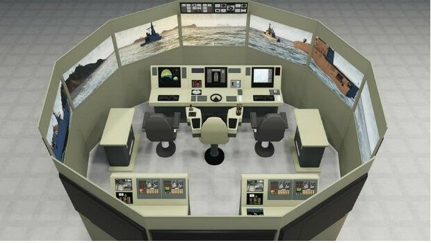
23rd March 2017
VSTEP and Damen sign cooperation agreement
23rd March 2017
Stand and Deliver! Could parcel drones trigger the Highwayman's return23rd March 2017
Public comment on proposed Indexed 3D Scene Layers (I3S) Community23rd March 2017
GSDI Marine/Coastal SDI Best Practice Webinar 29 March at 1400h CET
23rd March 2017
Ctrack Introduces Driver App To Improve Driver Behaviour23rd March 2017
Kaspersky Industrial CyberSecurity for Energy boosts protection
23rd March 2017
Advances in Digital Agriculture at Digital Earth & Locate17
22nd March 2017
Hexagon Mining selects downtown Tucson, AZ for headquarters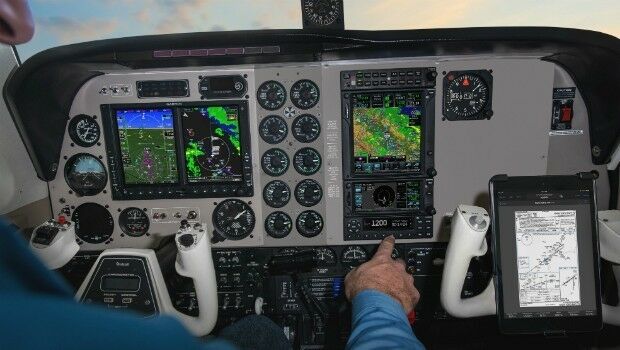
22nd March 2017
Garmin announces EASA certification for all-in-one ADS-B transponders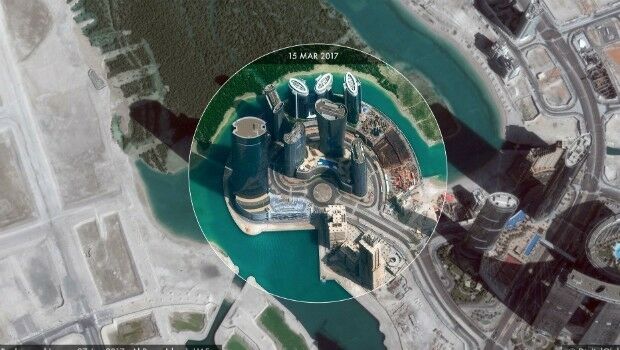
22nd March 2017
High-resolution satellite images made accessible to anyone
22nd March 2017
3D Repo Brings Cloud Expertise to Government Funded Smart Infrastructure Project
22nd March 2017
Avalanche Photodiode Arrays from LASER COMPONENTS
22nd March 2017
Four Instrument Partners to Accelerate Autonomous Vehicle Development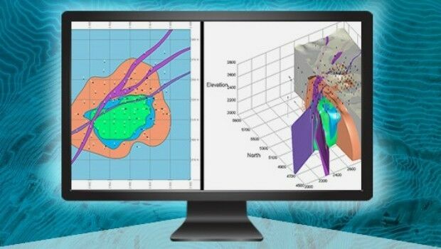
21st March 2017
Esri Teams with IBM to Offer Cutting-Edge Spatial Analytics
21st March 2017
5 GOOD REASONS to follow Pix4D on Social Media21st March 2017
The ‘control room of the future’ is here to help police keep you safe
21st March 2017
Terrabotics Joins the Geological Remote Sensing Group
21st March 2017
Optimised Transport Plans with Paragon Waypoint Mapping21st March 2017
Cyberbit honored as Leader in Cyber Security Detection and Response21st March 2017
Pressure mounts on Australian Government to launch space agency21st March 2017
PAZ to extend Airbus radar satellite constellation21st March 2017
SimActive and Tianlifa Launch Integrated UAV Solution
20th March 2017
Northumbrian Water's Transferred Drains and Sewers Project Boosted20th March 2017
4 Ways Maptitude 2017 Saves You Time & Money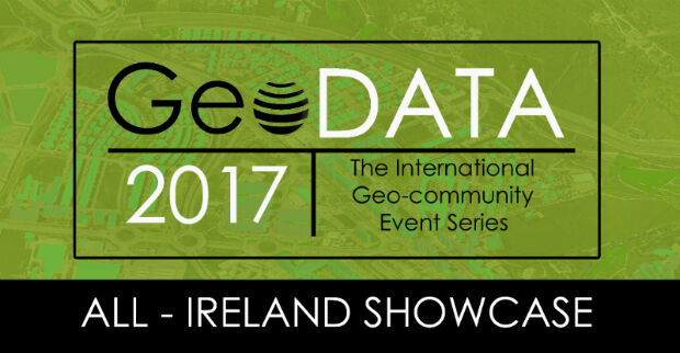
20th March 2017
GeoDATA 2017 Ireland Next Week - Last chance to register
20th March 2017
New generation of the Ekinox Series inertial sensors from SBG Systems
20th March 2017
US Blue Tech Companies Promoted at Ocean Business 2017
20th March 2017
Maxoptra’s Routing & Scheduling Solution is Purrrrrfect for Natures Menu20th March 2017
Digpro chosen by yet another Norwegian energy company
20th March 2017
Michael Gerhards is new Head of CyberSecurity Germany20th March 2017
Greg Bentley to Hold Press Conference at SPAR 3D Expo
18th March 2017
Image Platform Bundles for Analysis, Management, and Analytics18th March 2017
Esri Brings The Science of Where to IBM InterConnect 2017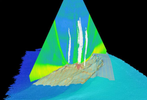
17th March 2017
Fugro hunts for more Hydrocarbon Seeps in US Gulf of Mexico
17th March 2017
GEO Business 2017 launches its FREE to attend workshops