
Eni to utilize Earth Observation satellite data and services
10th May 2017
Eni to utilize Earth Observation satellite data and servicesThe compilation, reproduction and dissemination of maps and charts by means of manual (analogue) or digital techniques, tools and workflows. This topic covers the compilation, reproduction, dissemination and use of both analogue (paper) and digital maps, charts and atlases. As well as the science of cartography, including georeferencing and geocoding, digital techniques for compiling and generating various types of raster and vector maps and charts are covered, as are the digital mapping tools and Geographic Information Systems available for this purpose. The application of cartography for aeronautical, terrestrial and marine purposes is also covered
10th May 2017
Eni to utilize Earth Observation satellite data and services
10th May 2017
Blue Marble Releases Beta Version of Global Mapper Mobile for Android10th May 2017
Fugro Commences Mareano Survey For Norwegian Hydrographic Service9th May 2017
European satellite technology maps storms, pollution and marine safety9th May 2017
PCI Geomatics Now a Planet Ecosystem Partner9th May 2017
2G Robotics and Sonardyne announce new collaboration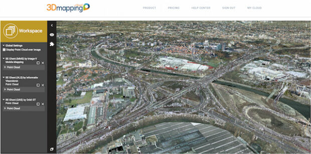
9th May 2017
Orbit GT updates 3D Mapping Cloud with faster Performance Measurements9th May 2017
Applied Streetview Selects Quarry One Eleven for Marketing9th May 2017
Get on the road with the new Wi-Fi® enabled TomTom VIA 53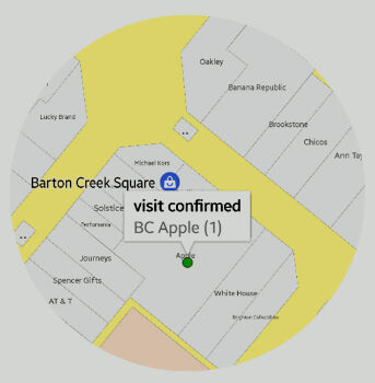
9th May 2017
sensewhere Launches Visit Confirmation Platform for Mobile Attribution9th May 2017
Wantman Completes Extensive UAV Project with SimActive9th May 2017
BARTHAUER is consistently expanding its information offering8th May 2017
Parrot develops its commercial drone offer with end-to-end solutions8th May 2017
Google Streetview used to find Britain's “lost” 1930s-era cycleways8th May 2017
OGC invite to Environmental Linked Feature Interoperability Experiment
8th May 2017
Phase One Industrial Adds Support for DJI Drones8th May 2017
exactEarth Announce Two-Year $1.45 Million Commercial Customer Renewal8th May 2017
Scotland's top civil engineering experts to tackle water crises8th May 2017
Septentrio launches AsteRx-m2 OEM GNSS Receiver8th May 2017
Elbit to Provide Satellite-On-the-Move Systems to the IMOD8th May 2017
Essential Energy use innovative technology to manage vegetation6th May 2017
Esri and UNOSAT Host GIS for a Sustainable World Conference5th May 2017
PCI Geomatics to Present OBIA and InSAR Papers at ISRSE-375th May 2017
Handheld Business Partner Conference Agenda Announced
5th May 2017
Springfield, Illinois, Maximizes Efficiency with Cityworks ELA4th May 2017
Save €225! Early-bird pricing ends tomorrow4th May 2017
Hydrographic Surveys To Improve Maritime Safety In Papua New Guinea
4th May 2017
Mesa 2 Rugged Tablet Now Runs on Android OS4th May 2017
37th EARSeL Symposium - Prague, Czech Republic in June 27-30, 2017.3rd May 2017
HERE placed at the core of connected services for drivers3rd May 2017
A Triumph of Keynote Lectures to delve into Space Exploration3rd May 2017
Harvard Seeking Submissions for “Map of the Month” Contest
3rd May 2017
senseFly Corridor solution boosts linear mapping projects efficiency3rd May 2017
PMeV elects Frequentis Director as new executive board member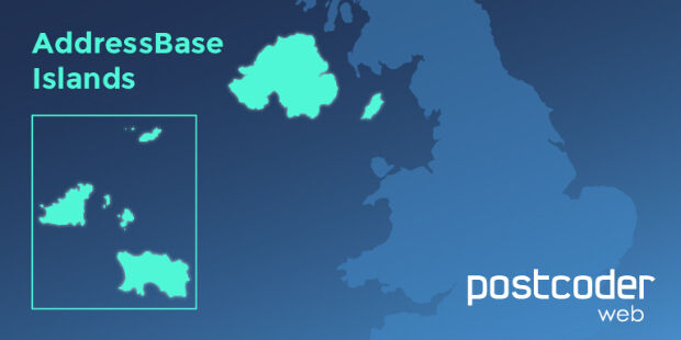
3rd May 2017
Allies strengthens PostCoder with AddressBase Islands3rd May 2017
Global Mapper and Geographic Calculator Free Academic License Program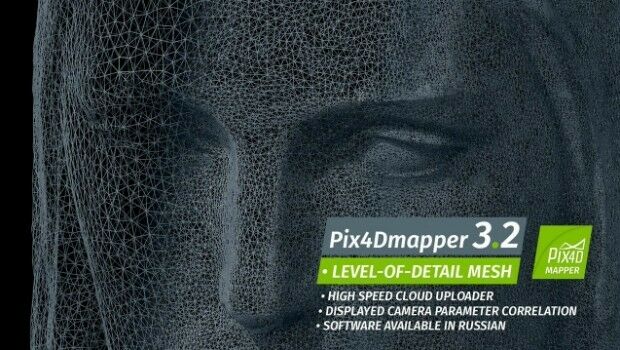
2nd May 2017
Pix4Dmapper 3.2 Now Generates Tiled Level-of-Detail (LoD) Mesh