
Geoblink selects HERE to help the retail industry
11th July 2017
Geoblink selects HERE to help the retail industryThe compilation, reproduction and dissemination of maps and charts by means of manual (analogue) or digital techniques, tools and workflows. This topic covers the compilation, reproduction, dissemination and use of both analogue (paper) and digital maps, charts and atlases. As well as the science of cartography, including georeferencing and geocoding, digital techniques for compiling and generating various types of raster and vector maps and charts are covered, as are the digital mapping tools and Geographic Information Systems available for this purpose. The application of cartography for aeronautical, terrestrial and marine purposes is also covered
11th July 2017
Geoblink selects HERE to help the retail industry11th July 2017
Esri Adds Airbus Global Elevation Data to Online Maps11th July 2017
UK MoD to present Ministerial Address at Global MilSatCom 201710th July 2017
ArcGIS Hub Gives Communities a Powerful Location-Based Solution
10th July 2017
Esri Honored by San Diego with "Esri User Conference Day" Proclamation10th July 2017
PCI Geomatics to Present Historical Airphoto Processing Case Study.jpg)
10th July 2017
Obstacle Obstruction Survey at Massachusetts Airport10th July 2017
Esri and HERE sign multi-year map data licensing agreement10th July 2017
Schneider Electric to Showcase at 2017 Esri User Conference10th July 2017
BreezoMeter is using live road traffic data from HERE10th July 2017
Truck Parking Europe with the first pan-European reservation platform
10th July 2017
OS releases open dataset and free map of Britain’s Greenspaces10th July 2017
Europa Technologies: finalist in prestigious insurance industry awards7th July 2017
New members of the Supervisory Board of AND7th July 2017
HERE powers over-the-air map updates for Volvo cars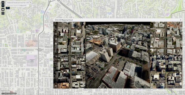
7th July 2017
Orbit GT and Vexcel Imaging showcase Oblique and Streetlevel 3D data
7th July 2017
Carbomap Ready to Map the World with Advanced LiDAR on Fixed-Wing UAV6th July 2017
DAT/EM Systems International Updates Landscape Software
6th July 2017
Esri's Online Learning Guide for Working with Imagery and ArcGIS6th July 2017
MARSS Launches Networked Tactical Command And Control System6th July 2017
Local Roads given £1bn funding boost in the nick of time6th July 2017
CompassCom to Release CompassTracker App at Esri User Conference
6th July 2017
Trimble Catalyst: High-Accuracy, On-Demand Positioning-as-a-Service
6th July 2017
Trimble Catalyst: High-Accuracy, On-Demand Positioning-as-a-Service
6th July 2017
senseFly announces worry-free service package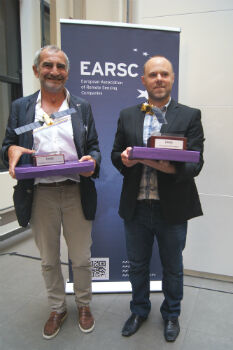
6th July 2017
And the winners of the EARSC Awards 2017 are...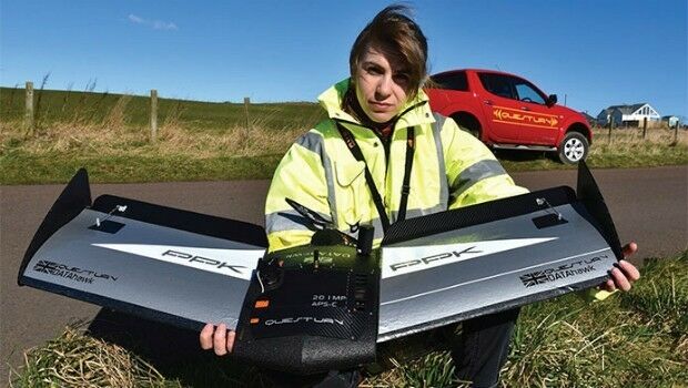
6th July 2017
Ultra-high accuracy version of DATAhawk now available` - DATAhawk PPK6th July 2017
Disy and Talend Introduce New Connector for Geospatial Integration6th July 2017
Driverless vehicle trials underway in London6th July 2017
BepiColombo - a four in one satellite to uncover Mercury´s mysteries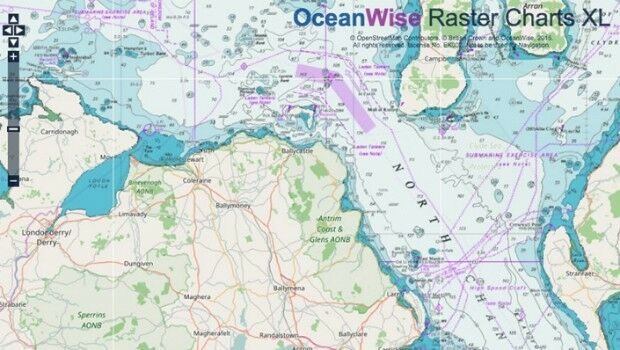
6th July 2017
Marine Mapping Agreement for Northern Ireland6th July 2017
TomTom to Develop New Traffic Service for Future of Driving6th July 2017
Proceedings of the GSDI 15 World Conference Published6th July 2017
URISA Activities During the Esri User Conference
6th July 2017
Esri CityEngine 2017 Makes Urban Planning More Efficient
5th July 2017
NEW Architectural 3D Models of UK available from Joanna-James5th July 2017
LafargeHolcim Cements Relationship with Maxoptra Route Planning5th July 2017
OGC announces Geoscience Australia as its newest Principal Member
5th July 2017
Sentinel-3 OLCI and SLSTR Level 2 Products now fully operational
5th July 2017
Understanding large-scale plant health with Satellite Data5th July 2017
Wärtsilä waterjets to power new Danish high-speed ferry4th July 2017
Copernicus App Lab is open for registration