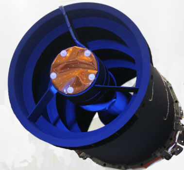
Elbit Space Imaging Systems, JUPITER and VENµS Were Launched
2nd August 2017
Elbit Space Imaging Systems, JUPITER and VENµS Were LaunchedThe compilation, reproduction and dissemination of maps and charts by means of manual (analogue) or digital techniques, tools and workflows. This topic covers the compilation, reproduction, dissemination and use of both analogue (paper) and digital maps, charts and atlases. As well as the science of cartography, including georeferencing and geocoding, digital techniques for compiling and generating various types of raster and vector maps and charts are covered, as are the digital mapping tools and Geographic Information Systems available for this purpose. The application of cartography for aeronautical, terrestrial and marine purposes is also covered
2nd August 2017
Elbit Space Imaging Systems, JUPITER and VENµS Were Launched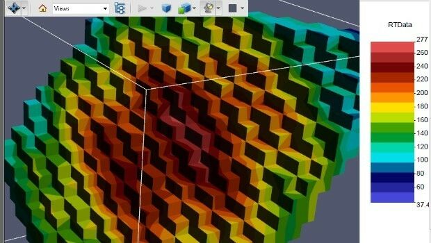
1st August 2017
PDF3D Release PV+ 5.4 Visualization & Publishing Update
1st August 2017
3D Repo Appoints Carmen Fan as Chief Technology Officer1st August 2017
Geovation Programme now open to location and land disruptors
1st August 2017
Manoeuvring the largest offshore floating facility ever built
31st July 2017
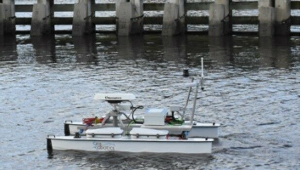
SeaRobotics Wins Contract for Autonomous Hydrographic Survey Vehicles31st July 2017
Skyline Software Systems Releases Terraexplorer for Web V7.0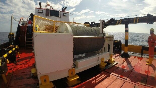
31st July 2017
Okeanus Science & Technology Acquires DT Marine Products


29th July 2017
Free Point of Interest Data by Type for Use with Maptitude28th July 2017
UAS Mapping Certification Program at Commercial UAV Expo 201728th July 2017
New subscription plans for Oasis montaj suite of geoscience software
28th July 2017
BP Honored at 2017 Esri International User Conference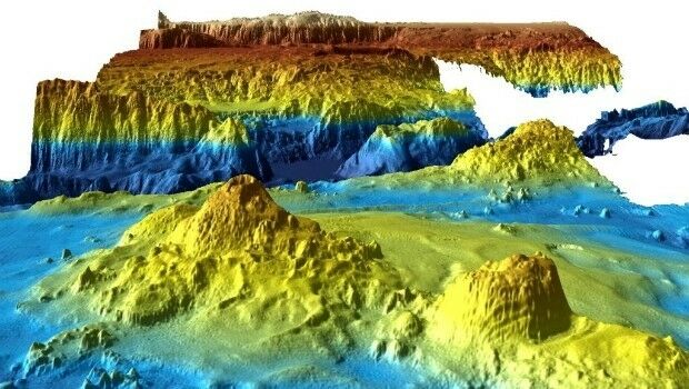
28th July 2017
Unique Seafloor Data Provides New Insight To Scientific Communities28th July 2017
Stakeholders in Global Smart City Market Seek New Funding Models
27th July 2017
MicaSense Atlas is now integrated with Pix4D desktop software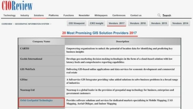
27th July 2017
Orbit GT selected as one of 20 most promising geospatial companies27th July 2017
OGC announces Leidos’ upgrade to Principal Membership
27th July 2017
HERE launches supercharged Real-Time Traffic service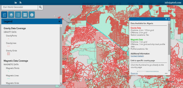
27th July 2017
Explore the World’s Geology with Getech’s Interactive Maps
27th July 2017
Bluesky Aerial Photography Helps Yorkshire Water Keep an Eye on Assets27th July 2017
GeoCue GNSS Direct Geopositioning System For Low Cost DJIDrones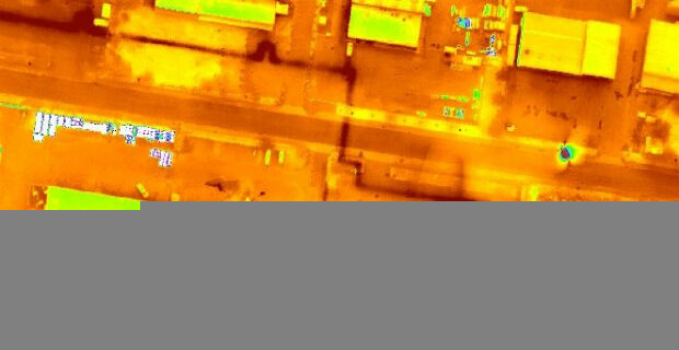
27th July 2017
Icaros and TeAx Announce an Integrated Drone Mapping Solution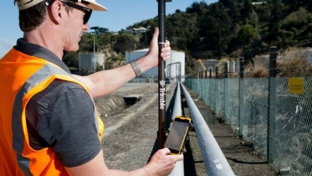
27th July 2017
Trimble Introduces New Android Application26th July 2017
Majority Of Drone Owners Welcome Flying Exam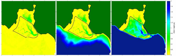
26th July 2017
ABPmer helps develop new coastal restoration project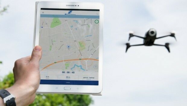
26th July 2017
DFS launches free app to support safe drone flights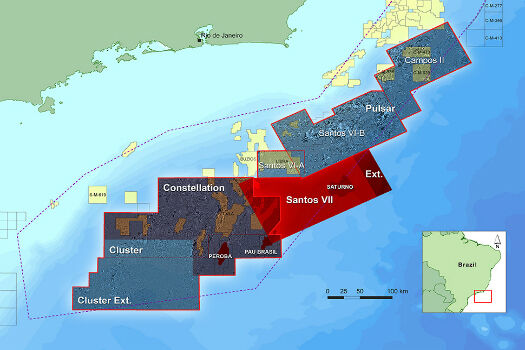
26th July 2017
CGG Extends Santos VII Multi-Client Survey26th July 2017
DroneMapper Chooses Global Mapper for UAV Imagery Processing26th July 2017
PCI Geomatics to Celebrate 35 years in Business
25th July 2017
Hampshire firefighters and public safer with integrated communications
25th July 2017
Fugro Achieves CFA Pile Test Record At High Rise Development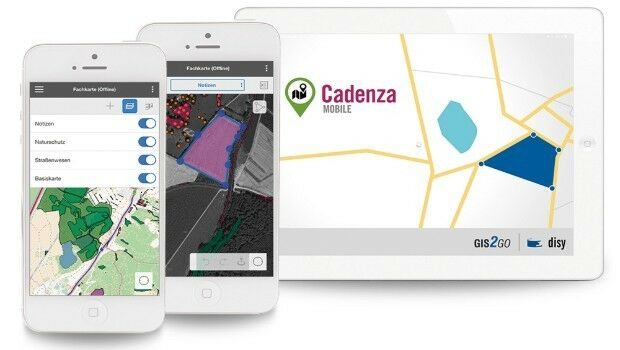
25th July 2017
Shaping the future of spatial data management and analytics
24th July 2017
Plowman Craven Launches Vogel R3D Rail Survey System
24th July 2017
FLIR Releases FLIR Blackfly S GigE Machine Vision Camera Family
24th July 2017
Border Security System Accepted by U.S. Customs and Border Protection
24th July 2017
MTI puts the recycling supply chain onto the blockchain
22nd July 2017
Teledyne Odom MB2 multi beam system for Teesport UK22nd July 2017
Cityworks Congratulates 2017 SAG Award Winners
22nd July 2017
Brainnwave Expands in Geo with Quarry One Eleven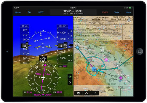
21st July 2017
Garmin Pilot adds synthetic vision to Android mobile devices21st July 2017
Dennis Eagle launches StaySafe panic alarm app