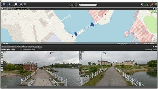
Orbit GT and Nordic GeoCenter, Finland, sign Reseller Agreement
4th September 2017
Orbit GT and Nordic GeoCenter, Finland, sign Reseller AgreementThe compilation, reproduction and dissemination of maps and charts by means of manual (analogue) or digital techniques, tools and workflows. This topic covers the compilation, reproduction, dissemination and use of both analogue (paper) and digital maps, charts and atlases. As well as the science of cartography, including georeferencing and geocoding, digital techniques for compiling and generating various types of raster and vector maps and charts are covered, as are the digital mapping tools and Geographic Information Systems available for this purpose. The application of cartography for aeronautical, terrestrial and marine purposes is also covered
4th September 2017
Orbit GT and Nordic GeoCenter, Finland, sign Reseller Agreement4th September 2017
HUBER+SUHNER to showcase new solutions at DSEI 20174th September 2017
Elbit to Provide a Maritime System to an Asia-Pacific Navy
2nd September 2017
Qelzal Starts Flight Safety Testing of Autonomous Vision Sensor System
2nd September 2017
Bentley Systems' 2017 Be Inspired Awards Program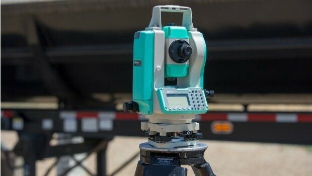
1st September 2017
NPL 322+ New Reflectorless and Prism-only Total Station1st September 2017
Free Global Mapper to Organizations Responding to Hurricane Harvey
1st September 2017
Drones and Pix4D drone mapping software saving time and money1st September 2017
MapAction Announces New Director of Fundraising & Marketing
1st September 2017
National agency will double Australia's space industry1st September 2017
Wärtsilä successfully tests remote control ship operating capability
31st August 2017
2017 URISA Board Election Results Announced
31st August 2017
OGC recognizes the IJIS Institute with Distinguished Member Award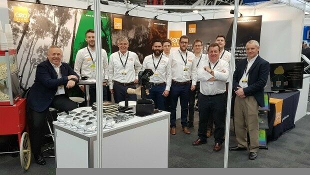
31st August 2017
Record six months for GeoSLAM thanks to boom in "Digital Engineering"
31st August 2017
Yotta Releases its Alloy Connected Asset Management Platform
31st August 2017
Optimizing Maritime Safety and Efficiency31st August 2017
Bureau Veritas releases new rules for offshore service vessels31st August 2017
CGG signs agreement with Mozambique Ministry
31st August 2017
4th User Conference to Celebrate Geospatial Innovation30th August 2017
OGC is seeking participants for its GeoPackage (GPKG)
30th August 2017
Leica iCON now supports Excidor AB tilt rotator control system30th August 2017
Sentinel-5 Precursor begins final journey to launch site30th August 2017
RIMS BV first approved service supplier to Bureau Veritas30th August 2017
Astun Technology Supports Most Successful FOSS4G Ever
30th August 2017
Connected Solution From Intelligent Telematics
29th August 2017
Hexagon Mining Partners with Colorado School of Mines29th August 2017
CSA Seagrass Enhancement Project in North Carolina Underway
29th August 2017
Advancing our Real-Time Global Vessel Tracking Service29th August 2017
Integrated Drone Multispectral Mapping Solution for Agriculture
29th August 2017
Geographical mismatches between capacity and need hinders Conservation
29th August 2017
Informed Solutions Celebrate 25 Years of Success!29th August 2017
OSNI digital mapping now available through viaEuropa web service29th August 2017
CSO Alliance and Airbus to improve Maritime Community safety worldwide
29th August 2017
CGG Starts Espirito Santo IV survey offshore Brazil29th August 2017
Elbit to Perform an F-5 Upgrade Program for an Asia-Pacific Country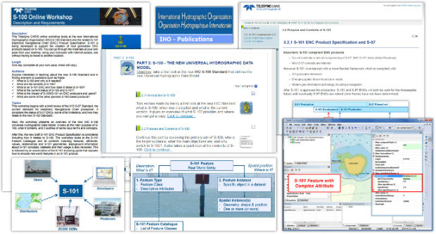
29th August 2017
Teledyne CARIS Releases S-100 Online Workshop29th August 2017
GIS Cloud Exhibiting at the INTERGEO 2017 in Berlin29th August 2017
GSSI Showcases Newest GPR Equipment at Damage Prevention Symposium29th August 2017
Exploring the new Global Drone Ecosystem in Lausanne, Switzerland28th August 2017
SPOT 6/7 imagery for improved efficiency of US agriculture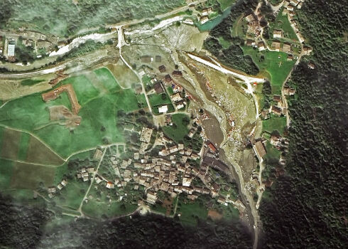
28th August 2017
Seen From Space: Landslide in the Swiss Alps26th August 2017
Terra Drone is to release Terra Mapper a new image processing software24th August 2017
Lorry technology trials could slash fuel costs and congestion
24th August 2017
Free Healthcare Data for Use with Maptitude Mapping Software
24th August 2017
GPM2 Design choose COPTRZ to enable drone surveying & inspection