Dstl to develop Active Protection System technology
14th September 2017
Dstl to develop Active Protection System technologyThe compilation, reproduction and dissemination of maps and charts by means of manual (analogue) or digital techniques, tools and workflows. This topic covers the compilation, reproduction, dissemination and use of both analogue (paper) and digital maps, charts and atlases. As well as the science of cartography, including georeferencing and geocoding, digital techniques for compiling and generating various types of raster and vector maps and charts are covered, as are the digital mapping tools and Geographic Information Systems available for this purpose. The application of cartography for aeronautical, terrestrial and marine purposes is also covered
14th September 2017
Dstl to develop Active Protection System technology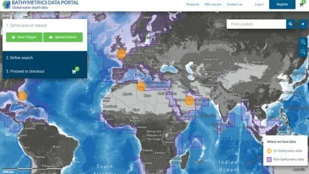
14th September 2017
New Bathymetrics Data Portal delivers quality water depth data online
14th September 2017
Skyfront Sets World Record for Drones with 4 hour and 34 minute flight13th September 2017
PCI Geomatics Releases Geomatica 2017, Service Pack 112th September 2017
New iPhone indoor Maps spells an innovation opportunity for retailers
12th September 2017
Shaping a New 3D World with Portal for Point Clouds and 3D Models
12th September 2017
New counter-drone system unveiled at DSEI 2017
12th September 2017
Carl Pulfrich Award 2017 goes to Prof. Dr. Franz Rottensteiner
12th September 2017
Brainnwave Makes Data Available to Support Disaster Relief_Airbus_DS.jpg)
12th September 2017
Airbus to reshape Earth observation market
12th September 2017
Elbit Systems and CAE Team to Pursue UK Defence Training Capability12th September 2017
In-Fill Radar and Tower System for U.S. Customs and Border Protection12th September 2017
Drone Software Donation for Hurricane Recovery
12th September 2017
GEO Business 2018: Over 75% of space already booked12th September 2017
OceanWise Marine Data Management & GIS Workshop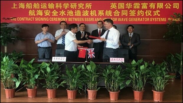
12th September 2017
Making big waves in China to test ship design11th September 2017
AND aims to redefine map making & change the mapping industry
11th September 2017
Reducing the risk of propulsion loss – new guidance
11th September 2017
The future European Governmental Satellite Communications programme9th September 2017
GSSI Announces Licensing Agreement with MIT Lincoln Laboratory8th September 2017
Ctrack Selected by Northumbrian Water Limited
8th September 2017
Hexagon Receives Recognition from Huawei for Safe City Solution8th September 2017
MapAction sends two more teams to reinforce Hurricane Irma response
8th September 2017
PTC to Move Global Headquarters to Boston Seaport8th September 2017
OGC approves Community Standard for streaming 3D Content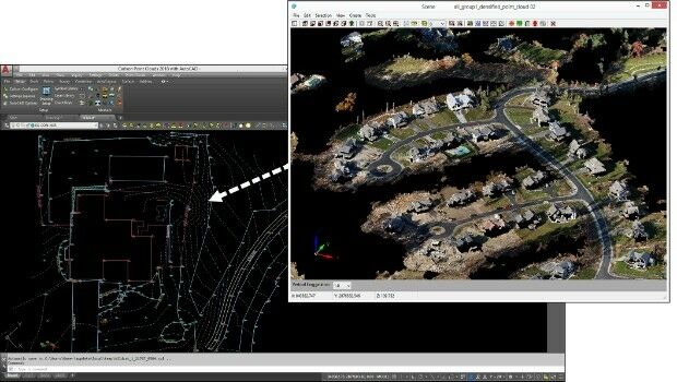
7th September 2017
Faster, More Expansive Carlson Point Cloud for 2018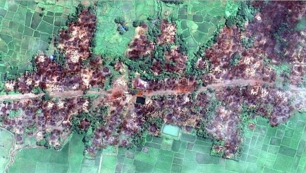
7th September 2017
Myanmar: Satellite Images Show Massive Fire Destruction7th September 2017
Globalstar Brings the Power of the Sun to IoT Asset Management
7th September 2017
Handheld launches blog at ruggedinformer.com
7th September 2017
Location technology from HERE central to Audi A8's guidance system
7th September 2017
Put the Science of Where into Practice with The ArcGIS Book7th September 2017
Locating Bahrain’s Underground Utilities
7th September 2017
SmarTrack Situational Awareness System for GPS Denied Environments7th September 2017
Agenda for 19th Global MilSatCom Conference and Exhibition Released
7th September 2017
Customer-Driven Improvements Highlight Carlson Survey 2018
6th September 2017
Airborne mapping system from 3D Laser Mapping takes off
6th September 2017
Ricardo and Roke collaborate on vehicle cyber security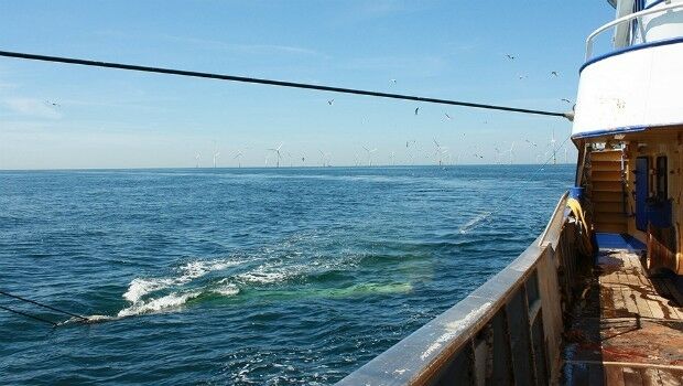
5th September 2017
Special Fishing Cables for Vessels in North Sea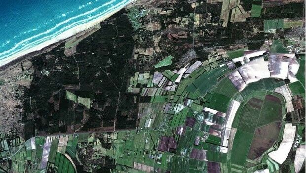
5th September 2017
100% success rate in European Commission’s 2017 CwRS Program5th September 2017
Public comment on proposed Geocoding API Standards Working Group5th September 2017
Second Lockheed Martin GPS III Satellite Successfully Completes Test5th September 2017
SimActive Releases Correlator3D™ Version 7.0
5th September 2017
SCADA Security Conference 2017 in Prague, Czech Republic4th September 2017
OGC seeks sponsors for its Underground Infrastructure Pilot Project