
Near real-time global 3D radar is on the horizon
1st July 2020
Near real-time global 3D radar is on the horizon
1st July 2020
Near real-time global 3D radar is on the horizon
30th June 2020
Maxar Technologies Announces its Intention to Acquire Vricon to Accelerate Growth in Emerging Markets for 3D Technology and Extend its Lead in Earth Intelligence
11th June 2020
Co-Located Events AEC Next, SPAR 3D, and Geo Week Pivot to Virtual Content Series for 2020
26th May 2020
APCOA and HERE to partner on joint digital parking initiative
5th May 2020
Trian3DBuilder to produce 3D scenarios from HERE HD Live Map
24th April 2020
Bentley Institute announces “Digital Infrastructure Student Idea Challenge 2020”
22nd April 2020
Fugro wins contract for A9 motorway widening in the Netherlands
15th April 2020
Golden Software Simplifies Surfer Workflows for Faster Gridding
3rd April 2020
Events Rescheduled & Will Take Place Together July 27-29, 2020
2nd April 2020
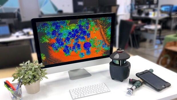
Pointfuse Laser Scanning Software Innovates Construction Workflows for Shockey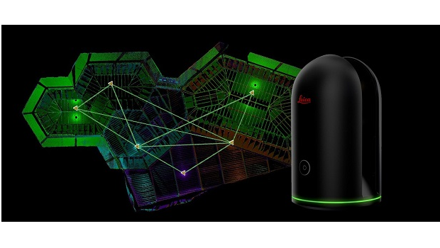
1st April 2020
Leica Geosystems announces new 3D laser scanning bundle
1st April 2020
Bentley Institute Press Announces Availability of “Inside MicroStation CONNECT Edition" Book Series
31st March 2020
Pix4D presents the next generation of photogrammetry and analytics software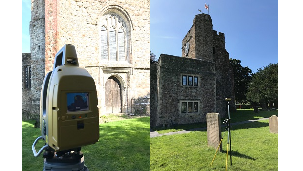
31st March 2020
Topcon provides modern solutions for heritage project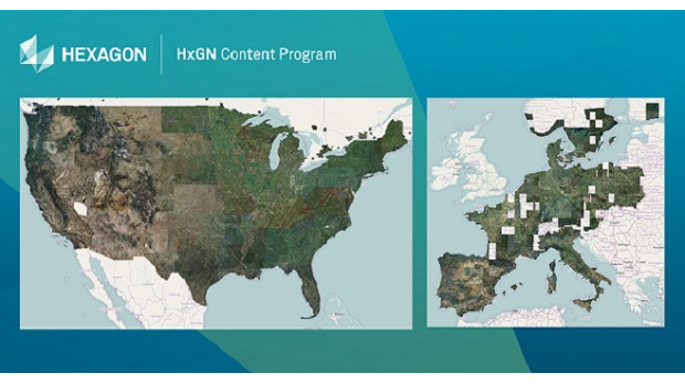
23rd March 2020
HxGN Content Program provides aerial imagery in response to COVID-19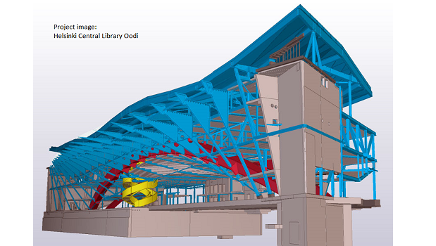
23rd March 2020
Trimble Introduces Tekla 2020 Structural BIM Software Solutions
19th March 2020
Labs Site Gives Developers Early Access to Tools, Code and Pre-release Software
18th March 2020
Bentley Systems’ SVP Alan Kiraly Elected to the Board of MIMOSA
15th March 2020
University of Derby students partner with Topcon to scan Falkirk Wheel
13th March 2020
Re-imagining future workplaces with sensors, sustainability, IOT and AI
13th March 2020
The National Construction Expo - The Arena MK, Milton Keynes - 6th May, 2020
12th March 2020
Bluesky 3D Model Supports Glasgow’s Plans for Regeneration and Data Integration

9th March 2020
SimActive Announces Online Training Session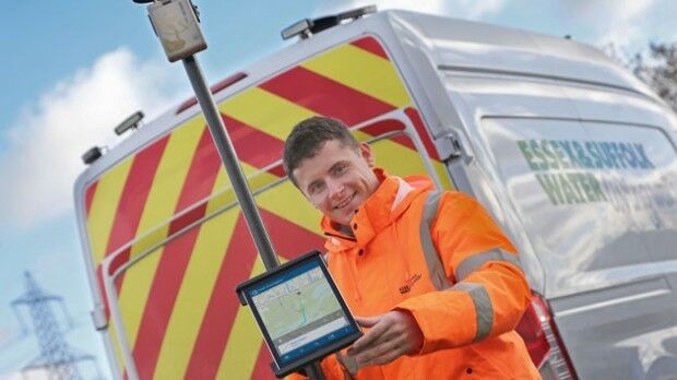
5th March 2020
MGISS Helps Essex & Suffolk Water Pioneer 3D Asset Data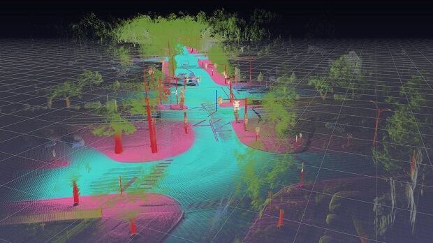
27th February 2020
HERE unveils Geodata Models to lower 5G wireless network planning costs
21st February 2020
Paracosm Partners with Geo-Plus to Expand Land Survey Offerings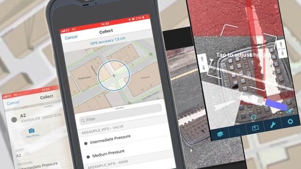
21st February 2020
MGISS Launches Integrated Web App for AR Visualisations of Buried Assets
19th February 2020
Leica Geosystems brings the world’s first MultiStation to the next level
16th February 2020
Bentley Confidentially Submits Registration Statement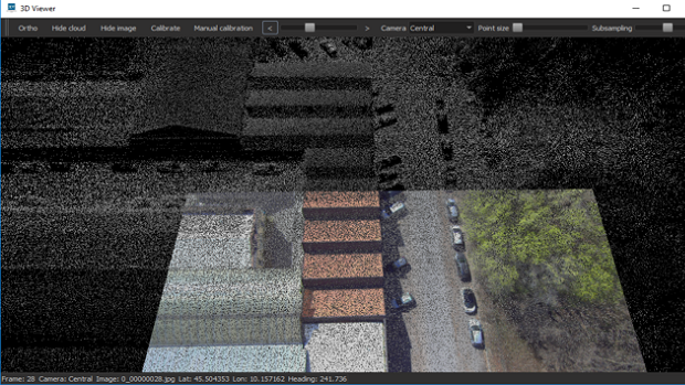
5th February 2020
SmartProcessing Lidar 1.2 software release

28th January 2020
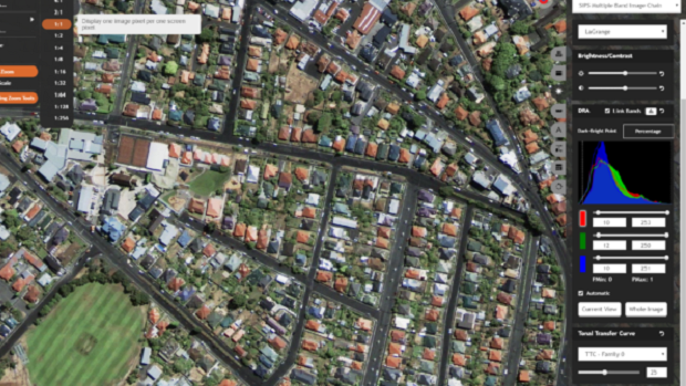
Hexagon Unveils M.App X 2020 for Enhanced Imagery Intelligence
27th January 2020
Bluesky International Launches MetroVista 3D City Models Online

8th January 2020
OGC announces the creation of new GeoPose Standards Working Group
8th January 2020
Hexagon introduces visualisation platform
20th December 2019
HERE Technologies welcomes Mitsubishi Corporation and NTT as new investors
18th December 2019
OGC announces virtualcitySYSTEMS as the winner of the 2019 OGC CityGML Challenge
17th December 2019
Mixed Reality Dimensional Interface for Professional Immersive Computing
17th December 2019
GeoSLAM solution enables quick and easy to stockpile volume analysis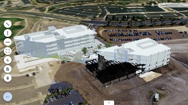
10th December 2019
Trimble Clarity: Free Point Cloud Viewer
10th December 2019
Scotland’s Edinburgh Napier University to Establish Trimble Technology Lab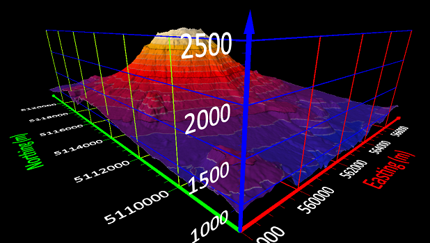
4th December 2019
Golden Software Streamlines Gridding Functionality in Surfer
3rd December 2019
Getmapping partners with 3D Visualisation Technology Leaders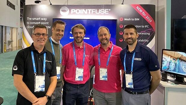
3rd December 2019
Pointfuse and Autodesk Platinum Partner U.S. CAD Announce Partnership