
Bluesky Launches MetroVista 3D City Mapping Service in US
28th November 2019
Bluesky Launches MetroVista 3D City Mapping Service in US
28th November 2019
Bluesky Launches MetroVista 3D City Mapping Service in US
21st November 2019
Pointfuse Launches Simple BIM Solution for Facilities Management
21st November 2019
Leica Geosystems launches BLK3D Web, integrates with Autodesk
19th November 2019
Plowman Craven Receives BSI BIM Kitemark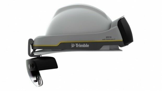
13th November 2019
Trimble Announces Availability of the XR10 with HoloLens 2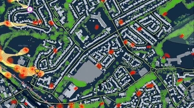
11th November 2019
Terrafirma adopts Bluesky Tree Map for Subsidence Hazard Assessment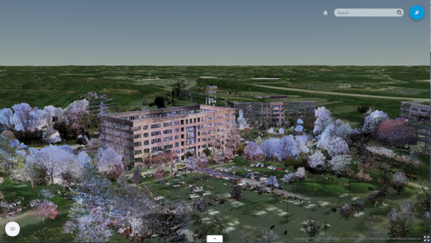
8th November 2019
Trimble Clarity Now Offered as Web Application for Point Clouds and 3D Models.jpg)
8th November 2019
London Build 2019: Show Preview Available for Download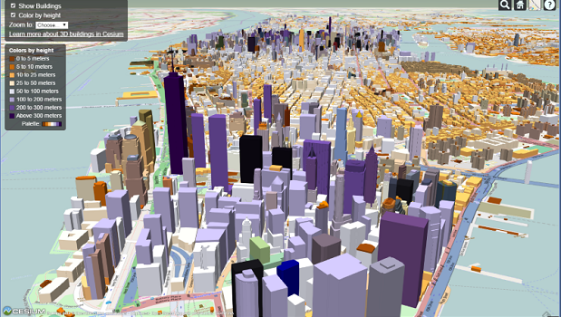
7th November 2019
Cesium Takes City Visualizations Into the 3rd Dimension
4th November 2019
UK BIM Framework publish two new documents

1st November 2019
UAVOS and Polynesian Exploration up to Creating Autonomous Solution for 3D Mapping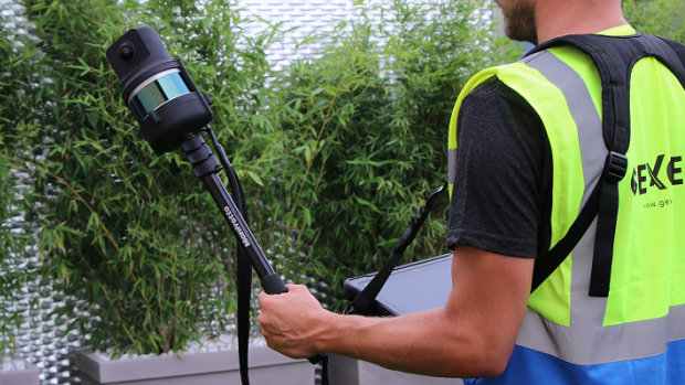
1st November 2019
The Handheld 3D Mapping System with High-res 5K Images
24th October 2019
SITECH South is now a RIEGL Distributor in North America
23rd October 2019
Bentley Systems’ Design Integration Offerings Advance BIM to 4D through Digital Twins
22nd October 2019
Bentley Systems and Topcon Positioning Systems Launch their Digital Construction Works Joint Venture
15th October 2019
Pointfuse New Scan 2 BIM Workflow at Digital Construction Week
15th October 2019
Varjo Announces Two New Human-Eye Resolution HMDs
15th October 2019
Orbit GT and Viametris, France, sign Reseller Agreement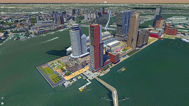
14th October 2019
Orbit GT launches 3D Mapping Cloud v19.10
11th October 2019
Schneider Digital releases new 3D PluraView 24“ Full HD
9th October 2019
CHNT 24, 2019 - Schedule timetable online
4th October 2019
Ground Penetrating Radar: The Unlikely New Hero of Autonomous Vehicles
25th September 2019
Bluesky Appoints Jamieson to Drive Innovation in Aerial Mapping
24th September 2019
CityGML-Urban Planning ADE Ideathon will be held in Japan
23rd September 2019
Riegl VUX-240 wins the Wichmann Intergeo Innovation Award 2019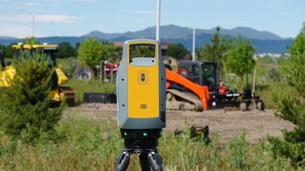
19th September 2019
Trimble Blends Performance and Simplicity with New X7 3D Laser Scanning System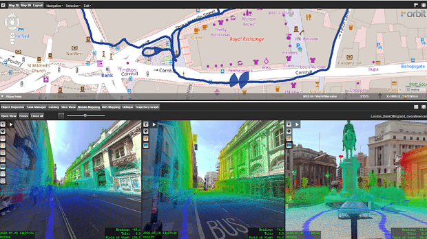
19th September 2019
Orbit GT and GeoSLAM, UK, sign Reseller Agreement
17th September 2019
Trimble SiteVision Takes Data Visualization Outdoors
16th September 2019
Bluesky Launches International MetroVista City Mapping Service at Intergeo
22nd August 2019
Pointfuse Laser Scanning Software Transforms Digital Construction Workflows
22nd August 2019
Bluesky LiDAR Survey Helps Dublin Airport Reduce Risk of Flooding
16th August 2019
Bluesky LiDAR Survey Helps Dublin Airport Plan Drainage Infrastructure and Reduce Risk of Flooding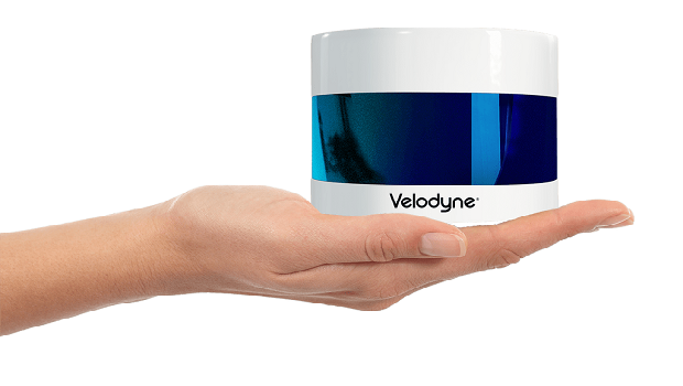
12th August 2019
Velodyne Lidar Announces Breakthrough Sensor for Autonomous Systems, Puck 32MR
9th August 2019
Kyocera to Strengthen Open Innovation in AI and IoT with New Research Center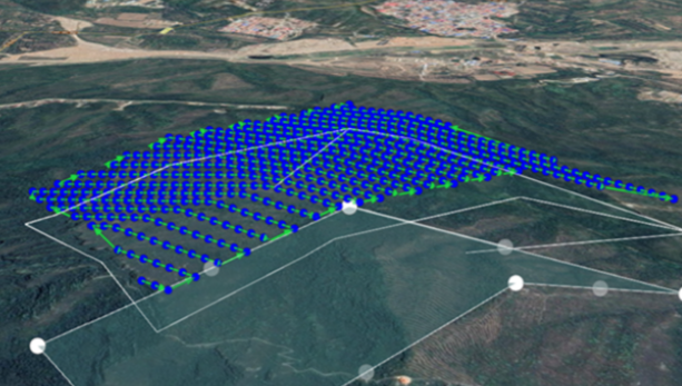

7th August 2019
Printed Electronics USA: The Must-Attend Event for Applications and Innovations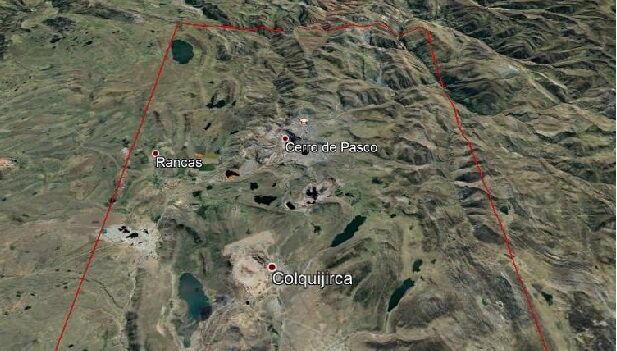
7th August 2019
Space-based Monitoring System gets the Go-ahead for Expansion

1st August 2019
FARO 3D Technology Seminar Asia Pacific 2019
1st August 2019
Terra Drone Europe conducts oil rig platform survey and 3D modeling for Shell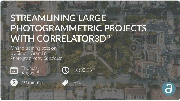
31st July 2019
Streamlining Large Photogrammetric Projects with Correlator3D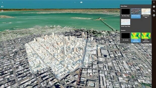
25th July 2019
Orbit GT launches 3D Mapping portfolio v19.7 with new website
11th July 2019
Seequent continues investment in innovative geoscience technology
10th July 2019
Cesium launches with $5 million investment9th July 2019
Ordnance Survey creates ‘win-win’ for construction and geospatial industries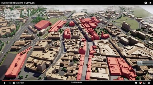
8th July 2019
Bluesky 3D Model Helps AECOM Create Blueprint for Yorkshire Town Redevelopment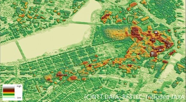
2nd July 2019
NTT DATA and RESTEC Launch AW3DFull Global 3D Map with 2.5-meter Definition