
AEC Next and SPAR 3D 2019 Keynote Speakers Announced
1st March 2019
AEC Next and SPAR 3D 2019 Keynote Speakers Announced
1st March 2019
AEC Next and SPAR 3D 2019 Keynote Speakers Announced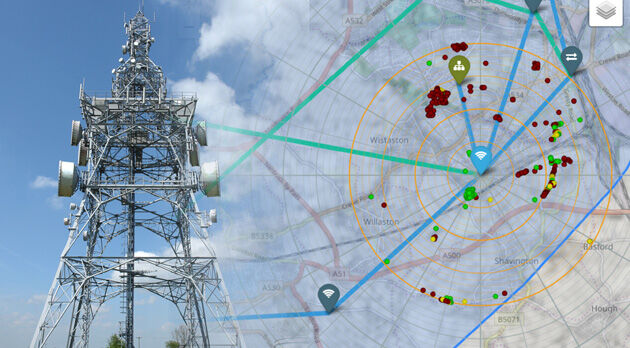
28th February 2019
Bluesky 3D Models Improve Mobile, 5G and Smart City Network Planning27th February 2019
Palatiello Promotes USGS 3DEP Before Congress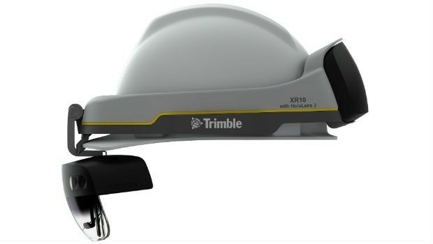
26th February 2019
Trimble Announces Next Generation Mixed-Reality Device
25th February 2019
Bentley Systems Introduces Mixed Reality App
15th February 2019
Terra Drone Optimizes Long-Distance Power Line inspection
15th February 2019
OGC requests public comment on draft charter for new Portrayal Domain Working Group
14th February 2019
Link between trees and mental health revealed by researchers using Bluesky Tree Map
13th February 2019
Mobile Mapping System Road-Scanner for the first tram line in Bologna
12th February 2019
NavVis now uses SLAM to automatically remove point cloud artifacts
5th February 2019
OGC adopts 3D Tiles as Community Standard
2nd February 2019
Greenvalley International Launches Premium Handheld Mobile Mapping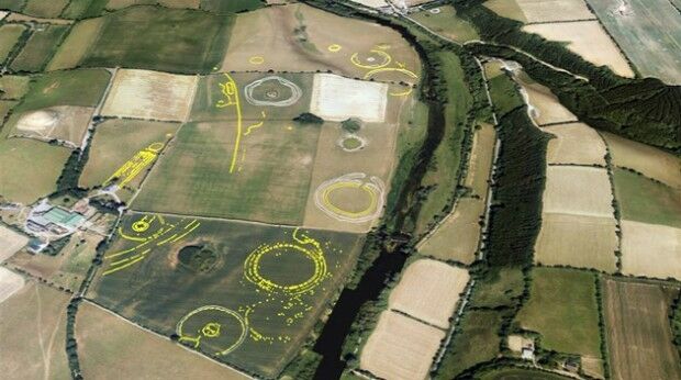
30th January 2019
Bluesky Aerial Photographs Reveal Hidden Irish Archaeological Sites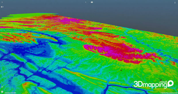
25th January 2019
Orbit GT brings 3DEP online on 3D Mapping Cloud
25th January 2019
Elaine Lewis becomes Non-Executive Director16th January 2019
Hexagon’s Geospatial Division Releases Luciad V2018.1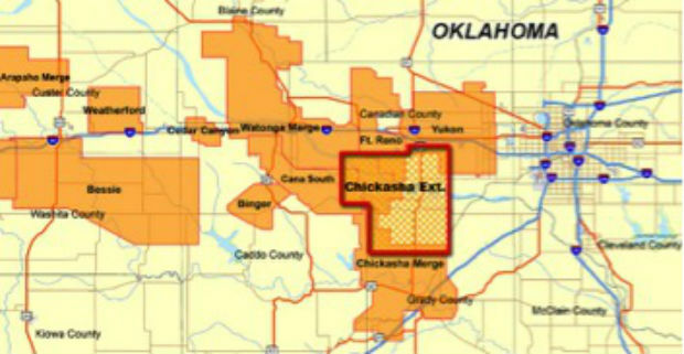
16th January 2019
CGG Continues to Expand Anadarko Basin Library
10th January 2019
Experience strongest ever SLAM with GeoSLAM's upgrade any SLAM device campaign
9th January 2019
Bristol Water renews annual subscription with Rezatec
9th January 2019
Request for Information: “Mixed Reality to the Edge”7th January 2019
pdf3d.io introduces rapid integration and RESTful server

11th December 2018
Gexcel presents the new HERON® Indoor Mobile Mapping System6th December 2018
Carlson Software Releases Carlson iCAD 2019

5th December 2018
Esri Partners with the Ocean Health Index Team
4th December 2018
Global expansion on the horizon for mapping technology firm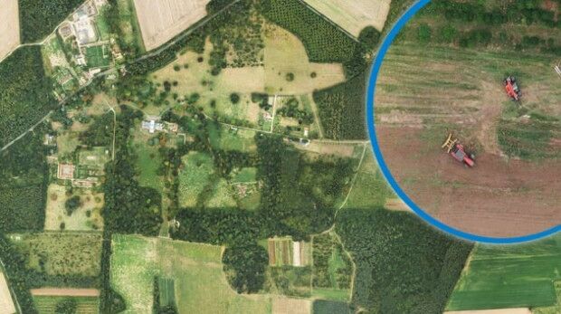
4th December 2018
Bluesky Aerial Images Help Reveal Secrets of Farm Management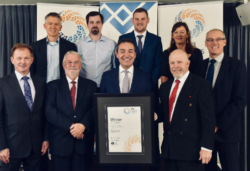
3rd December 2018
Maptek Sentry wins Excellence in Innovation award28th November 2018
Add Geographic Intelligence to your Software Projects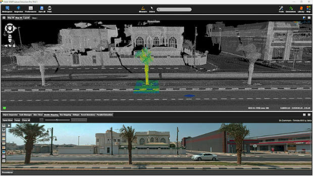
27th November 2018
Orbit GT releases version 19 of 3D Mapping portfolio
21st November 2018
Bluesky first to use Leica CityMapper to capture UK cities in 3D

16th November 2018
GLM Takes Next Steps to Expand its Business with Dassault Systèmes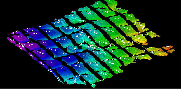
15th November 2018
Multi-objective optimisation reaching new heights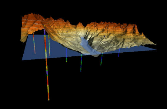
13th November 2018
Golden Software Enhances 3D Data Visualization in Surfer 16
13th November 2018
Bentley Systems Announces the Acquisition of ACE enterprise Slovakia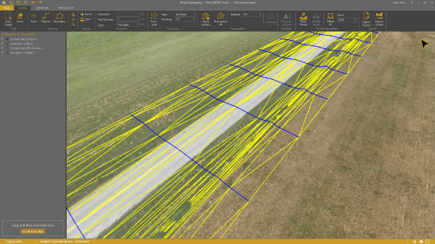
13th November 2018
Virtual Surveyor 6.1 Handles More Than Drone Data13th November 2018
Bentley Systems Announces Agreement to Acquire AIworx,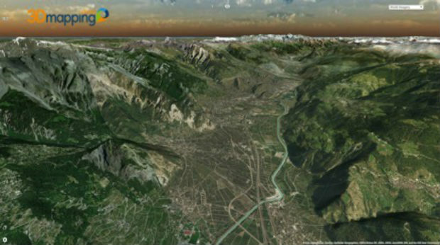
13th November 2018
Orbit GT upgrades 3D Mapping Cloud to support Meshes, DEMs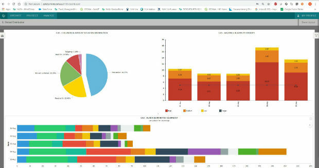
8th November 2018
Hexagon strengthens mine safety portfolio with enterprise platform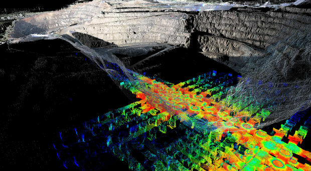
8th November 2018
PointStudio - New name and platform for Maptek spatial data application
7th November 2018
All good things come in threes: MetOp-C successfully launched