_2.jpg)
Bentley Announces Finalists in 2017 "Be Inspired" Awards Program
11th August 2017
Bentley Announces Finalists in 2017 "Be Inspired" Awards Program
BARTHAUER securely positioned for the future
10th August 2017
BARTHAUER securely positioned for the future
3D Repo’s VR Simulator Helps TRL Shape Autonomous Vehicles Services
10th August 2017
3D Repo’s VR Simulator Helps TRL Shape Autonomous Vehicles Services
Upcoming SuperGIS Webinar- Web-based 3D Cadastral Mapping
9th August 2017
Upcoming SuperGIS Webinar- Web-based 3D Cadastral Mapping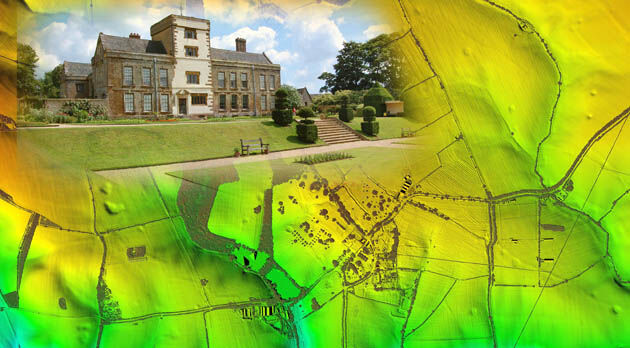
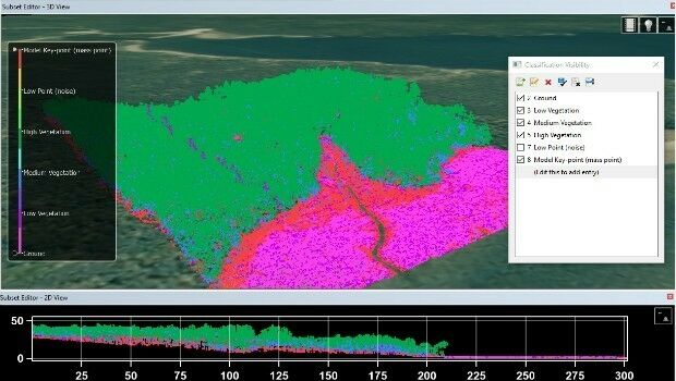
Bluesky LiDAR Helps ArcHeritage Reveal Hidden Treasures
9th August 2017
Bluesky LiDAR Helps ArcHeritage Reveal Hidden Treasures
Skyline Software Systems Releases Photomesh 7.2
8th August 2017
Skyline Software Systems Releases Photomesh 7.2
CGG Launches Gippsland ReGeneration reprocessing project in Australia
7th August 2017
CGG Launches Gippsland ReGeneration reprocessing project in Australia
AutoPIPE CONNECT Edition Now Includes ASME B31J at No Additional Cost
4th August 2017
AutoPIPE CONNECT Edition Now Includes ASME B31J at No Additional Cost
Efficient Management of Large Process Facilities
3rd August 2017
Efficient Management of Large Process Facilities
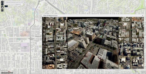
Orbit GT updates 3D Mapping Cloud with Oblique Imagery Support
3rd August 2017
Orbit GT updates 3D Mapping Cloud with Oblique Imagery Support
PDF3D Release PV+ 5.4 Visualization & Publishing Update
1st August 2017
PDF3D Release PV+ 5.4 Visualization & Publishing Update
3D Repo Appoints Carmen Fan as Chief Technology Officer
1st August 2017
3D Repo Appoints Carmen Fan as Chief Technology Officer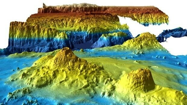
Unique Seafloor Data Provides New Insight To Scientific Communities
28th July 2017
Unique Seafloor Data Provides New Insight To Scientific Communities.jpg)
TCarta Marine provided with Spatial Data Package for Arabian Gulf
21st July 2017
TCarta Marine provided with Spatial Data Package for Arabian Gulf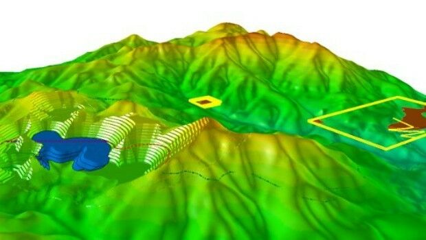
Hexagon Mining Introduces HxGN Dynamic Haulage
19th July 2017
Hexagon Mining Introduces HxGN Dynamic Haulage
U.S. Army Corps Adds Global Mapper to its List of Approved Software
14th July 2017
U.S. Army Corps Adds Global Mapper to its List of Approved Software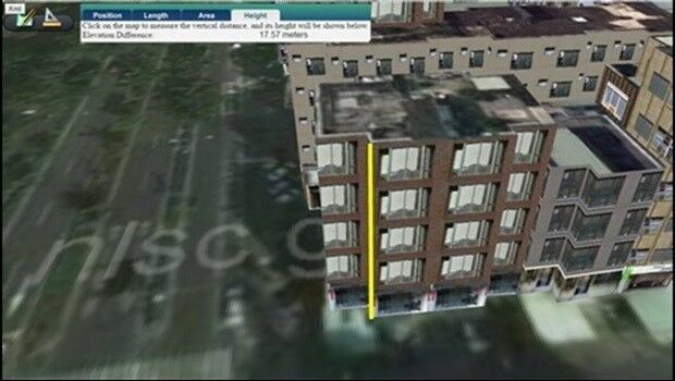
Managing Assets from Different Angles- SuperGIS 3D Earth Server
13th July 2017
Managing Assets from Different Angles- SuperGIS 3D Earth Server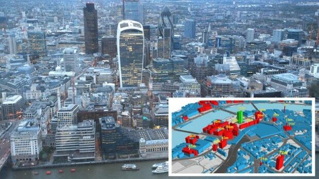
Bluesky Launches Nationwide Map of Building Heights
13th July 2017
Bluesky Launches Nationwide Map of Building Heights
Esri and Microsoft Join Forces to Accelerate Conservation
12th July 2017
Esri and Microsoft Join Forces to Accelerate Conservation
8th BaSYS User Conference with record number of participants
12th July 2017
8th BaSYS User Conference with record number of participants
ArcGIS 10.5 Enterprise Architecture Powers DigitalGlobe's Offerings
11th July 2017
ArcGIS 10.5 Enterprise Architecture Powers DigitalGlobe's Offerings
Schneider Electric to Showcase at 2017 Esri User Conference
10th July 2017
Schneider Electric to Showcase at 2017 Esri User Conference
Europa Technologies: finalist in prestigious insurance industry awards
10th July 2017
Europa Technologies: finalist in prestigious insurance industry awards
Orbit GT and Vexcel Imaging showcase Oblique and Streetlevel 3D data
7th July 2017
Orbit GT and Vexcel Imaging showcase Oblique and Streetlevel 3D data
DAT/EM Systems International Updates Landscape Software
6th July 2017
DAT/EM Systems International Updates Landscape Software
Esri CityEngine 2017 Makes Urban Planning More Efficient
6th July 2017
Esri CityEngine 2017 Makes Urban Planning More Efficient
NEW Architectural 3D Models of UK available from Joanna-James
5th July 2017
NEW Architectural 3D Models of UK available from Joanna-James
Understanding large-scale plant health with Satellite Data
5th July 2017
Understanding large-scale plant health with Satellite Data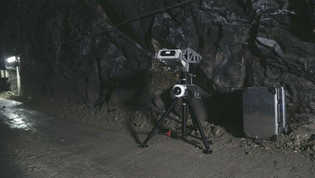
Safety, stability monitoring radar for the underground mining industry
29th June 2017
Safety, stability monitoring radar for the underground mining industry
Latest update to CH2M’s next generation Flood Modeller software
29th June 2017
Latest update to CH2M’s next generation Flood Modeller software
Global Mapper LiDAR Module v18.2 Now Available
22nd June 2017
Global Mapper LiDAR Module v18.2 Now Available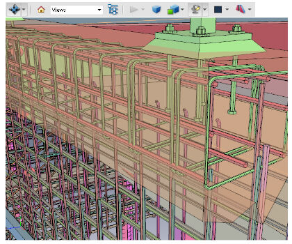
PDF3D V2.14 Meets Demands of Drones, Scanners and 3D Design Apps
21st June 2017
PDF3D V2.14 Meets Demands of Drones, Scanners and 3D Design Apps
Golden Software Releases Network Licenses for Surfer® and Grapher™
21st June 2017
Golden Software Releases Network Licenses for Surfer® and Grapher™
Dassault Systèmes and Airbus APWorks Collaborate
20th June 2017
Dassault Systèmes and Airbus APWorks Collaborate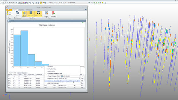
Hexagon Mining introduces statistical tools for mine planning
20th June 2017
Hexagon Mining introduces statistical tools for mine planning
Bentley Systems to Present at BIM4Water Summer Reception in London UK
20th June 2017
Bentley Systems to Present at BIM4Water Summer Reception in London UK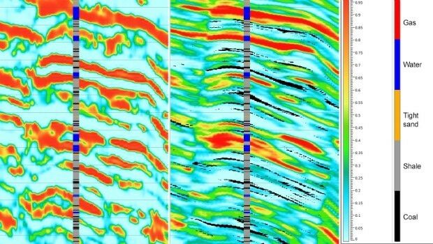
Geostatistical seismic reservoir characterization solution
19th June 2017
Geostatistical seismic reservoir characterization solutionAAM to License Pointerra Technology for 3D Data
19th June 2017
AAM to License Pointerra Technology for 3D Data
Utility post processing software delivers CAD drawings in less time
14th June 2017
Utility post processing software delivers CAD drawings in less time
Latest 3D Modeling Technologies at Goodwood Festival of Speed
14th June 2017
Latest 3D Modeling Technologies at Goodwood Festival of Speed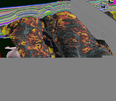
CGG Launches JumpStart Regional Geoscience Programs
14th June 2017
CGG Launches JumpStart Regional Geoscience Programs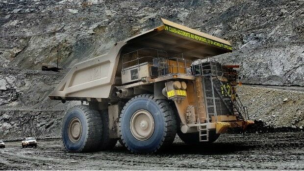
Hexagon launches HxGN Mine VIS, a vehicle intervention system
13th June 2017
Hexagon launches HxGN Mine VIS, a vehicle intervention system
Blue Marble Conducts Successful Global Mapper Training Class
8th June 2017
Blue Marble Conducts Successful Global Mapper Training Class
Hexagon Safety & Infrastructure Listed on G-Cloud 9 Framework
7th June 2017
Hexagon Safety & Infrastructure Listed on G-Cloud 9 Framework