
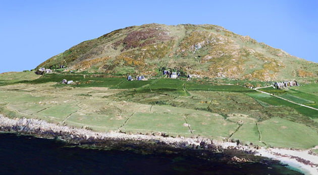
Bluesky 3D maps help protect coastal heritage sites in new EU Project
29th March 2017
Bluesky 3D maps help protect coastal heritage sites in new EU Project
Arithmetica and point3D Partnership Promises Digital Transformation in 3D Modelling
29th March 2017
Arithmetica and point3D Partnership Promises Digital Transformation in 3D Modelling
Sign up for a free Trimble Scanning Workshop
27th March 2017
Sign up for a free Trimble Scanning Workshop
Bluesky Launches New Online Resource for Geographic Information of Ireland
27th March 2017
Bluesky Launches New Online Resource for Geographic Information of Ireland
Public comment on proposed Indexed 3D Scene Layers (I3S) Community
23rd March 2017
Public comment on proposed Indexed 3D Scene Layers (I3S) Community
Hexagon Mining selects downtown Tucson, AZ for headquarters
22nd March 2017
Hexagon Mining selects downtown Tucson, AZ for headquarters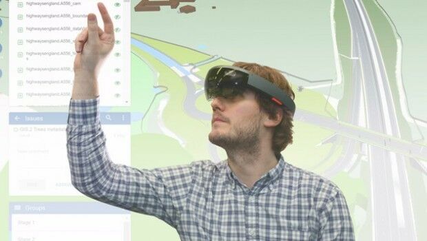
3D Repo Brings Cloud Expertise to Government Funded Smart Infrastructure Project
22nd March 2017
3D Repo Brings Cloud Expertise to Government Funded Smart Infrastructure Project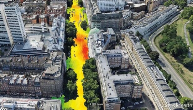
EarthSense Systems Computer Models Impact of Trees on Urban Air Pollution
22nd March 2017
EarthSense Systems Computer Models Impact of Trees on Urban Air Pollution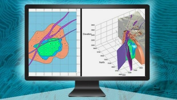
Greg Bentley to Hold Press Conference at SPAR 3D Expo
20th March 2017
Greg Bentley to Hold Press Conference at SPAR 3D Expo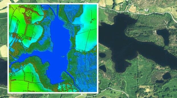
Bluesky to 3D Laser Map Environmental Features in Ireland
20th March 2017
Bluesky to 3D Laser Map Environmental Features in Ireland
The Getech Group Delivers Insights into African Lakes from Space
16th March 2017
The Getech Group Delivers Insights into African Lakes from Space
Bluesky Acquires US Aerial Survey Company Col-East
15th March 2017
Bluesky Acquires US Aerial Survey Company Col-East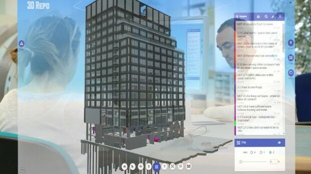
On-the-Fly Earth Observation Imagery Analytics in Your Browser
14th March 2017
On-the-Fly Earth Observation Imagery Analytics in Your Browser
OGC publishes Moving Features Access specification
13th March 2017
OGC publishes Moving Features Access specification
NCTech announce ColourCloud processing hosted on Google Cloud Platform
10th March 2017
NCTech announce ColourCloud processing hosted on Google Cloud Platform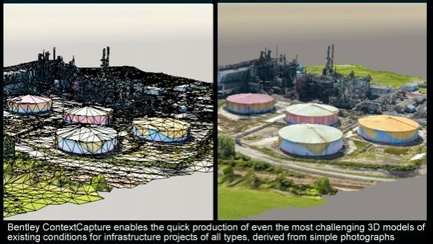
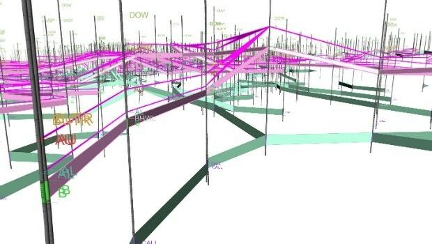
Reality Modeling for Utility Infrastructure
10th March 2017
Reality Modeling for Utility Infrastructure
New remote job site support service with bundled cellular data
9th March 2017
New remote job site support service with bundled cellular data
Topcon announces integrated mass data processing software
9th March 2017
Topcon announces integrated mass data processing software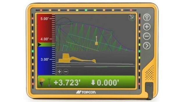
New 10-inch touchscreen display for construction machine control
9th March 2017
New 10-inch touchscreen display for construction machine control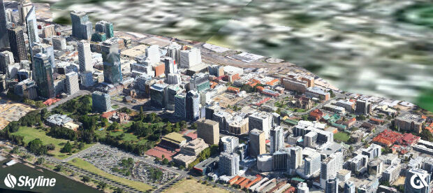
GeoXphere & Skyline collaboration accelerates 3D City Model production
9th March 2017
GeoXphere & Skyline collaboration accelerates 3D City Model production

Maptek resource modelling technology on show at PDAC
6th March 2017
Maptek resource modelling technology on show at PDAC
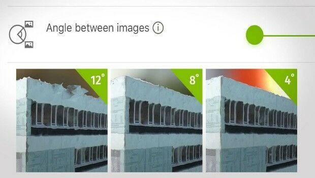
How do I choose the right image-capture settings for 3D models?
3rd March 2017
How do I choose the right image-capture settings for 3D models?
Mobile Data Collection has never been easier!
1st March 2017
Mobile Data Collection has never been easier!
3D Repo wins European funding for cyber security system research
1st March 2017
3D Repo wins European funding for cyber security system research
Geosoft showcases VOXI IP and resistivity inversion technology
1st March 2017
Geosoft showcases VOXI IP and resistivity inversion technology
GeoSLAM Growth Continues With Two Senior Appointments
28th February 2017
GeoSLAM Growth Continues With Two Senior Appointments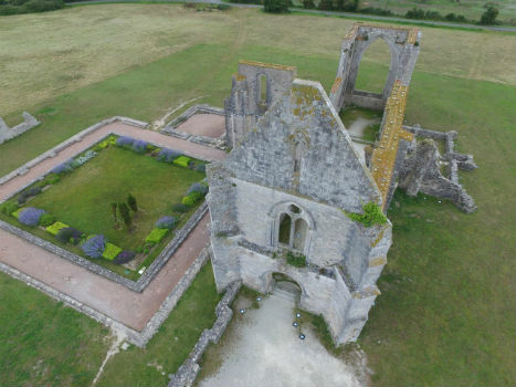
Leveraging 3D modeling and printing skills as a service
28th February 2017
Leveraging 3D modeling and printing skills as a service
LizardTech Releases MrSID Generation 4 Decode SDK Version 9.5.4
24th February 2017
LizardTech Releases MrSID Generation 4 Decode SDK Version 9.5.4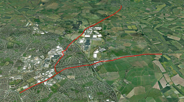
CartoConsult Brings GIS Innovation to Government Programme to Tackle Traffic Congestion
22nd February 2017
CartoConsult Brings GIS Innovation to Government Programme to Tackle Traffic Congestion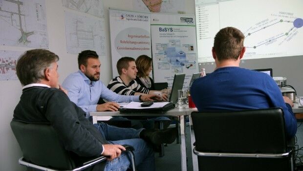
GAUSS+LÖRCHER: New BARTHAUER training partner in southern Germany
22nd February 2017
GAUSS+LÖRCHER: New BARTHAUER training partner in southern Germany
Global Mapper 18.1 Released with Improved 3D Viewing
22nd February 2017
Global Mapper 18.1 Released with Improved 3D Viewing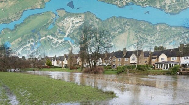
Bluesky Announces New Online Flood Risk Map of the UK
21st February 2017
Bluesky Announces New Online Flood Risk Map of the UK
Qlucore Projection Score aids better visualization of large data sets
20th February 2017
Qlucore Projection Score aids better visualization of large data sets
Fugro Announces Partnership With Shell Ocean Discovery XPRIZE
17th February 2017
Fugro Announces Partnership With Shell Ocean Discovery XPRIZE
Biggest Collection of Arctic Elevation Data Yet
17th February 2017
Biggest Collection of Arctic Elevation Data Yet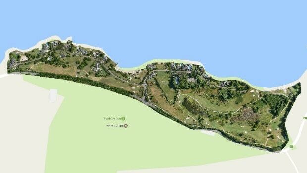
Three reasons golf courses are the next drone mapping territory
15th February 2017
Three reasons golf courses are the next drone mapping territory
Golden's new 2D and 3D Mapping, Modeling, and Analysis Software
15th February 2017
Golden's new 2D and 3D Mapping, Modeling, and Analysis Software
3D Repo Appoints Andrew Norrie as Commercial Director
14th February 2017
3D Repo Appoints Andrew Norrie as Commercial Director
Bluesky Wins Innovation Funding for Mobile Phone Mapping Project
9th February 2017
Bluesky Wins Innovation Funding for Mobile Phone Mapping Project
TCarta Marine and Proteus Geo Announce Merger
8th February 2017
TCarta Marine and Proteus Geo Announce Merger