
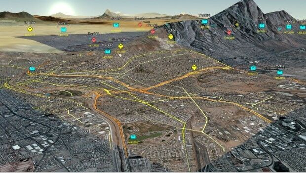
3D Repo Develop Virtual Reality App for Motorway Construction Workers
7th February 2017
3D Repo Develop Virtual Reality App for Motorway Construction Workers
7th February 2017
3D Repo Develop Virtual Reality App for Motorway Construction Workers6th February 2017
Orbit GT to announce disruptive 3D Mapping Cloud solution6th February 2017
Bluesky Appoints Strategic Development Manager3rd February 2017
Planning and Design Solutions for Utilities jointly offered3rd February 2017
Dassault Systèmes Announces SOLIDWORKS World 2017
31st January 2017
Blue Marble Teams Up with Pointerra to Provide Cloud-Based LiDAR Data

25th January 2017
Abstract Submissions Invited for GIS-Pro 2017 in Jacksonville, Florida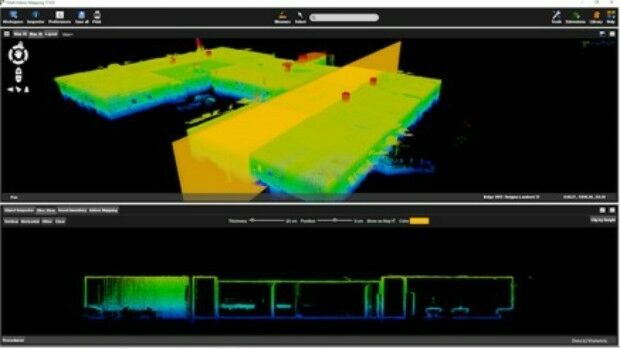
25th January 2017
Orbit GT releases Indoor Mapping solution with Floor Plan Builder
24th January 2017
Airport GIS | LiDAR, imagery and feature extraction for airport operations.jpg)
24th January 2017
Bluesky Announces 2017 Flying Plans for Ireland
24th January 2017
3D Repo BIM App Helps Crossrail Digitally Manage Assets
20th January 2017
AGI and Bentley Systems Announce Cesium Consortium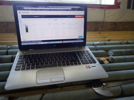
20th January 2017
Geosoft and Minalytix partner to bring MX Deposit to the marketplace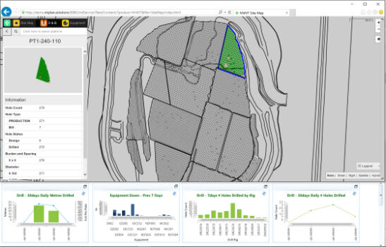
17th January 2017
Hexagon Mining acquires mine production management firm17th January 2017
SimActive Used for Coastal Erosion Assessment with UAVs5th January 2017
DMT contracted for 3D seismic survey in Landau5th January 2017
Mitsubishi Electric to Display Advanced Mobile Mapping System at CES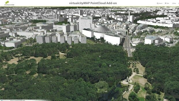
4th January 2017
Significant Savings on Track’Air MIDAS Systems for 2017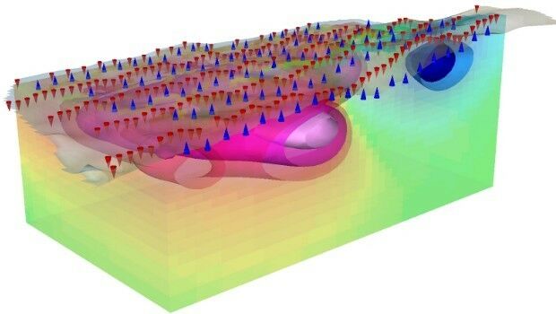
20th December 2016
Geosoft introduce IP and resistivity inversion in VOXI Earth Modelling
16th December 2016
virtualcitySYSTEMS simplifies handling of massive geodata8th December 2016
Magnetic inversion results for Ngamiland available for download30th November 2016
EarthSense Scientists Model Impact of Green Infrastructure on City Traffic Pollution30th November 2016
Esri Announces Additional Presenters for Geodesign Summit 201729th November 2016
3D Repo’s BIM Software Wins Recognition at International Innovation Awards23rd November 2016
Qatar Rail applies Maptek Eureka software to geological investigations16th November 2016
Indexed 3D Scene Layers as a Community standard work item15th November 2016
Maptek appointments to lead strategic delivery of technology roadmap11th November 2016
3D Laser Maps Reveal Devon's Hidden Archaeology3rd November 2016
An integrated and bundled survey solution for drones2nd November 2016
Arup hosted British Information Modelling Event hailed a success27th October 2016
Global Mapper LiDAR Module v18 Now Available25th October 2016
3D Scanning Industry Veteran hired by PrecisionPoint24th October 2016
Meet Who's Who of European BIM & Geospatial Industry at GEOBIM 201620th October 2016
Bluesky Aerial Mapping Tech Helps Prevent Trees Falling onto Vital Infrastructure19th October 2016
OGC approves Standard for use in the Modeling and Simulation World19th October 2016
Arithmetica Appoints point3D as North American Reseller of SphereVision 360 Imaging Software12th October 2016
Innovations in Measurement Data Processing11th October 2016
CivilStorm and StormCAD for Stormwater Designers and Managers