
News
News as it happens! Keep in touch with the latest developments in business and technology in the regions or worldwide.

Mitsubishi Corporation and NTT complete acquisition of 30% stake in HERE Technologies
2nd June 2020
Mitsubishi Corporation and NTT complete acquisition of 30% stake in HERE Technologies
Simactive announces Webinar on How to Calibrate and Process Multispectral Imagery
2nd June 2020
Simactive announces Webinar on How to Calibrate and Process Multispectral ImageryFugro’s RILA technology wins Network Rail Western Route track survey contract
2nd June 2020
Fugro’s RILA technology wins Network Rail Western Route track survey contract
Integrated Skills Limited joins forces with Yotta to help councils drive down service route costs and build up public trust
2nd June 2020
Integrated Skills Limited joins forces with Yotta to help councils drive down service route costs and build up public trust

How to Share and Visualize Drone Projects in the Cloud
1st June 2020
How to Share and Visualize Drone Projects in the CloudSatellite Imagery: SpaceX Falcon 9 Crew Dragon Launch
1st June 2020
Satellite Imagery: SpaceX Falcon 9 Crew Dragon Launch
Diamond Aircraft Appoints New Service Center in Texas
1st June 2020
Diamond Aircraft Appoints New Service Center in Texas
SPRINT forms partnership with konfer digital innovation brokerage service
29th May 2020
SPRINT forms partnership with konfer digital innovation brokerage service
Riegl Ricast Podcast Goes Global: Now Available From Your Favorite App Stores
29th May 2020
Riegl Ricast Podcast Goes Global: Now Available From Your Favorite App Stores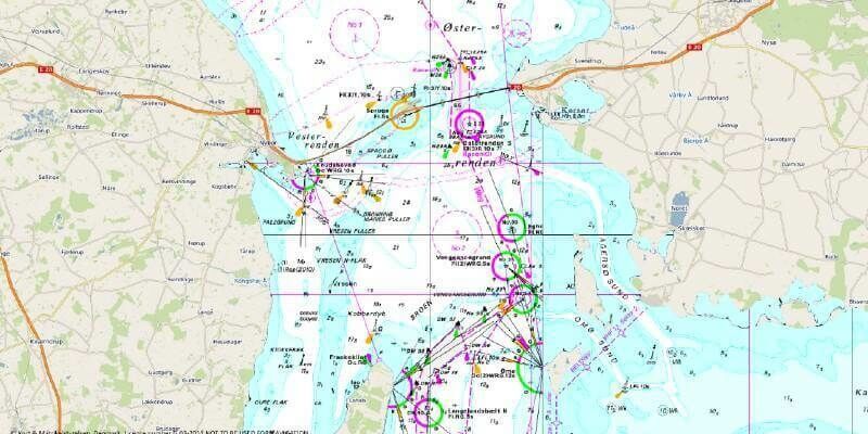
OceanWise release innovative Global Raster Chart dataset
29th May 2020
OceanWise release innovative Global Raster Chart dataset

Sonardyne Tests Navigation Systems For Autonomous Surface Vehicles For Uk Mod
28th May 2020
Sonardyne Tests Navigation Systems For Autonomous Surface Vehicles For Uk Mod

Spie Defense + Commercial Sensing Digital Forum 2020: Riegl’s Scientific Presentations Now Online
28th May 2020
Spie Defense + Commercial Sensing Digital Forum 2020: Riegl’s Scientific Presentations Now Online
Landmark appoints Alex Wrottesley as Managing Director of Environment and Mapping division
28th May 2020
Landmark appoints Alex Wrottesley as Managing Director of Environment and Mapping division
Teledyne CARIS appoints new sales manager for the US
27th May 2020
Teledyne CARIS appoints new sales manager for the US
Landmark extends Promap Premium Layers with free access to all layers until the end of June
27th May 2020
Landmark extends Promap Premium Layers with free access to all layers until the end of June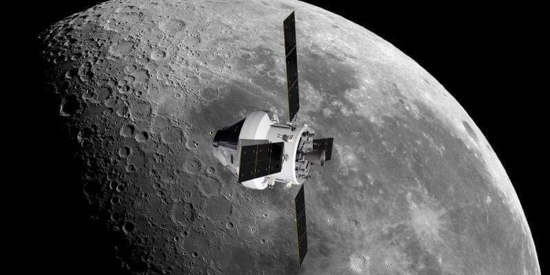
Airbus wins ESA contract to construct third European Service Module for NASA’s Orion spacecraft
27th May 2020
Airbus wins ESA contract to construct third European Service Module for NASA’s Orion spacecraft
HERE technologies appoints Grey Matter as one of their distributors
26th May 2020
HERE technologies appoints Grey Matter as one of their distributors
Microsoft updates Bing Maps features to support fleets as delivery demand surges
26th May 2020
Microsoft updates Bing Maps features to support fleets as delivery demand surgesUAVOS expands saker male uas family in collaboration with kacst
26th May 2020
UAVOS expands saker male uas family in collaboration with kacst
APCOA and HERE to partner on joint digital parking initiative
26th May 2020
APCOA and HERE to partner on joint digital parking initiative