
Terrestrial Surveying
The 2D and 3D measurement of points, distances and angles of features and objects on the Earth’s surface. See also Surveying Instrumentation topic. This topic covers the science and techniques that govern the 2D and 3D measurement of points, distances and angles of natural and man-made features and objects on the Earth’s surface. These measurements are acquired for a wide range of practical applications in construction, engineering, land use planning, mapmaking and cadastral projects, See also Surveying Instrumentation topic for the various tools employed to acquire survey measurements.

High profile satellite derived bathymetry project from Proteus
9th May 2016
High profile satellite derived bathymetry project from Proteus
Arithmetica Reveals Latest Tech at Museums and Heritage Show
9th May 2016
Arithmetica Reveals Latest Tech at Museums and Heritage Show
Aerial Mapping Company Bluesky Announces Expansion
5th May 2016
Aerial Mapping Company Bluesky Announces Expansion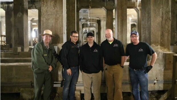
National Mall Employs HighTech Surveying for 21st-Century Preservation
5th May 2016
National Mall Employs HighTech Surveying for 21st-Century Preservation
Senceive Making Waves In Wireless Monitoring
5th May 2016
Senceive Making Waves In Wireless Monitoring
Hemisphere GNSS Announces Management Changes
5th May 2016
Hemisphere GNSS Announces Management Changes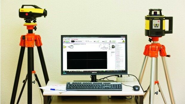
Leica releases new calibration system for value-added service
4th May 2016
Leica releases new calibration system for value-added service
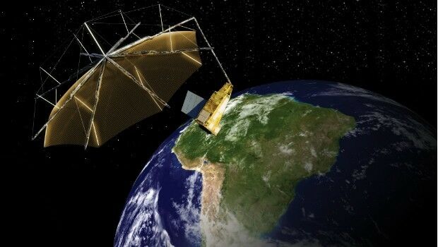
Airbus Defence and Space signs contract to build Biomass
3rd May 2016
Airbus Defence and Space signs contract to build Biomass
NCTech and Top Gear USA capture the Rubicon Trail in 360 degrees
27th April 2016
NCTech and Top Gear USA capture the Rubicon Trail in 360 degrees
Bluesky Aerial Photomap Definitive Information Resource for Irish Council
27th April 2016
Bluesky Aerial Photomap Definitive Information Resource for Irish Council
Leica Geosystems delivers 10th DMC III aerial camera
26th April 2016
Leica Geosystems delivers 10th DMC III aerial camera
KOREC partners with Cadcorp to integrate field data capture
26th April 2016
KOREC partners with Cadcorp to integrate field data capture
Trimble Partners with the University of Cambridge
21st April 2016
Trimble Partners with the University of Cambridge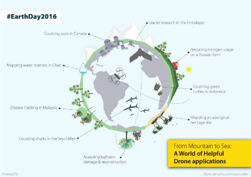
Earth Day 2016: From mountain to sea, a world of helpful drone apps
21st April 2016
Earth Day 2016: From mountain to sea, a world of helpful drone apps
Setting the Standard for Survey Equipment Hire
21st April 2016
Setting the Standard for Survey Equipment Hire
Leica Geosystems wins 2 Red Dot Design Awards
21st April 2016
Leica Geosystems wins 2 Red Dot Design Awards
Anatum Field Evaluation of Bluetooth GNSS Receivers
20th April 2016
Anatum Field Evaluation of Bluetooth GNSS Receivers
MicroPilot Selects Spirent GNSS Simulators
20th April 2016
MicroPilot Selects Spirent GNSS Simulators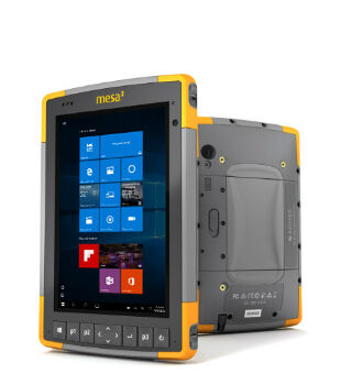
Mesa 2 Rugged Windows Tablet is Now Shipping
20th April 2016
Mesa 2 Rugged Windows Tablet is Now Shipping
Trimble Announces Call for Speakers for its 2016 Dimensions User Conference
20th April 2016
Trimble Announces Call for Speakers for its 2016 Dimensions User Conference
With iXBlue, the future of positioning is now
18th April 2016
With iXBlue, the future of positioning is now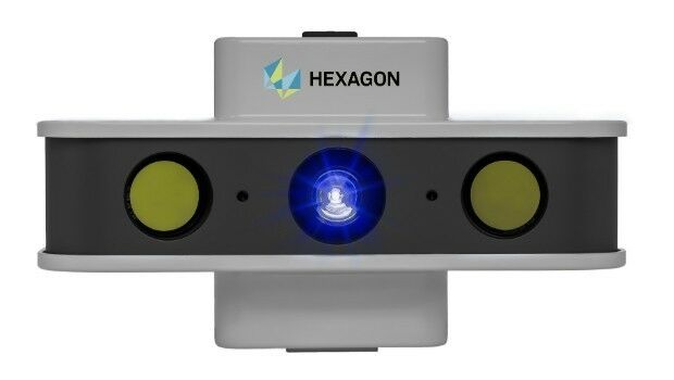
NEW! PrimeScan: Entry-level solution for precise 3D digitization
18th April 2016
NEW! PrimeScan: Entry-level solution for precise 3D digitization3.jpg)
Hexagon Geospatial Releases Power Portfolio 2016
18th April 2016
Hexagon Geospatial Releases Power Portfolio 2016


Topcon demonstrates Smart Working Tech at Geo Business
15th April 2016
Topcon demonstrates Smart Working Tech at Geo Business
Arithmetica reveals 360 imaging and 3D laser modeling tech at Forensics Europe
15th April 2016
Arithmetica reveals 360 imaging and 3D laser modeling tech at Forensics Europe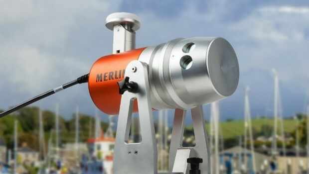
Renishaw welcomes Measutronics Corporation to its distributor network
15th April 2016
Renishaw welcomes Measutronics Corporation to its distributor network
DigitalGlobe to Announce Q1 2016 Financial Results on April 27
14th April 2016
DigitalGlobe to Announce Q1 2016 Financial Results on April 27
Vexcel Imaging introduces the new UltraCam Condor
13th April 2016
Vexcel Imaging introduces the new UltraCam Condor
Leica Geosystems launches 2016 Plan Contest
13th April 2016
Leica Geosystems launches 2016 Plan Contest
Topcon announces new machine control dealer in Italy
13th April 2016
Topcon announces new machine control dealer in Italy
Leica Geosystems partners with DotProduct LLC, SpheronVR AG
12th April 2016
Leica Geosystems partners with DotProduct LLC, SpheronVR AG
Coventry Gets Sky Blue View with Bluesky Photomap
12th April 2016
Coventry Gets Sky Blue View with Bluesky Photomap
Maryland SHA using broadcast quality camera in Furgo vehicle
11th April 2016
Maryland SHA using broadcast quality camera in Furgo vehicle
Seafloor Delivers Autonomous Multibeam Survey System To Skanska
6th April 2016
Seafloor Delivers Autonomous Multibeam Survey System To Skanska
ABPmer reviews fishing impact on seabird MPA features
6th April 2016
ABPmer reviews fishing impact on seabird MPA features
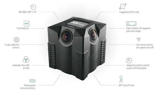
NCTech unveils new 360 degree imaging developments for iSTAR camera
5th April 2016
NCTech unveils new 360 degree imaging developments for iSTAR camera
Sofradir space activities update - role in ExoMars mission
5th April 2016
Sofradir space activities update - role in ExoMars mission
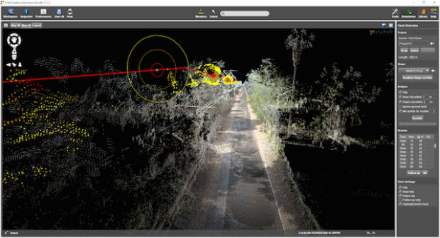
Orbit GT launches Mobile Mapping Feature Extraction Bundle
4th April 2016
Orbit GT launches Mobile Mapping Feature Extraction Bundle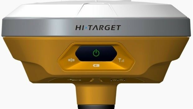
Latest products from Hi-Target Surveying Instrument Co. Ltd
4th April 2016
Latest products from Hi-Target Surveying Instrument Co. Ltd