
Terrestrial Surveying
The 2D and 3D measurement of points, distances and angles of features and objects on the Earth’s surface. See also Surveying Instrumentation topic. This topic covers the science and techniques that govern the 2D and 3D measurement of points, distances and angles of natural and man-made features and objects on the Earth’s surface. These measurements are acquired for a wide range of practical applications in construction, engineering, land use planning, mapmaking and cadastral projects, See also Surveying Instrumentation topic for the various tools employed to acquire survey measurements.
Earthquake in Myanmar Damage 171 Ancient Buddhist Pagodas
30th August 2016
Earthquake in Myanmar Damage 171 Ancient Buddhist Pagodas
VisionMap A3 Edge Innovates Precision Agriculture in North Dakota
29th August 2016
VisionMap A3 Edge Innovates Precision Agriculture in North Dakota
Hi-Target Europe successfully launched new products in Czech
26th August 2016
Hi-Target Europe successfully launched new products in Czech
Topcon Survey Reveals Huge Potential Of Machine Control
24th August 2016
Topcon Survey Reveals Huge Potential Of Machine Control
Lithuanian Survey Experts Takes Delivery Of Siteco Road-Scanner
24th August 2016
Lithuanian Survey Experts Takes Delivery Of Siteco Road-Scanner
HERMES® 450 soars during the North Dakota UAS Field Day
23rd August 2016
HERMES® 450 soars during the North Dakota UAS Field Day
Stesalit Systems Ltd supplies GPS PDA to Odisha Forestry Department
22nd August 2016
Stesalit Systems Ltd supplies GPS PDA to Odisha Forestry Department
Septentrio Supplies to Oregon Department of Transport
18th August 2016
Septentrio Supplies to Oregon Department of Transport
Seafloor’s In-Water Demonstration At Oceans ’16
17th August 2016
Seafloor’s In-Water Demonstration At Oceans ’16
Fugro Supports Total Ultra-Deep Water Drilling Campaign
16th August 2016
Fugro Supports Total Ultra-Deep Water Drilling Campaign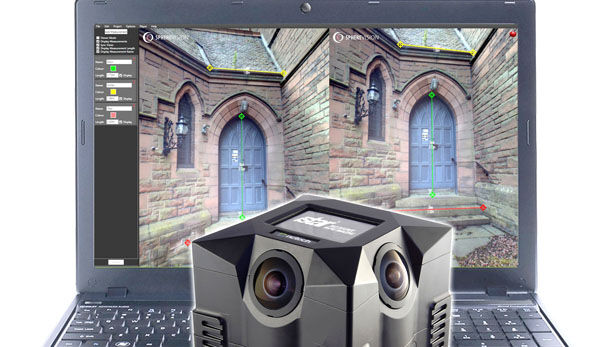
New SphereVision 360 Imaging Software Integrates iSTAR Measurement Module
11th August 2016
New SphereVision 360 Imaging Software Integrates iSTAR Measurement Module
Barrow Upon Soar Rail Closure Prompts Monitoring Calls
10th August 2016
Barrow Upon Soar Rail Closure Prompts Monitoring Calls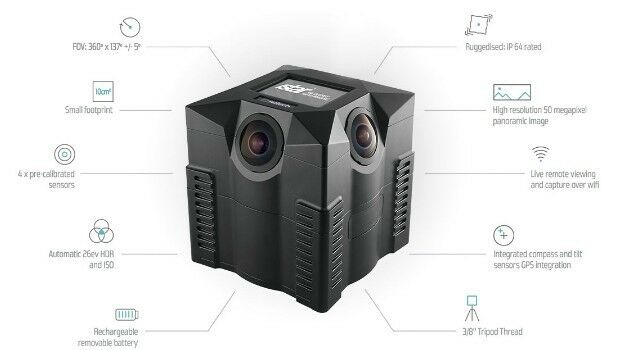
iSTAR 360 degree Measurement Module integrated by imaging companies
10th August 2016
iSTAR 360 degree Measurement Module integrated by imaging companies

New Blackfly S - the Latest Imaging Technology in Compact Housing
6th August 2016
New Blackfly S - the Latest Imaging Technology in Compact Housing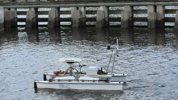
SeaRobotics Delivers Unmanned Surface Vehicle
4th August 2016
SeaRobotics Delivers Unmanned Surface Vehicle
Fugro Completes Ghana Metocean Data Acquisition For Hess Corporation
2nd August 2016
Fugro Completes Ghana Metocean Data Acquisition For Hess Corporation
Geneq's announcement of iSXBlue receivers compatibility
2nd August 2016
Geneq's announcement of iSXBlue receivers compatibility
HERE appoints Peter Meier as Chief Financial Officer
25th July 2016
HERE appoints Peter Meier as Chief Financial Officer
Praise for The Survey School’s prize-winning 2016 graduates
25th July 2016
Praise for The Survey School’s prize-winning 2016 graduates
Airbus Defence and Space Launches “One Tasking”
20th July 2016
Airbus Defence and Space Launches “One Tasking”
SSTL expands LEO platform capability with VESTA nanosatellite
19th July 2016
SSTL expands LEO platform capability with VESTA nanosatellite
Fugro Commences Offshore Geotechnical Contract For ONGC India
18th July 2016
Fugro Commences Offshore Geotechnical Contract For ONGC India
NM Group awarded contract to deliver transmission powerline survey
18th July 2016
NM Group awarded contract to deliver transmission powerline survey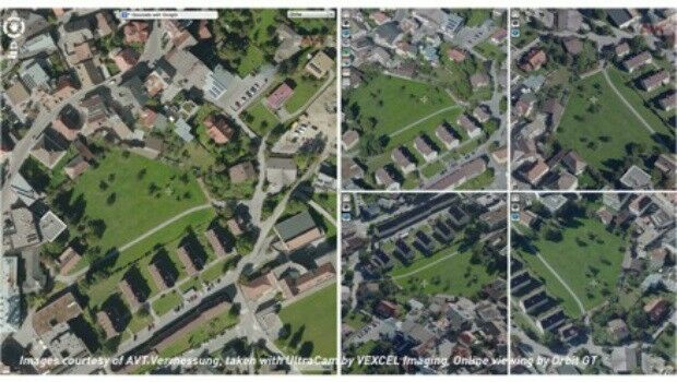
Orbit GT and Vexcel Imaging, Austria sign Reseller Agreement
8th July 2016
Orbit GT and Vexcel Imaging, Austria sign Reseller Agreement
Patrol+® a flying success with survey completed for National Grid
8th July 2016
Patrol+® a flying success with survey completed for National Grid
Topcon poll reveals cost of stolen equipment
8th July 2016
Topcon poll reveals cost of stolen equipment
Vexcel Imaging and Orbit GT sign Reseller Agreement
8th July 2016
Vexcel Imaging and Orbit GT sign Reseller Agreement
First glimpse of potential Nullarbor treasures
7th July 2016
First glimpse of potential Nullarbor treasures
Hi-Target Maintenance Center in Jicin, Czech
7th July 2016
Hi-Target Maintenance Center in Jicin, Czech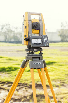
Topcon Announces All New GT Robotic Series Total Stations
6th July 2016
Topcon Announces All New GT Robotic Series Total Stations

CSA Conducts Seagrass Enhancement Project in North Carolina
6th July 2016
CSA Conducts Seagrass Enhancement Project in North Carolina
Leica Geosystems announces world’s first fused airborne sensor
5th July 2016
Leica Geosystems announces world’s first fused airborne sensor
Trimble R2 GNSS Receiver Now Available for Data Collection
30th June 2016
Trimble R2 GNSS Receiver Now Available for Data Collection
Fugro on track with Ground Penetrating Radar Surveys for SNCF
30th June 2016
Fugro on track with Ground Penetrating Radar Surveys for SNCF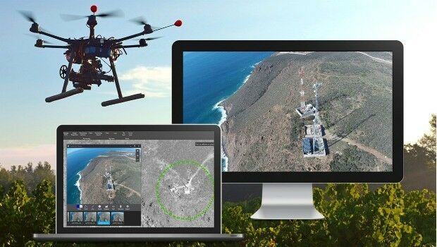

Fugro deploys more Resource for World’s Largest Seep-Hunting Survey
30th June 2016
Fugro deploys more Resource for World’s Largest Seep-Hunting Survey
EUMETSAT approves new Strategy of Meteosat-8 over the Indian Ocean
30th June 2016
EUMETSAT approves new Strategy of Meteosat-8 over the Indian Ocean
Spectra MobileMapper 50 Combines Smartphone with GNSS Capabilities
29th June 2016
Spectra MobileMapper 50 Combines Smartphone with GNSS Capabilities

Septentrio Announces Upgrades for Altus NR2 and PinPoint-GIS
29th June 2016
Septentrio Announces Upgrades for Altus NR2 and PinPoint-GIS
Arithmetica’s SphereVision Captures 360 Degree Sub-Sea Selfies on YouTube Beach
24th June 2016
Arithmetica’s SphereVision Captures 360 Degree Sub-Sea Selfies on YouTube Beach