
Avenza Releases MAPublisher 10.2 For Adobe Illustrator
11th July 2018
Avenza Releases MAPublisher 10.2 For Adobe Illustrator11th July 2018
Avenza Releases MAPublisher 10.2 For Adobe Illustrator10th July 2018
Belgians’ purchasing power for food three times that of Poles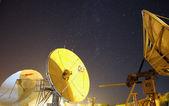
10th July 2018
Goonhilly unveils roadmap for commercial space communications
10th July 2018
thinkWhere Helps Transform Land Registration in Scotland
10th July 2018
Cadcorp releases FindIT to reduce time spent on searches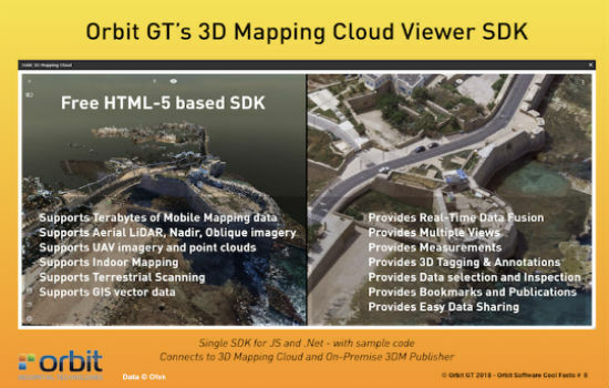
5th July 2018
Orbit GT releases free SDK/API for 3D Mapping Cloud SaaS platform2nd July 2018
OGC Seeks Public Comment on 3D Tiles Candidate Community Standard
2nd July 2018
thinkWhere Approved as G-Cloud 10 Government Supplier28th June 2018
SKYNET 6 Updates at 20th Annual Global MilSatCom Conference
28th June 2018
OGC seeks public comment on Part 1 of the Features and Geometries
27th June 2018
NIBE Hots Up Service Levels with Maxoptra Routing
26th June 2018
OGC seeks public comment on Tile Matrix Set Candidate Standard
26th June 2018
thinkWhere In Pole Positions with of 8 Years of Quality Certification23rd June 2018
Free Business Location Data for Use with Maptitude 201822nd June 2018
Soar TGE to generate the world’s first fully decentralised global super-map using drones
21st June 2018
Safe Software renews FME Certification for 1Spatial’s Mary O’Brien20th June 2018
Join Geospatial, Hydrometeorological and GNSS Conference15th June 2018
Hexagon introduces HxGN MineOperate UG Pro for Miners15th June 2018
GAF to provide consulting services in Mozambique

14th June 2018
Mansfield District Council looks to Cadcorp web mapping to reduce GIS maintenance overheads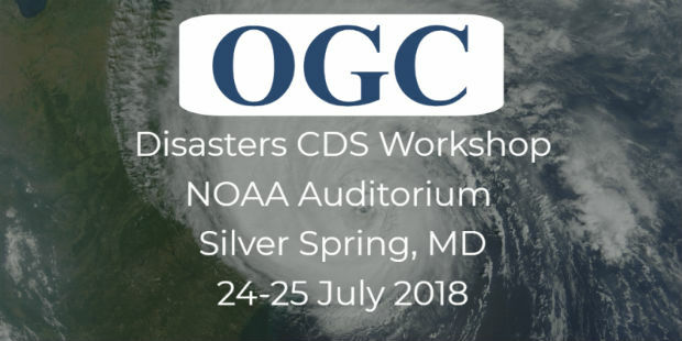
7th June 2018
OGC Invites you to the Disasters CDS Workshop at the NOAA Auditorium7th June 2018
Going Deeper Underground – Can We Build An Underground Map Of The UK?7th June 2018
Rezatec join forces with specialist contractor, Detection Services
5th June 2018
Esri Location Intelligence to Integrate with SAP HANA Spatial Services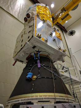
5th June 2018
Airbus-built Aeolus wind sensor satellite ready for shipment
30th May 2018
Esri Announces Release of Sentinel-2 Image Services29th May 2018
Airbus wins major NATO communications system contract25th May 2018
Ordnance Survey announce rise in sales for both paper and digital OS Maps24th May 2018
thinkWhere Supports Global Humanitarian Project to Map Disaster Areas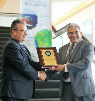
23rd May 2018
Fugro's Contribution To Global Ocean Mapping Earns NOAA Commendation18th May 2018
SpaceDataHighway: 10,000 successful laser connections16th May 2018
Carlson PhotoCapture to be presented at GEO Business 2018
15th May 2018
Comprehensive Education Featured at GIS-Pro & CalGIS 2018
15th May 2018
Marex Spectron Announces Joint-Venture with Earth-i14th May 2018
Airbus CyberSecurity brings its expertise to EU funded Brain-IoT Project
9th May 2018
Data Gateway brings powerful data validation and processing via a self-serve, training-free experien
8th May 2018
Exciting toolkit of technologies on display at GEO Business 20188th May 2018
CCW celebrates 20 years of advancing mission critical communications8th May 2018
Big Data, 5G, automation and artificial intelligence
7th May 2018
OGC seeks public comment on new Interoperable Simulation


1st May 2018
EarthSense Maps Show Homeowners Air Pollution Levels
26th April 2018
EarthSense adds ultra-fine particulates to MappAir air pollution map26th April 2018
Esri's Developer Technology Supports Situational Awareness Workflows