
Leica Geosystems smart antenna provides superior performance
7th April 2016
Leica Geosystems smart antenna provides superior performance
7th April 2016
Leica Geosystems smart antenna provides superior performance
6th April 2016
GeoPlace endorses transformational power of addresses and street data6th April 2016
Maptitude Team Provides Sponsorship for NEGIS Spring Conference
6th April 2016
The next AGI ECN webinar is 12th April 2016!6th April 2016
The new version 6.1 of the PHOTOMOD software family has been released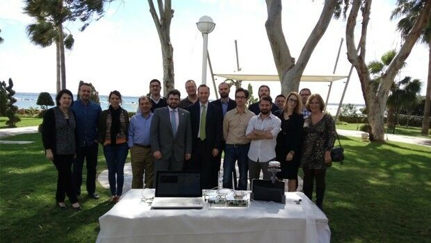
6th April 2016
Experimental location based augmented reality system for utilities infrastructure management tested.
6th April 2016
CYBERBIT Awarded Intelligence and Cyber System Contract in Africa
6th April 2016
Trimble Launches New Version of its Smart Water Management Software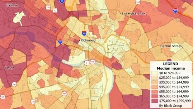
6th April 2016
Caliper Offers 2016 Census Block Groups Data6th April 2016
Improved Mine Planning Software in Spring release6th April 2016
IDV Solutions launches Visual Command Center 5.0
6th April 2016
ABPmer reviews fishing impact on seabird MPA features6th April 2016
GeoSpatial Experts Announces Reseller Agreement with WTH Technology5th April 2016
Geomatics SME leads EU FP7 private sector involvement in Cyprus5th April 2016
Hexagon Safety & Infrastructure Software deployed in Phillippines5th April 2016
UK Power Networks and Northumbrian Water sign up to receive OS mapping
5th April 2016
Exprodat Supports OGA Exploration Licence Competition5th April 2016
NCTech unveils new 360 degree imaging developments for iSTAR camera5th April 2016
Team Internet boosts geographic targeting accuracy5th April 2016
Airbus D&S and Thales to produce new digital maps for French defence
5th April 2016
Unitra Maritime Manila Inc. purchases NAUTIS Simulators
4th April 2016
Fugro Completes Offshore Works For EOWDC At Aberdeen Bay4th April 2016
Mick George Ltd: adopts Masternaut Connect Telematics Technology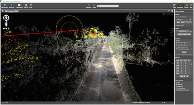
4th April 2016
Orbit GT launches Mobile Mapping Feature Extraction Bundle2nd April 2016
Elsevier and Society of Exploration Geophysicists Geo Announcement1st April 2016
Cheshire East Highways Implements Yotta’s Horizons1st April 2016
SENSEWHERE: Scottish Indoor Location Technology Spreading Across China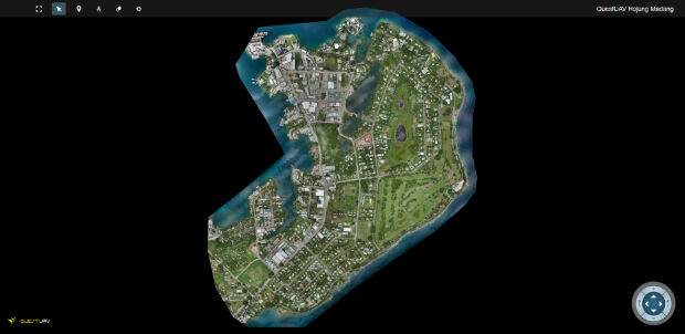
1st April 2016
QuestUAV's South Korean Partner maps Madang, Papua New Guinea1st April 2016
Esri Adds Innovative Web Map Analytics Tool to ArcGIS Marketplace
31st March 2016
BARTHAUER presenting at Pipeline Technology Conference in Berlin
31st March 2016
Chinese Qihoo 360’s child tracking watch uses u-blox GNSS Technology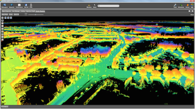
31st March 2016
Orbit GT releases update for essential Mobile Mapping Content Manager
30th March 2016
New Leica Geosystems reference servers and monitoring receiver
30th March 2016
Intergraph Utility Network Model extended across the Enterprise30th March 2016
OS reveals winning ideas that will improve our relationship with water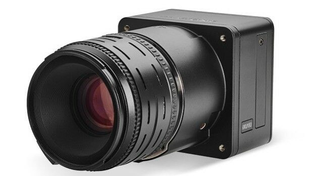
30th March 2016
Direct Georeferencing with Phase One iXU 150 Camera and POS AVX 21030th March 2016
RegioGraph 2016: New geomarketing software from GfK hits the market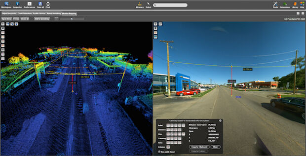

30th March 2016
Free Report: UAVs in Precision Agriculture30th March 2016
Trimble Launches FieldPoint RTX Correction Service29th March 2016
Commercial UAV Expo Issues Free Report: Surveying and Mapping with UAVs
29th March 2016
what3words hires Steve Coast, founder of OpenStreetMap