
Satellite Positioning, Navigation & Timing (PNT)
Don't miss a beat, sign up to our newsletter

OGC's 99th Technical & Planning Committee Meetings Announced
16th May 2016
OGC's 99th Technical & Planning Committee Meetings Announced
New tool supports Global Intelligence Community
16th May 2016
New tool supports Global Intelligence Community
Airbus Defence and Space opens a ground station in Australia
16th May 2016
Airbus Defence and Space opens a ground station in Australia
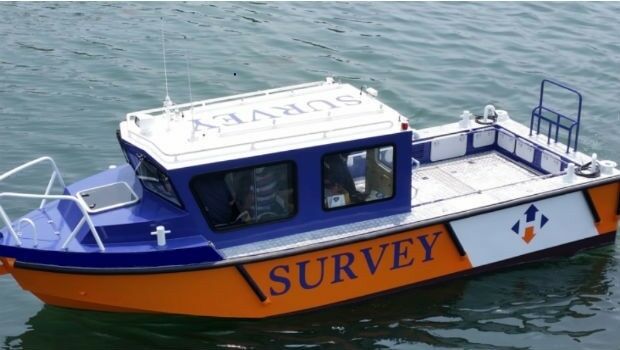
Horizon Launch High Spec Nearshore Survey Boat
16th May 2016
Horizon Launch High Spec Nearshore Survey Boat
Esri Wins TM Forum Live! Award for Internet of Things Project
15th May 2016
Esri Wins TM Forum Live! Award for Internet of Things Project

Second Women in Drones Event Planned for InterDrone
13th May 2016
Second Women in Drones Event Planned for InterDrone
indoo.rs joins the Wayfindr Alliance to support the visually impaired
13th May 2016
indoo.rs joins the Wayfindr Alliance to support the visually impaired
HERE announces members of the new Supervisory Board
13th May 2016
HERE announces members of the new Supervisory Board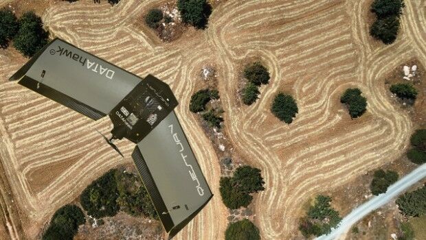
QuestUAV complete reseller rollout of Q-100 DATAhawks
13th May 2016
QuestUAV complete reseller rollout of Q-100 DATAhawks
Itron Brings Analytic Outcomes as a Service to Utilities
12th May 2016
Itron Brings Analytic Outcomes as a Service to Utilities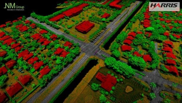
NM Group collaborate with Harris Corporation
12th May 2016
NM Group collaborate with Harris Corporation

A GeoPlace commissioned study projects net benefits up to £202 million
12th May 2016
A GeoPlace commissioned study projects net benefits up to £202 million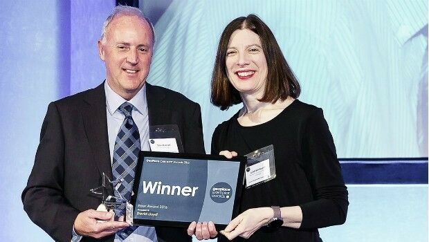
David Lloyd wins Peer Award at GeoPlace Exemplar Awards
12th May 2016
David Lloyd wins Peer Award at GeoPlace Exemplar Awards
UAVAir train candidates for better standard of drone pilot graduates
11th May 2016
UAVAir train candidates for better standard of drone pilot graduates
OGC adopts WaterML2.0 Part 2 - Ratings, Gaugings and Sections Standard
11th May 2016
OGC adopts WaterML2.0 Part 2 - Ratings, Gaugings and Sections Standard
Ordnance Survey select Solent Mind as new corporate charity
11th May 2016
Ordnance Survey select Solent Mind as new corporate charity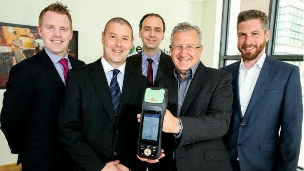
Esri Ireland & Leica put accuracy into the hands of field workers
11th May 2016
Esri Ireland & Leica put accuracy into the hands of field workers
Integration of Orion’s European Service Module
11th May 2016
Integration of Orion’s European Service Module
Hyperspectral Imaging and Applications | HSI 2016 Announcement
11th May 2016
Hyperspectral Imaging and Applications | HSI 2016 Announcement
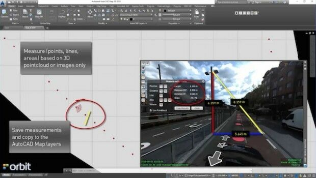
Orbit GT launches AutoCAD MAP plugin for Mobile Mapping
11th May 2016
Orbit GT launches AutoCAD MAP plugin for Mobile Mapping


Trimble Free App for AMERICAN Flow Control Water Valves and Hydrants
11th May 2016
Trimble Free App for AMERICAN Flow Control Water Valves and Hydrants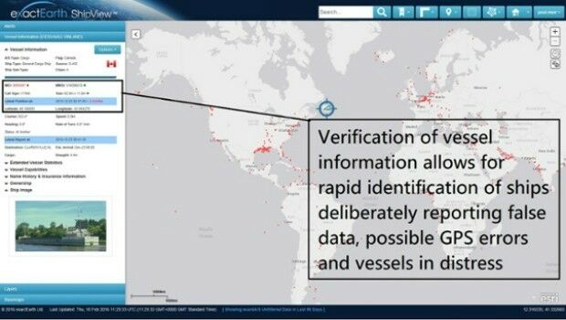
Knowledge is Power- exactEarth Announces Vital New Information Service
11th May 2016
Knowledge is Power- exactEarth Announces Vital New Information Service
Earth-i Takes the Best of British to Geospatial World Forum
10th May 2016
Earth-i Takes the Best of British to Geospatial World Forum
Radiodetection launches new Ground Penetrating Radar systems
10th May 2016
Radiodetection launches new Ground Penetrating Radar systems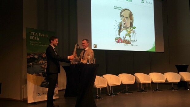
Airbus D&S and partners win ITEA Award for fight against cyber threats
10th May 2016
Airbus D&S and partners win ITEA Award for fight against cyber threats
Fugro commences Barents Sea Metocean and Ice Network Project
10th May 2016
Fugro commences Barents Sea Metocean and Ice Network Project
Nottingham flood expert is honoured by Royal Geographical Society
10th May 2016
Nottingham flood expert is honoured by Royal Geographical Society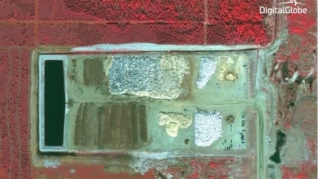
GreenRoad Sets Its Sights on Field Services Market
10th May 2016
GreenRoad Sets Its Sights on Field Services Market
High profile satellite derived bathymetry project from Proteus
9th May 2016
High profile satellite derived bathymetry project from Proteus
£4 return on every £1 spent on council address and street information
9th May 2016
£4 return on every £1 spent on council address and street information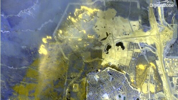
DigitalGlobe Dramatic Images: Oil Sands Fire
9th May 2016
DigitalGlobe Dramatic Images: Oil Sands Fire
Esri UK Customer Success Awards Shortlist Announced
6th May 2016
Esri UK Customer Success Awards Shortlist Announced
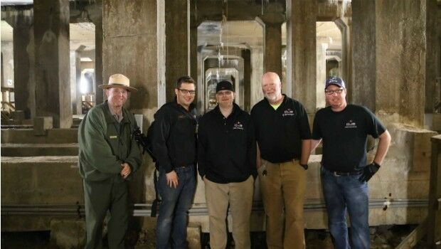
National Mall Employs HighTech Surveying for 21st-Century Preservation
5th May 2016
National Mall Employs HighTech Surveying for 21st-Century Preservation
Take Note of Recent Changes to Insurance Law, Urged by UAVAir
5th May 2016
Take Note of Recent Changes to Insurance Law, Urged by UAVAir
Hemisphere GNSS Announces Management Changes
5th May 2016
Hemisphere GNSS Announces Management Changes