
u-blox NEO-M8U and NEO-M8P awarded for Internet of Things innovation
14th June 2016
u-blox NEO-M8U and NEO-M8P awarded for Internet of Things innovation14th June 2016
u-blox NEO-M8U and NEO-M8P awarded for Internet of Things innovation14th June 2016
GreenRoad to Exhibit at Service Management Expo 201614th June 2016
£8 million monsoon project launches in India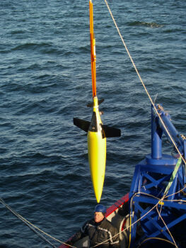
14th June 2016
£8 million monsoon project launches in India
13th June 2016
Abstract Submissions Invited for 2017 GIS/CAMA Technologies Conference_Copyright_Dassault_SysteI%20mes.jpg)
13th June 2016
Dassault Systèmes and Cybernaut Investment Group Sign Agreement
13th June 2016
AECOM collaborates with Trimble on the use of HoloLens technology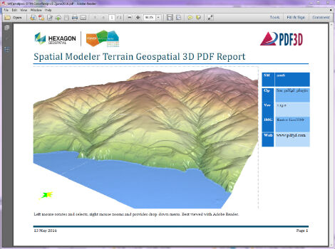
13th June 2016
PDF3D Releases 3D Geospatial PDF Plugin for ERDAS IMAGINE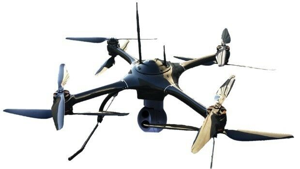
13th June 2016
Aero Surveillance announces a new version of its Octocopter ASV 3010th June 2016
Satellite navigation expert decorated by Royal Institute of Navigation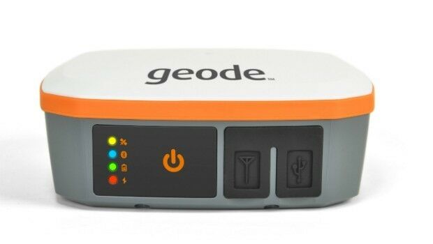
10th June 2016
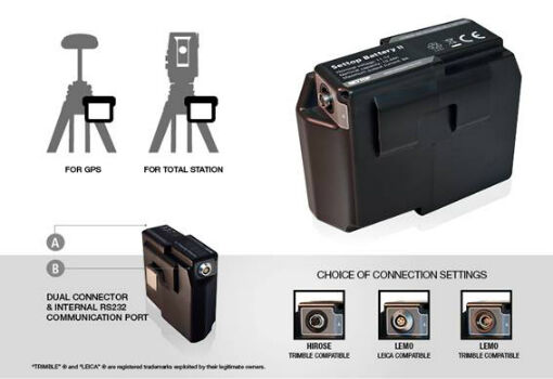
Meet the Geode™—A Rugged Sub-Meter GNSS Receiver10th June 2016
City of Aurora Honored for Water Operations GIS Overhaul
10th June 2016
Geospatial on a Budget: When Cost Really is Total Cost10th June 2016
exactEarth Providing S-AIS Services to French Navy10th June 2016
OriginGPS and Sierra Wireless Strike New Partnership
10th June 2016
Plowman Craven wins Parliament BIM & scanning contract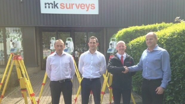
10th June 2016
Mobile mapping – The Future has arrived for MK Surveys
9th June 2016
Eco-Center AG is a new customer of Barthauer Software GmbH
9th June 2016
New Esri Book Shows How GIS Technology Can Help the Oceans Thrive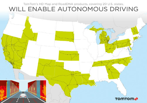
9th June 2016
TomTom Showcases Precise Location Capability
8th June 2016
Hydropower Development Europe 2016 , 14-15 September, Lyon, France8th June 2016
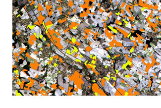
What is the economic value of satellite Imagery?8th June 2016
HERE and Hyundai strengthen their collaboration for European Drivers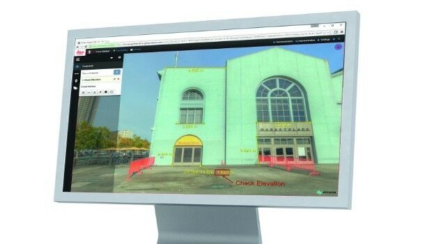
8th June 2016
Leica Geosystems releases new software capabilities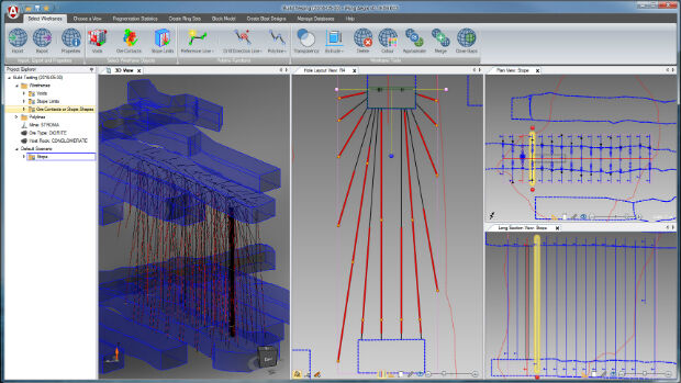

8th June 2016
Hexagon Safety & Infrastructure Software helps Madhya Pradesh Police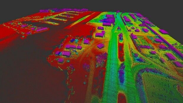
8th June 2016
Merrick-Surdex JV Awarded Contract with USGS
8th June 2016
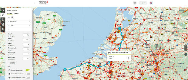
Route Planning For Truckers Now Available From TomTom8th June 2016
Masternaut exhibiting at Company Car In Action show
7th June 2016
Leica Lino ML180 saves costs with smart one-man operation
6th June 2016
Hexagon Software Aids Emergency Response in Gotthard Base Tunnel
6th June 2016
Final reminder about the Early Careers Network webinar - 8th June 2016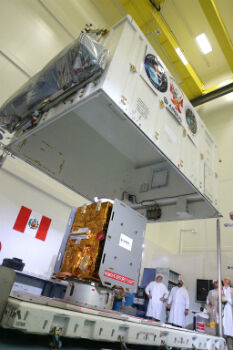
6th June 2016
Airbus Defence and Space completed PerúSAT-1 in less than 24 months
6th June 2016
Wanted: Mobile Apps to Handle Big Data from Space4th June 2016
SonarMite™ Drivers now Available for Trimble Access Field Software4th June 2016
Seafloor adds a Second Reson SeaBat T50-P MBES to Rental Pool3rd June 2016
Esri Brings GIS to Young Developers for National Day of Civic Hacking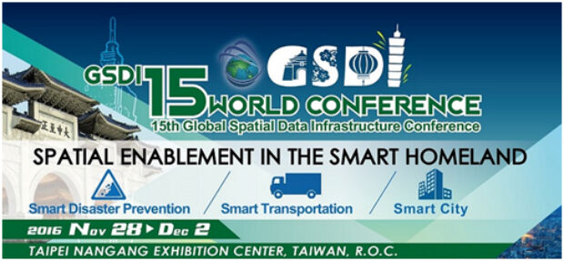
3rd June 2016
By popular demand the GSDI 15 Conference Abstract Deadline is 1 July2nd June 2016
Quartix Ranked #1 of the UK’s Top 50 Quoted Tech Companies