
OGC seeks public comment on candidate Sensor Model Language (SensorML) v2.1 standard
16th May 2019
OGC seeks public comment on candidate Sensor Model Language (SensorML) v2.1 standard
16th May 2019
OGC seeks public comment on candidate Sensor Model Language (SensorML) v2.1 standard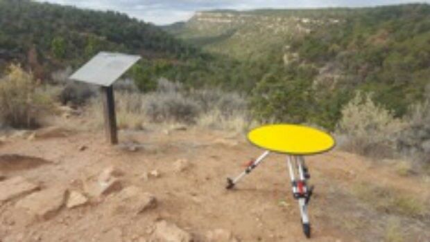
16th May 2019
Routescene's improved approach to quantifying accuracy
16th May 2019
1Spatial acquire GEOMAP-IMAGIS and conclude simultaneous agreement with Esri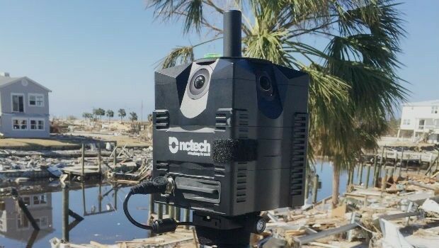
16th May 2019
360-degree camera provides ground-based imaging following weather disasters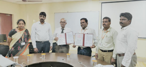
16th May 2019
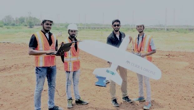
Terra Drone India and Vignan University set up drone lab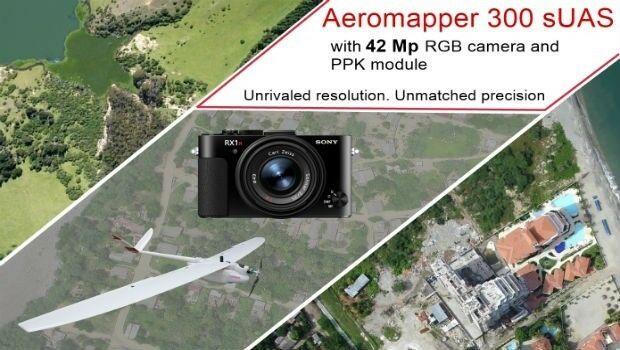
15th May 2019
AEROMAPPER 300 & 42Mp camera with PPK bundle
15th May 2019
Jesse Norman MP conveyed need for high quality data for transport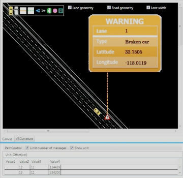
15th May 2019
Mitsubishi Electric and HERE develop road hazard alert system
15th May 2019
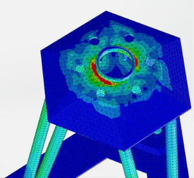
Putting a revolutionary new offshore wind foundation to the test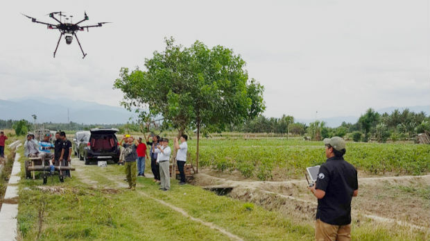
15th May 2019
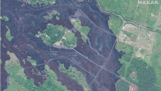
Satellite Imagery: Hawaii One Year After Kilauea Eruption
14th May 2019
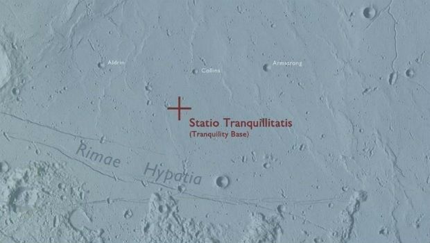
Ordnance Survey map commemorates 1969 moon landing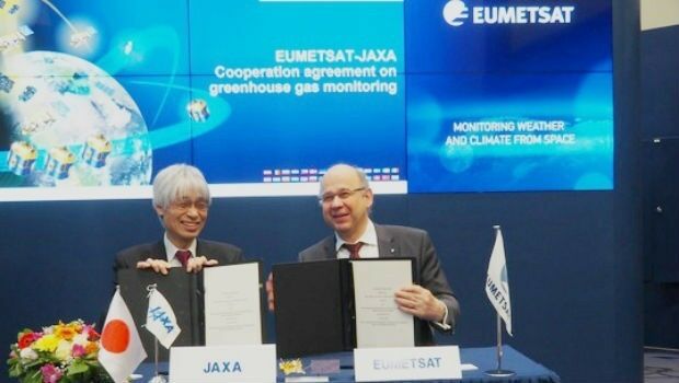
14th May 2019
EUMETSAT, Japanese space agency to cooperate on greenhouse gas monitoring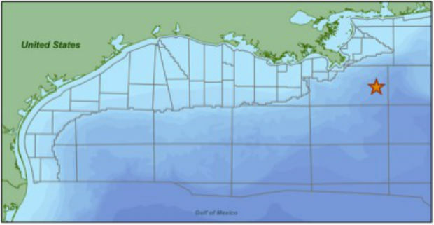
14th May 2019
CGG Begins First Multi-Client Ocean Bottom Node Survey
14th May 2019
IQGeo launches ‘reality-centric’ geospatial platform_dipping_sonar_onboard_Seagull.jpg)
14th May 2019
The Israeli Navy Deployed its HELRAS equipped Seagull
14th May 2019
Bentley Systems Announces Availability of OpenSite Designer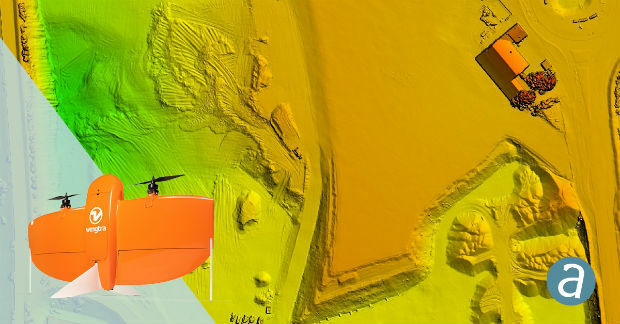
14th May 2019
SimActive Software Enables Processing of Wingtra Drone Data14th May 2019
Bentley Systems Announces the Availability of OpenBuildings Station Designer14th May 2019
PCI Geomatics to showcase Analysis Ready Data tools13th May 2019
AND appoints DDS as reseller of the AND Digital Maps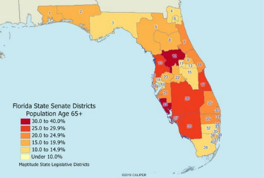
10th May 2019
2019 State Legislative District & Congressional District Boundaries
10th May 2019
Unifly in top three 'hottest' European scale-ups at TNW Conference 201910th May 2019
New digital maps available for Germany, Austria and Switzerland
10th May 2019
Terra Drone opens Angola branch due to high demand from oil and gas industry


9th May 2019
Terra Drone India surveys 4,200 sq km in Maharashtra
9th May 2019
Garmin receives approval for the GFC 500 autopilot in the Mooney M20
8th May 2019
Rene Worms joins Atmos UAV as Head of Global Sales
8th May 2019
Infrastructure Inspection – UAS Are All Over It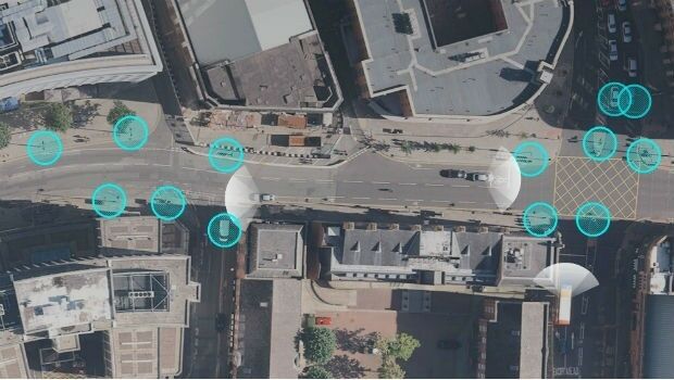

8th May 2019
Maptitude Mapping Software Team Provides Awards & Prizes for 2019 AAG
8th May 2019
CSA Completes Field Surveys Offshore Puerto Rico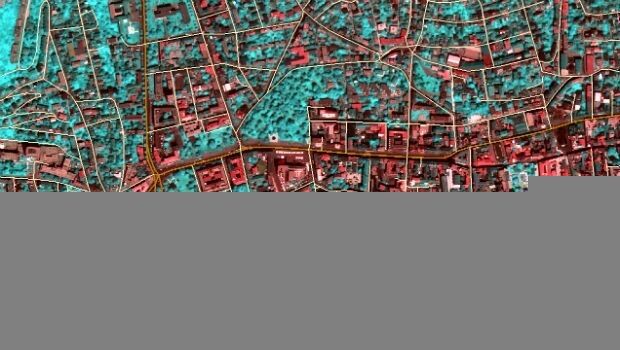
7th May 2019
TCarta teams up with King’s College London and wins ESA Funding7th May 2019
HERE powers new serverless location-based functions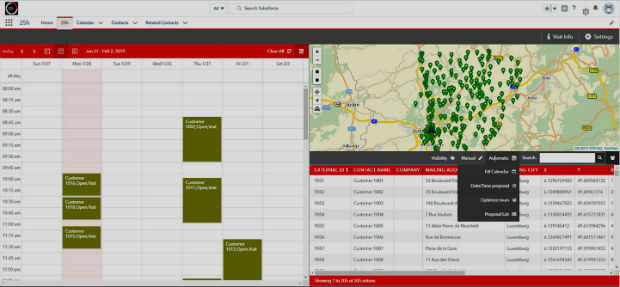
7th May 2019
PTV Group's new route planning app now available on Salesforce AppExchange7th May 2019
Firefighting drones are the future of fire safety7th May 2019
Globalstar Satellite IoT Devices for Smart Animal Tracking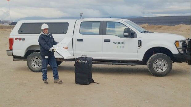
7th May 2019
Wood Adopts Delair UX11 UAV For Large Scale Surveying