
Caliper Offers 2019 Census Block Groups Data
7th May 2019
Caliper Offers 2019 Census Block Groups Data
7th May 2019
Caliper Offers 2019 Census Block Groups Data6th May 2019
Esri releases ArcGIS 10.7 unifying Esri software and services6th May 2019
Airbus takes next major step for Telesat’s LEO satellite constellation
6th May 2019
Airbus to build multimission satellite for MEASAT
6th May 2019
Hisdesat appoints Airbus and Thales Alenia Space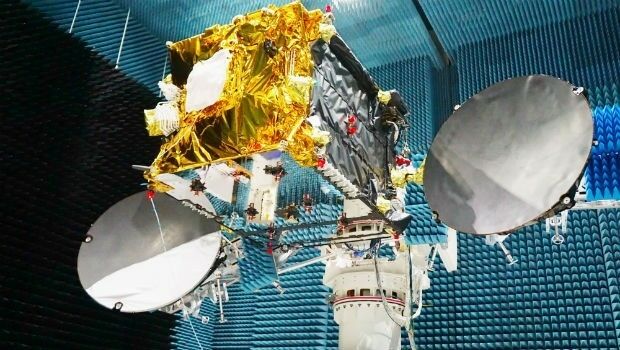
6th May 2019
Launch of the second SpaceDataHighway satellite
6th May 2019
Orbit GT and TCract, France, sign Reseller Agreement
4th May 2019
Space Flight Laboratory Highlights Microspace Earth Observation
3rd May 2019
The Future is Two-Stroke: Hirth Engines Look to the Future of Hybrid UAVs3rd May 2019
Download your copy of the Little Book of Spatial Data Quality
2nd May 2019
GeoDATA Forum Announce thought provoking programme
2nd May 2019
A new, high-performing USV for ocean surveying2nd May 2019
Submissions for Galileo Masters 2019 Open May 1
2nd May 2019
Garmin offers new upgrades for G1000 NXi-equipped King Air aircraft2nd May 2019
Samsung SDS and Telensa Partner for Smart City Infrastructure
2nd May 2019
OGC calls for Sponsors of a major Innovation Initiative, Testbed 16
1st May 2019
Bench-Guard™ and Table-Guard™ - Laser Barriers
1st May 2019
Satellite Imagery: Caracas, Venezuela Protests
1st May 2019
Free Highway Exits & Interchanges Data for Use with Maptitude 2019

30th April 2019
Wingtra partners with 3DR to offer a complete aerial surveying solution
30th April 2019
SSTL announces new Earth Observation data contract with Airbus
30th April 2019
What’s behind the ground-breaking 3D habitat map of the Great Barrier Reef?
30th April 2019
senseFly introduces the Solar 360 thermal drone solution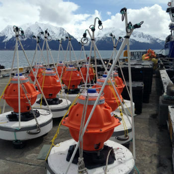
30th April 2019
Sonardyne technology chosen for new Canadian seabed observatory
30th April 2019
Helicopter Robinson Converted by UAVOS to Unmanned Drone30th April 2019
Fortem Technologies and Unifly Collaborate to Keep Airspace Safe29th April 2019
Yotta Incorporates Blueprints In Latest Alloy Release29th April 2019
World-first Artificial Intelligence-based simulation model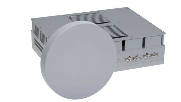
29th April 2019
DA-Group and Elbit Systems EW & SIGINT – Elisra Partner
27th April 2019
Geneq Inc. Announces New Website Launch For Its SXblue Products and Services27th April 2019
Cobham Antenna Systems Launches New C-UAS Antenna at AUVSI
26th April 2019
Fugro’s free seminars reveal the benefits of smart site investigation26th April 2019
Oriient Secures $4M to Finally Bring in-Store Navigation to the Masses
26th April 2019
Terra Drone Indonesia Performed Baseline Modeling

25th April 2019
Terra Drone and KDDI launch drone infrastructure inspection services
25th April 2019
New ‘OceanReports’ Tool Brings Ocean Data to Your Fingertips
25th April 2019
Photobioreactor: oxygen and a source of nutrition for astronauts25th April 2019
CSA Ocean Sciences Publishes Updated Global Equipment Catalog
25th April 2019
Garmin receives approval for the GFC 500 autopilot in the Cessna 180/18525th April 2019
RIEGL to Attend and Exhibit at AUVSI XPONENTIAL 2019 !
24th April 2019
Brazil’s Civil Aviation Authority Approves senseFly Drones