
Cartography
The compilation, reproduction and dissemination of maps and charts by means of manual (analogue) or digital techniques, tools and workflows. This topic covers the compilation, reproduction, dissemination and use of both analogue (paper) and digital maps, charts and atlases. As well as the science of cartography, including georeferencing and geocoding, digital techniques for compiling and generating various types of raster and vector maps and charts are covered, as are the digital mapping tools and Geographic Information Systems available for this purpose. The application of cartography for aeronautical, terrestrial and marine purposes is also covered
Esri Announces 2016 Storytelling with Maps Contest
6th April 2016
Esri Announces 2016 Storytelling with Maps Contest
GeoPlace endorses transformational power of addresses and street data
6th April 2016
GeoPlace endorses transformational power of addresses and street data
Maptitude Team Provides Sponsorship for NEGIS Spring Conference
6th April 2016
Maptitude Team Provides Sponsorship for NEGIS Spring Conference
The next AGI ECN webinar is 12th April 2016!
6th April 2016
The next AGI ECN webinar is 12th April 2016!
The new version 6.1 of the PHOTOMOD software family has been released
6th April 2016
The new version 6.1 of the PHOTOMOD software family has been released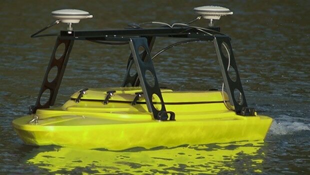
Seafloor Delivers Autonomous Multibeam Survey System To Skanska
6th April 2016
Seafloor Delivers Autonomous Multibeam Survey System To Skanska
CYBERBIT Awarded Intelligence and Cyber System Contract in Africa
6th April 2016
CYBERBIT Awarded Intelligence and Cyber System Contract in Africa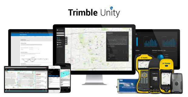
Trimble Launches New Version of its Smart Water Management Software
6th April 2016
Trimble Launches New Version of its Smart Water Management Software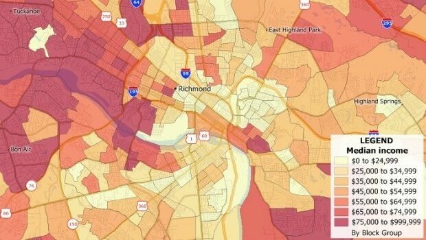
Caliper Offers 2016 Census Block Groups Data
6th April 2016
Caliper Offers 2016 Census Block Groups Data
Improved Mine Planning Software in Spring release
6th April 2016
Improved Mine Planning Software in Spring release
Esri Places in Top Ten of Forbes 2016 Best Midsize Employers
6th April 2016
Esri Places in Top Ten of Forbes 2016 Best Midsize Employers
IDV Solutions launches Visual Command Center 5.0
6th April 2016
IDV Solutions launches Visual Command Center 5.0
ABPmer reviews fishing impact on seabird MPA features
6th April 2016
ABPmer reviews fishing impact on seabird MPA features
GeoSpatial Experts Announces Reseller Agreement with WTH Technology
6th April 2016
GeoSpatial Experts Announces Reseller Agreement with WTH Technology
Hexagon Safety & Infrastructure Software deployed in Phillippines
5th April 2016
Hexagon Safety & Infrastructure Software deployed in Phillippines
UK Power Networks and Northumbrian Water sign up to receive OS mapping
5th April 2016
UK Power Networks and Northumbrian Water sign up to receive OS mapping
Exprodat Supports OGA Exploration Licence Competition
5th April 2016
Exprodat Supports OGA Exploration Licence Competition
NCTech unveils new 360 degree imaging developments for iSTAR camera
5th April 2016
NCTech unveils new 360 degree imaging developments for iSTAR camera
Sofradir space activities update - role in ExoMars mission
5th April 2016
Sofradir space activities update - role in ExoMars mission
Team Internet boosts geographic targeting accuracy
5th April 2016
Team Internet boosts geographic targeting accuracy
Airbus D&S and Thales to produce new digital maps for French defence
5th April 2016
Airbus D&S and Thales to produce new digital maps for French defence
Unitra Maritime Manila Inc. purchases NAUTIS Simulators
5th April 2016
Unitra Maritime Manila Inc. purchases NAUTIS Simulators

Fugro Completes Offshore Works For EOWDC At Aberdeen Bay
4th April 2016
Fugro Completes Offshore Works For EOWDC At Aberdeen Bay

University of Nottingham Innovation Park and UK Space Agency combine
4th April 2016
University of Nottingham Innovation Park and UK Space Agency combine
Mick George Ltd: adopts Masternaut Connect Telematics Technology
4th April 2016
Mick George Ltd: adopts Masternaut Connect Telematics Technology
Elbit Systems’ Subsidiary, Awarded CYBERBIT™ Contracts
4th April 2016
Elbit Systems’ Subsidiary, Awarded CYBERBIT™ Contracts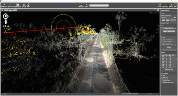
Orbit GT launches Mobile Mapping Feature Extraction Bundle
4th April 2016
Orbit GT launches Mobile Mapping Feature Extraction Bundle
Elsevier and Society of Exploration Geophysicists Geo Announcement
2nd April 2016
Elsevier and Society of Exploration Geophysicists Geo Announcement
OGC and ASTM International to Jointly Develop Standards and More
1st April 2016
OGC and ASTM International to Jointly Develop Standards and More
Cheshire East Highways Implements Yotta’s Horizons
1st April 2016
Cheshire East Highways Implements Yotta’s Horizons
SENSEWHERE: Scottish Indoor Location Technology Spreading Across China
1st April 2016
SENSEWHERE: Scottish Indoor Location Technology Spreading Across China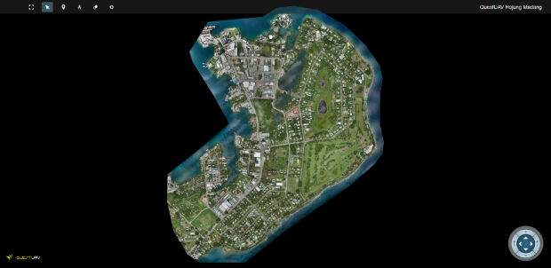
QuestUAV's South Korean Partner maps Madang, Papua New Guinea
1st April 2016
QuestUAV's South Korean Partner maps Madang, Papua New Guinea
Esri Adds Innovative Web Map Analytics Tool to ArcGIS Marketplace
1st April 2016
Esri Adds Innovative Web Map Analytics Tool to ArcGIS Marketplace
Pitney Bowes Launch Single Customer View Software Solution
31st March 2016
Pitney Bowes Launch Single Customer View Software Solution
Airbus Defence and Space to Enhance Qatar Armed Forces
31st March 2016
Airbus Defence and Space to Enhance Qatar Armed Forces.jpg)
Elbit Systems of America's Integrated Fixed Towers Certified
31st March 2016
Elbit Systems of America's Integrated Fixed Towers Certified
BARTHAUER presenting at Pipeline Technology Conference in Berlin
31st March 2016
BARTHAUER presenting at Pipeline Technology Conference in Berlin
Chinese Qihoo 360’s child tracking watch uses u-blox GNSS Technology
31st March 2016
Chinese Qihoo 360’s child tracking watch uses u-blox GNSS Technology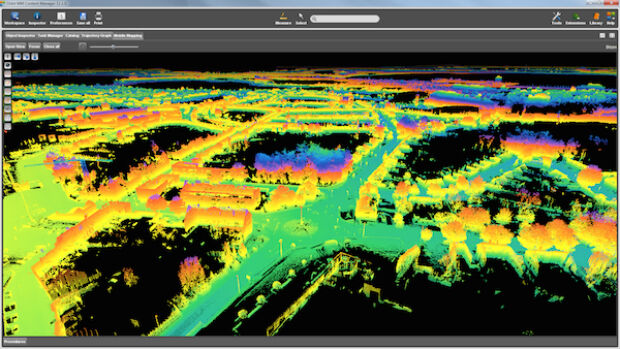
Orbit GT releases update for essential Mobile Mapping Content Manager
31st March 2016
Orbit GT releases update for essential Mobile Mapping Content Manager
New Leica Geosystems reference servers and monitoring receiver
30th March 2016
New Leica Geosystems reference servers and monitoring receiver
Intergraph Utility Network Model extended across the Enterprise
30th March 2016
Intergraph Utility Network Model extended across the Enterprise
OS reveals winning ideas that will improve our relationship with water
30th March 2016
OS reveals winning ideas that will improve our relationship with water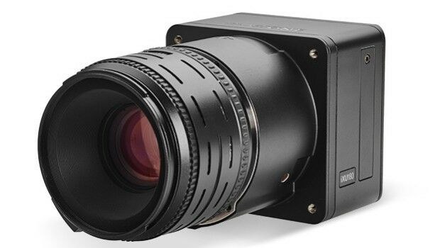
Direct Georeferencing with Phase One iXU 150 Camera and POS AVX 210
30th March 2016
Direct Georeferencing with Phase One iXU 150 Camera and POS AVX 210
RegioGraph 2016: New geomarketing software from GfK hits the market
30th March 2016
RegioGraph 2016: New geomarketing software from GfK hits the market