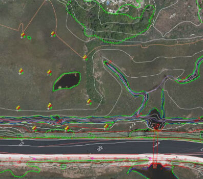
Col-East Taps Extensive Image Archive to Create Multi-Function Maps
6th October 2017
Col-East Taps Extensive Image Archive to Create Multi-Function Maps
6th October 2017
Col-East Taps Extensive Image Archive to Create Multi-Function Maps
5th October 2017
Geosoft and AcornSI move UXO classification to the cloud
3rd October 2017
Satellite Images show Europe's diversity in new book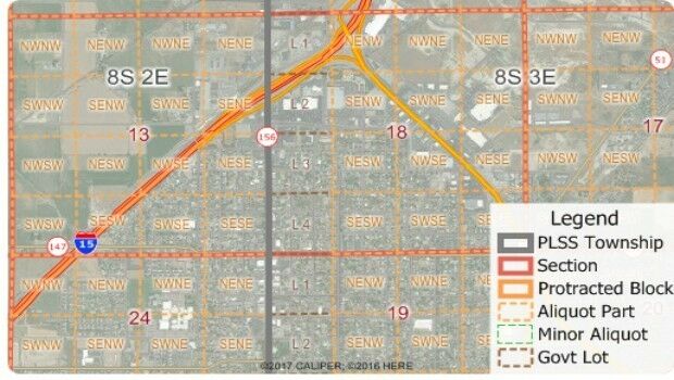
30th September 2017
Free Public Land Survey System (PLSS) Data for Use with Maptitude30th September 2017
Pitney Bowes selects HERE data to aid insurers
26th September 2017
New SphereVision 360 Imaging System Launched at Intergeo
22nd September 2017
Real-Time Construction Quality Management, Advanced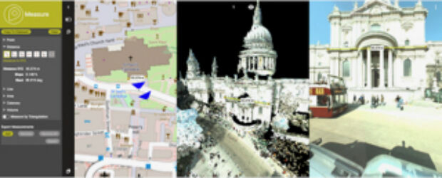
22nd September 2017
Orbit GT to showcase new 3D Mapping Cloud features at Intergeo, Berlin
22nd September 2017
5 ways in which councils are to celebrate Gazetteers@GIS Day19th September 2017
GeoCue Group Provides Free Lidar Data For Hurricane Impact Areas19th September 2017
Esri Podcast Series Explores How Location Technology Helps Businesses
16th September 2017
Esri to Present at TechCrunch Disrupt SF 2017
16th September 2017
Maptitude Supports High School Course in Geographic Technology15th September 2017
VolkerWessels to Use Yotta’s Horizons on Dutch Infrastructure Project
14th September 2017
Maxoptra Helps The Tomato Stall Deliver Fresh Produce Across UK
12th September 2017
Brainnwave Makes Data Available to Support Disaster Relief11th September 2017
AND aims to redefine map making & change the mapping industry
8th September 2017
Hexagon Receives Recognition from Huawei for Safe City Solution8th September 2017
MapAction sends two more teams to reinforce Hurricane Irma response
7th September 2017
Customer-Driven Improvements Highlight Carlson Survey 20185th September 2017
SimActive Releases Correlator3D™ Version 7.01st September 2017
MapAction Announces New Director of Fundraising & Marketing29th August 2017
OSNI digital mapping now available through viaEuropa web service29th August 2017
CGG Starts Espirito Santo IV survey offshore Brazil29th August 2017
GIS Cloud Exhibiting at the INTERGEO 2017 in Berlin29th August 2017
McCarthy & Stone select Cadcorp software for more efficient Workforce Planning
24th August 2017
Free Healthcare Data for Use with Maptitude Mapping Software24th August 2017
Learn Advanced Tools and Analysts with SuperGIS Online Manuals22nd August 2017
Caliper Corporation: 2017 Sustained Growth
22nd August 2017
1Spatial grows its team of Safe Software FME Certified Trainers
20th August 2017
Maptitude Sponsorship for MGGG Geometry of Redistricting Workshops
16th August 2017
TCarta Marine change the way dynamic environments are managed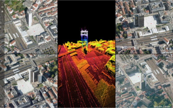
3rd August 2017
Orbit GT updates 3D Mapping Cloud with Oblique Imagery Support1st August 2017
Geovation Programme now open to location and land disruptors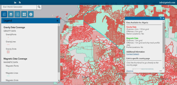
27th July 2017
Explore the World’s Geology with Getech’s Interactive Maps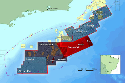
26th July 2017
CGG Extends Santos VII Multi-Client Survey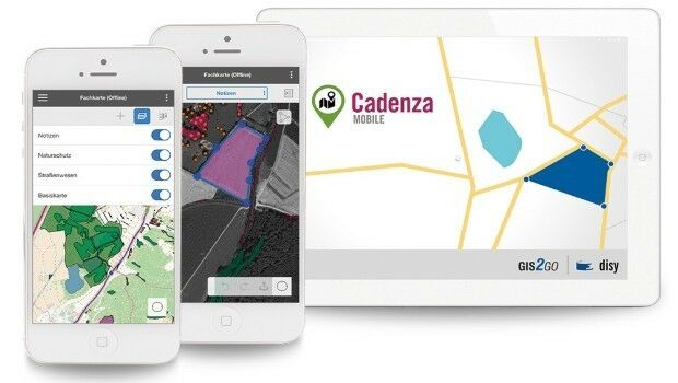
25th July 2017
Shaping the future of spatial data management and analytics
25th July 2017
1Spatial Awarded Safe Software’s Top Partner Award 2016
19th July 2017
Wirral Council migrates existing corporate GIS to Cadcorp.jpg)
19th July 2017
Emoji map by Europa Technologies wins Most Unique award at Esri UC.jpg)
12th July 2017
Learn More About Maptitude at the NCSL Annual Conference12th July 2017
The Science of Where Forward Recognized at Esri Awards12th July 2017
TerraGo Software Utilized for Official Guide to Hong Kong11th July 2017
Geoblink selects HERE to help the retail industry11th July 2017
Esri Adds Airbus Global Elevation Data to Online Maps10th July 2017
Esri and HERE sign multi-year map data licensing agreement10th July 2017
Schneider Electric to Showcase at 2017 Esri User Conference