
Introducing Thematic Mapper for Easy In-map Analytics
28th November 2016
Introducing Thematic Mapper for Easy In-map Analytics28th November 2016
Introducing Thematic Mapper for Easy In-map Analytics25th November 2016
what3words adopted by six national mapping agencies19th November 2016
Esri Creates First Global Map of the Catholic Church10th November 2016
Several new features in the latest version of dpSpatial 7.88th November 2016
To Help Create Safer Communities, Esri Hosts Public Safety Symposium8th November 2016
ADC WorldMap Releases Digital Atlas Version 7.33rd November 2016
Innovative Data and Mobile Solutions at Trimble Dimensions 20163rd November 2016
Professional Imagery Products Created in Minutes3rd November 2016
GAF to implement its eMC+ electronic Mining Cadastre in Niger2nd November 2016
Esri Maps the Way to a More Connected World at IoT West28th October 2016
Esri Sponsors 2016 Code for America Summit27th October 2016
East View Provides Remote Maps to Record Seeking Trekkers21st October 2016
The first Customer Created App lands on DataFlow21st October 2016
Esri Brings Smart Mapping to IBM World of Watson 201620th October 2016
Tell Stories That Matter to Your Organization with Esri Story Maps19th October 2016
Colin Bartholomew releases World MidScales Explorer version 16.118th October 2016
East View Nautical Website Now Offering SHOM Charts13th October 2016
CGG Awarded Multi-Client Projects Offshore Mozambique28th September 2016
Esri Becomes Ambassador of NOAA and NWS Weather-Ready Nation27th September 2016
eeGeo Partners With AMP for Interactive Real Estate 3D Mapping22nd September 2016
Esri Partners with XPRIZE Foundation to Map the Ocean21st September 2016
East View Offering Print-on-Demand Tyvek World Maps from Magna Carta16th September 2016
Watford Derailment Strengthens Mobile Mapping Argument9th September 2016
Esri Partners with the United Nations in the fight against Malaria31st August 2016
Cityworks Congratulates 2016 Esri Award Winners30th August 2016
Free Australia Postcode Maps by Australian City/State13th August 2016
GGP Systems partners with Blackpool Council13th August 2016
East View Signs Historic POD Contract with SEMAR12th August 2016
Global Mapper Chosen for Coastal Mapping Project21st July 2016
Hexagon Geospatial Honors Airbus Defense and Space with Shaping Change Recognition Programme
21st July 2016
BARTHAUER Company Bicycle Program German Company Gets Employees Moving
13th July 2016
Hexagon Geospatial Releases Power Portfolio 2016
30th June 2016
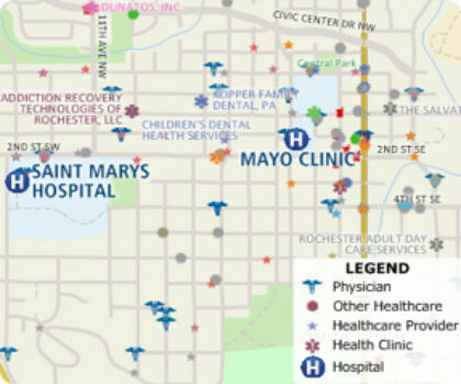
Free Healthcare Data for Use with Maptitude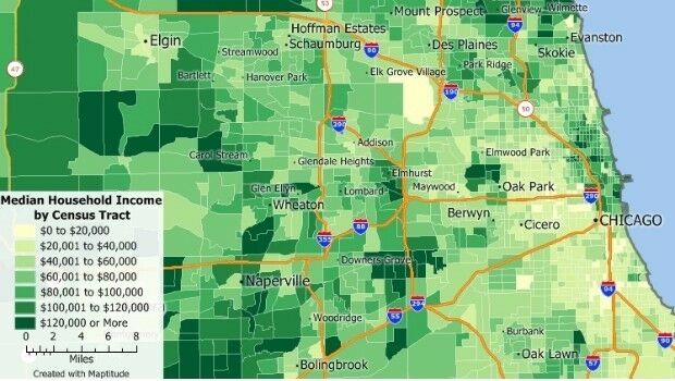
23rd June 2016
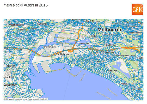
GfK releases new geodata for Australia and New Zealand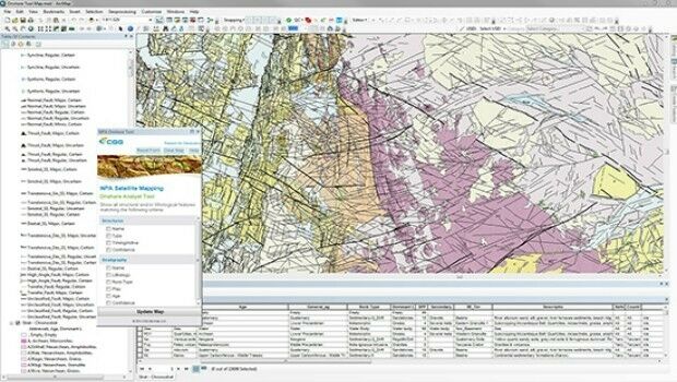
20th June 2016
CGG GeoConsulting introduces EARS BasinMap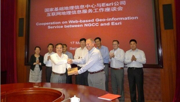
15th June 2016
Access to Authoritative Chinese Cartographic Maps and Imagery10th June 2016
City of Aurora Honored for Water Operations GIS Overhaul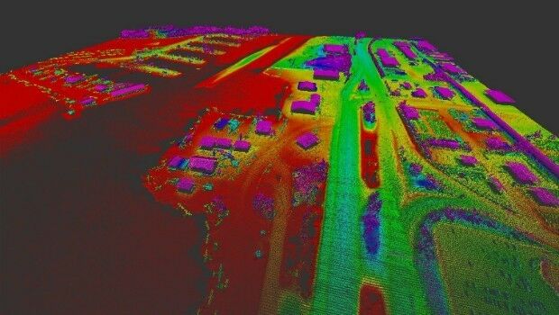
8th June 2016
Merrick-Surdex JV Awarded Contract with USGS27th May 2016
Strategic cooperation: BARTHAUER software installed at RIWA