Airbus to supply satellite communications system
23rd June 2018
Airbus to supply satellite communications system
23rd June 2018
Airbus to supply satellite communications system21st June 2018
Launch of sobloo - a Copernicus Data and Information Access Service (DIAS)21st June 2018
exactEarth and IHS Markit to Deliver Real-time Vessel Tracking Solution
20th June 2018
US/European oceans-monitoring satellite marks 10 years in service19th June 2018
PCI Geomatics Attend 39th Annual Canadian Symposium on Remote Sensing19th June 2018
Call for Proposals - ISPRS Scientific Initiatives 2019
15th June 2018
FIFA World Cup 2018 Stadiums As Seen From Space7th June 2018
Airbus and U.S. Air Force Commemorate 25yrs of Eagle Vision Program
7th June 2018
Rezatec join forces with specialist contractor, Detection Services7th June 2018
Airbus is showcasing an array of innovative products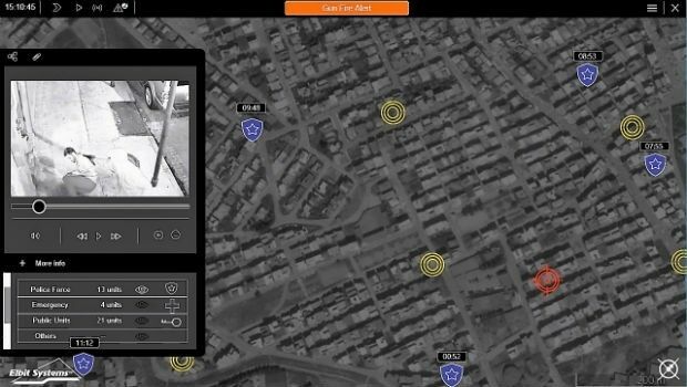
7th June 2018
Elbit Systems Launches MAY, a Wide-area Acoustic-based Situational Awareness Solution6th June 2018
2018 World Football Championship stadiums seen from space
6th June 2018
Earth-i Expands Team To Meet Demand for Insight and Analysis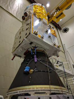
5th June 2018
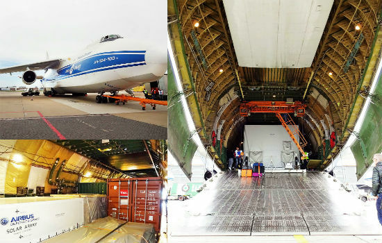
Airbus-built Aeolus wind sensor satellite ready for shipment
5th June 2018
SSTL awards Launch Services Agreement to Firefly Aerospace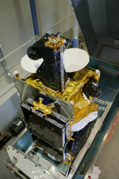
4th June 2018
Airbus-built SES-12 dual-mission satellite successfully launched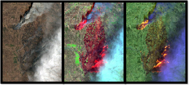
30th May 2018
Esri Announces Release of Sentinel-2 Image Services29th May 2018
Major GNSS project to boost potential for ‘satellite’ farming in Brazil29th May 2018
Airbus wins major NATO communications system contract25th May 2018
Airbus teams up to develop Space CARBon Observatory (SCARBO)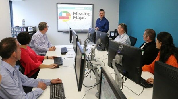
24th May 2018
thinkWhere Supports Global Humanitarian Project to Map Disaster Areas23rd May 2018
Global Mapper Helps Aerial Filmworks, Win Pulitzer Prize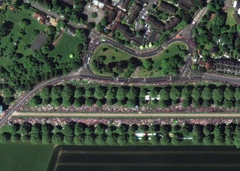
22nd May 2018
Satellite Image Shows Massive Royal Wedding Crowds
21st May 2018
CGG GeoConsulting Launches Robertson New Ventures Suite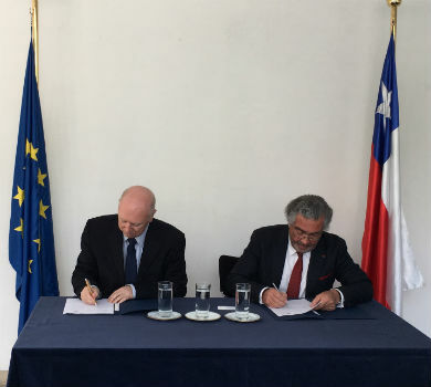
18th May 2018
EARSC and Eurochile join forces to promote Earth observation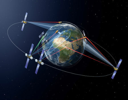
18th May 2018
SpaceDataHighway: 10,000 successful laser connections

17th May 2018
10-year GSA partnership with European Satellite Navigation Competition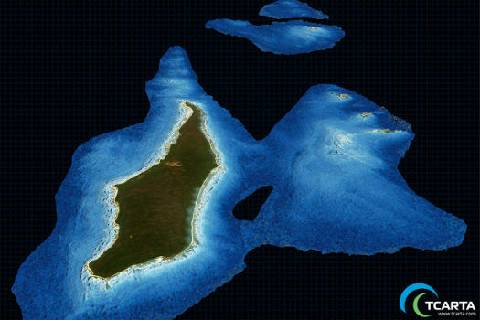
17th May 2018
TCarta Delivers Satellite Derived Bathymetry Data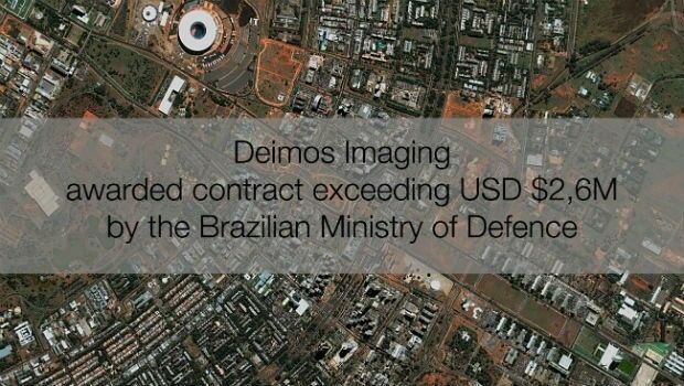
16th May 2018
Deimos Imaging awarded contract exceeding USD $2,6M by Brazilian MoD
16th May 2018
Carlson PhotoCapture to be presented at GEO Business 201816th May 2018
Swift Navigation Announces SBAS Support for Piksi Multi
15th May 2018
Marex Spectron Announces Joint-Venture with Earth-i14th May 2018
Airbus CyberSecurity brings its expertise to EU funded Brain-IoT Project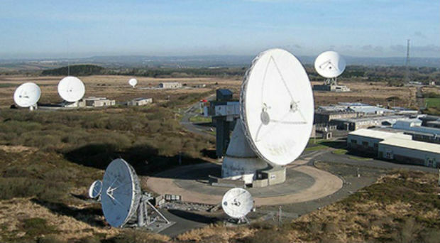
14th May 2018
Goonhilly lands £24m investment enabling global expansion
9th May 2018
Earth Observation Exploitation Platform Domain Working Group
9th May 2018
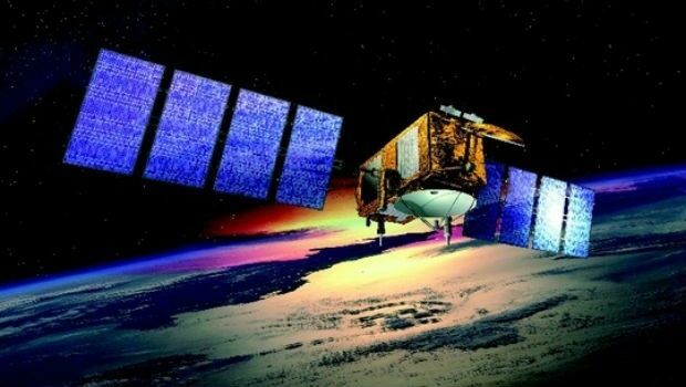
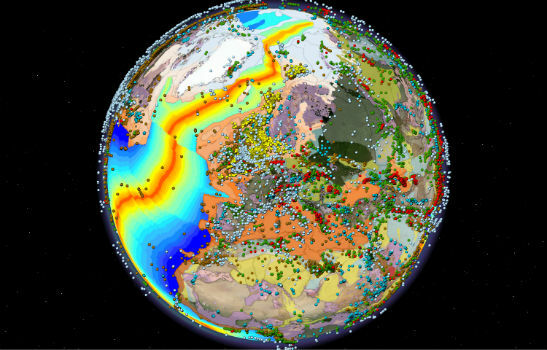
Sentinel-3B starts delivering on its promise8th May 2018
MilSatCom USA Conference Agenda has been Updated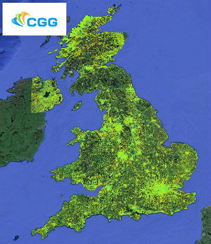
4th May 2018
CGG Launches New MotionMap UK National Ground Stability Database3rd May 2018
Australian states line up for slice of national space agency1st May 2018
Space Forum 2018: From Space Application To Space Exploration
27th April 2018
First International Satellite-Derived Bathymetry Conference Announced26th April 2018
Grand Paris Express: first results of satellite monitoring25th April 2018
Place & Location Technologies at heart of GEO Business Conference