
2018 URISA Exemplary Systems in Government Awards Process Opens
25th January 2018
2018 URISA Exemplary Systems in Government Awards Process Opens25th January 2018
2018 URISA Exemplary Systems in Government Awards Process Opens11th January 2018
OGC Announces Disasters Interoperability Concept Development Study2nd January 2018
OGC Invitation to Tender for Testbed 14 Thematic Exploitation Platform16th December 2017
Big Data Analytics for Geospatial Solutions Accelerated
15th December 2017
GeoSLAM Celebrates 5 Years In Business With New HQ & Record Growth14th December 2017
OGC is seeking sponsors for Phase 2 of its Future Cities Pilot Project11th December 2017
OGC Calls for Participation in Major Innovation Testbed (Testbed 14)6th December 2017
OGC seeks public comment on CDB Multi-spectral Imagery Extension6th December 2017
Monsanto and Boundless Collaborate for Open Source GIS Contributions30th November 2017
Data Model Development advances OGC’s Underground Pilot Project30th November 2017
OGC seeks public comment on CDB Multi-spectral Imagery Extension
29th November 2017
OGC Calls for Sponsors for Augmented Reality Pilot Project22nd November 2017
OGC's 105th Technical & Planning Committee Meeting
21st November 2017
OGC Calls for Participation in its Interoperability Plugfest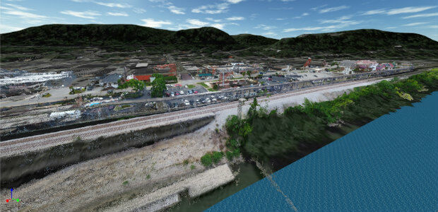
21st November 2017
viaEuropa Cloud Solo service added to G-Cloud 920th November 2017
Announcement EuroSDR 2018 series of e-learning17th November 2017
Global Mapper SDK Now Available on Amazon Web Services14th November 2017
Luciad Launches Next Generation of Geospatial Situational Awareness14th November 2017
Esri and Mobileye to Bring Real-Time Sensor Data to Public Transit8th November 2017
OGC invites you to its Testbed 13 Demonstration Event31st October 2017
OGC seeks public comment on TimeseriesML 1.2 Candidate Standard
30th October 2017
Helping Councils get the Most from Infrastructure Asset Management27th October 2017
OGC supports American Geographical Society’s 2017 Fall Symposium26th October 2017
New OGC standard improves the reference for Earth Information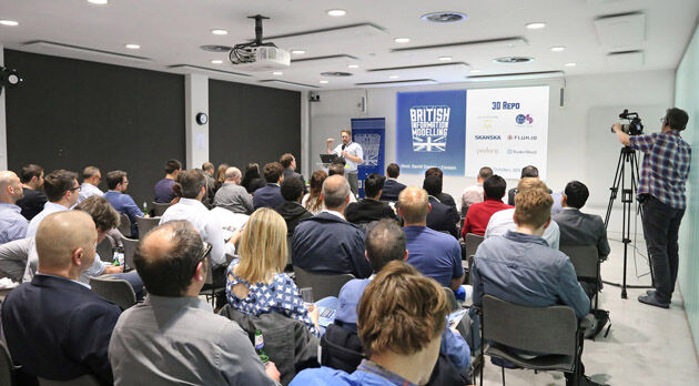
18th October 2017
Geospatial Themed BIM Event Debates GIS Data Integration13th October 2017
GSDI Webinar on Open Geospatial Data on 16 November 201710th October 2017
Garmin® Head-up Display (GHD) system for integrated flight decks
6th October 2017
European Consortium Demonstrates new Internet-of-Things Platform5th October 2017
OGC Announces New 3D Portrayal Service Standard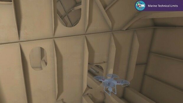
4th October 2017
Bureau Veritas joins the RECOMMS drones project
2nd October 2017
Approaches and solutions for tomorrow’s transport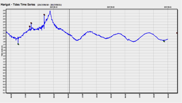
30th September 2017
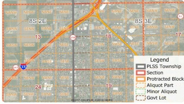
Free Public Land Survey System (PLSS) Data for Use with Maptitude
28th September 2017
Astun Technology Supports Ordnance Survey
28th September 2017
RIEGL announces significant product news at INTERGEO27th September 2017
Brainnwave Brings Unique Data Portal to Scotland Showcase26th September 2017
Partnership Offers Analysis Software for Scholarship Winners26th September 2017
ArcGIS Pro Users 'Finding the Best Place for a Public Park'26th September 2017
New extras added to Global Mapper V.19 - Now Availale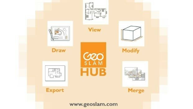
25th September 2017
New Product Launches At Intergeo From GeoSLAM25th September 2017
Orbit GT and Applanix, Canada, sign Reseller Agreement21st September 2017
2017 URISA Exemplary Systems in Government Award Recipients Announced21st September 2017
Three Swedish neighbouring municipalities choose Digpro
20th September 2017
River Thames simulation supports safer navigation for Tideway19th September 2017
GeoCue Group Provides Free Lidar Data For Hurricane Impact Areas
19th September 2017
Bentley’s AECOsim Building Designer CONNECT Edition