Share
Galway City Council is applying Bluesky International’s unique National Tree Map (NTM) data to assist the development of strategic planning policy designed to protect and support wildlife trying to survive in dwindling habitats due to the expansion of urban areas.
The NTM data was used in a study by the Vincent Wildlife Trust (VWT) to understand the functional connectivity of landscape features such as hedgerows and treelines. The study considered a number of features to identify key ecological corridors and stepping stones to protect and enhance them in the future. The output map also highlighted barriers to movement which would need to be addressed to support wildlife movement through and around the city.
“The decline in biodiversity in Ireland, including Galway City, has been caused largely by habitat loss driven by changing land use,” commented Paula Kearney, Biodiversity Officer at Galway City Council. “Habitat loss not only reduces the total habitat areas, but can also fragment the remaining habitat leaving small and often scattered areas, often impacted by barriers such as fences, walls and roadways. However, connectivity can be provided by linear features, such as hedgerows or river corridors, and small habitat patches can act as stepping stones to favourable habitats.”
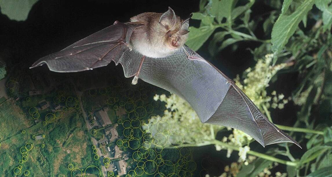
Galway City Council engaged with the Vincent Wildlife Trust, a mammal conservation charity, to conduct a desktop study using connectivity analysis software which borrows algorithms from electronic circuit theory to predict patterns of movement among wildlife populations. Focussing on the lesser horseshoe bat, which is found in just six areas of Ireland and is the only species of bat in Ireland which is deemed to require specialist areas of conservation, VWT was able to identify areas of high landscape connectivity.
“The bat, Rhinolophus hipposideros, is highly sedentary and relies heavily on linear landscape features to navigate whilst avoiding flying over illuminated and open areas,” added Patrick Wright, Wildlife Conservationist and Scientific Officer at the Vincent Wildlife Trust. “This makes it an ideal species to assess the impact of linear features and predict its movements according to resistance values posed by different landscapes.
“Bluesky’s National Tree Map allowed us to isolate key features, including a distance from trees variable, which we could interpret to map linear characteristics and structures within the landscape,” he continued. “From the output we were able to produce, it is clear that lesser horseshoe bat movement is likely to be restricted to narrow pathways within Galway City and that these are critical to maintain connectivity between populations.”
“The model and outputs created by VWT using the National Tree Map data have already been used to inform the Green Network for the Galway City Green Spaces Strategy,” Kearney concluded. “The purpose of this mapping is to inform strategic planning policy by identifying key ecological corridors and stepping stones to protect and enhance in order to support sensitive species and wildlife movement.”
Ralph Coleman, Chief Commercial Officer at Bluesky International, added, “Changes in agricultural practices and the expansion of urban areas are impacting not only the size and location of wildlife habitats, but also how animals navigate between them. Using the National Tree Map to identify and record habitats, and interpret movements, and then applying this information to inform planning policy, is imperative if we are to protect endangered and vulnerable species.”
Bluesky’s National Tree Map is created using innovative algorithms and image processing techniques, from the most up-to-date aerial photography and terrain data for the whole of Great Britain and Ireland. It provides a detailed reference of the location, canopy cover and height of trees 3m and taller which can be applied alongside other data to establish ownership, proximity to other features or assets, and relationships between demographic, economic or social data.
The National Tree Map data is widely used by a number of different market sectors, for example local authorities, energy and utility companies, property developers and academic and research organisations, investigating the role of trees and green spaces and their impact on health, environment and infrastructure.
Subscribe to our newsletter
Stay updated on the latest technology, innovation product arrivals and exciting offers to your inbox.
Newsletter

