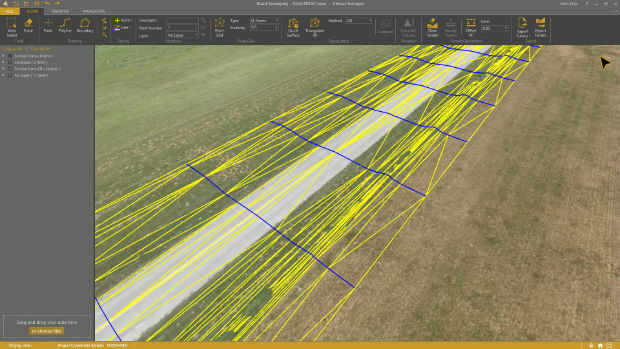
Virtual Surveyor 6.1 Handles More Than Drone Data
13th November 2018
Virtual Surveyor 6.1 Handles More Than Drone Data
13th November 2018
Virtual Surveyor 6.1 Handles More Than Drone Data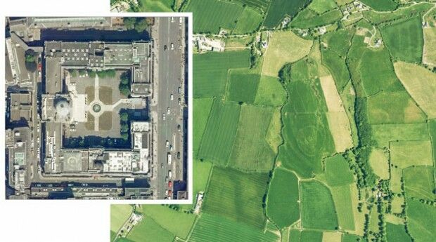
17th October 2018
Irish Government Award Bluesky as Geographic Data Supplier12th October 2018
Global Mapper Adds Online Access to NEXTMap One™18th September 2018
Bluesky & Getmapping Win UK Government Contract8th September 2018
In-house development with the Geodetic Development Kit GeoDLL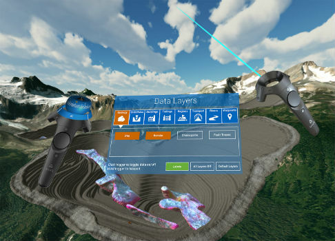
22nd August 2018
Maptek and LlamaZOO bring the mine to brilliant life
8th August 2018
Bentley Announces Finalists in the Year in Infrastructure 2018 Awards13th July 2018
Hexagon opens new mining headquarters in Tucson, Arizona6th June 2018
Bluesky Takes Aerial Mapping to New Levels in 2018
30th May 2018
Bluesky Takes to the Air to Complete Aerial Mapping of Ireland
22nd May 2018
Bluesky Esri UK Partnership Helps Roll-Out of 5G and Full Fibre Networks1st May 2018
Bentley Systems Invites Members of the Press and Industry Analysts
26th April 2018
Bentley Systems Acquires Plaxis, and Complementary SoilVision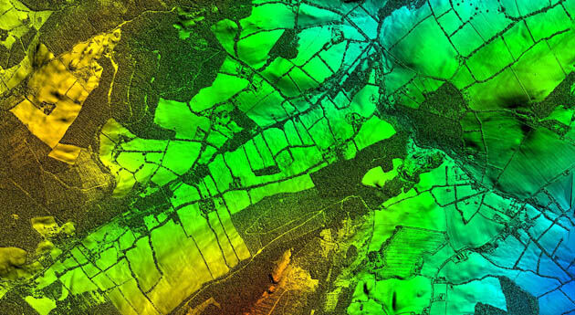
26th April 2018
Bluesky LiDAR Supports Major Irish Water Supply Project9th April 2018
Maptek showcases Sentry world-class monitoring system9th April 2018
UK BIM Alliance Product Data Working Group Confirmed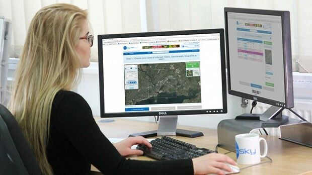
22nd March 2018
Bluesky Ireland Release New Online Geographic Data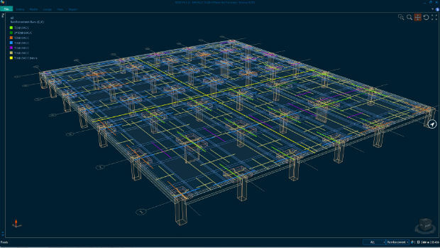
9th February 2018
Bentley Systems Expands Concrete Building Design and Documentation
7th February 2018
3DUserNet To Power Texodrone Online 3D Data Platform2nd February 2018
PCI Geomatics Releases GXL 2017, Service Pack 1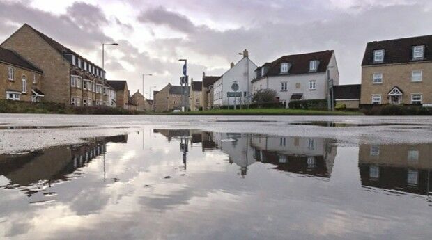
11th January 2018
Bluesky LiDAR Helps Wiltshire Council Tackle Flooding Risk6th December 2017
CGG announces the launch of CEO succession plan29th November 2017
Global Mapper Available with Photogrammetric Point Cloud Generation2nd November 2017
Bluesky LiDAR Data Used by RPS to Assess Flood Risk for Anglian Water26th October 2017
Smart City Capabilities at Smart City Expo World Congress 2017
23rd October 2017
Ian MacLeod receives SEG Cecil Green Enterprise Award
9th October 2017
Collaboration for Constructioneering Academy initiative
3rd October 2017
Satellite Images show Europe's diversity in new book
19th September 2017
Bentley’s AECOsim Building Designer CONNECT Edition8th September 2017
PTC to Move Global Headquarters to Boston Seaport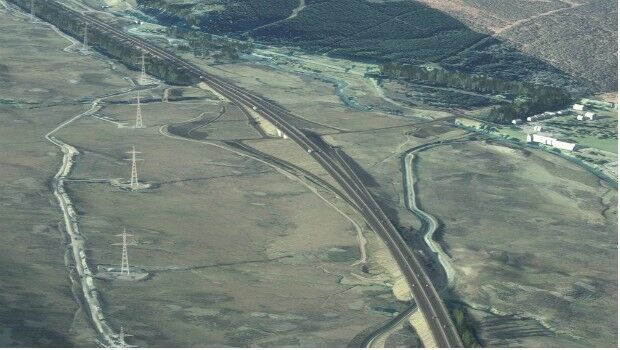
2nd September 2017
Bentley Systems' 2017 Be Inspired Awards Program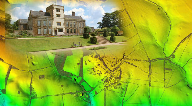
9th August 2017
Bluesky LiDAR Helps ArcHeritage Reveal Hidden Treasures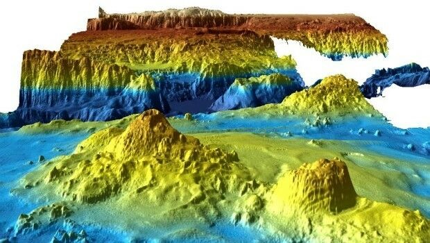
28th July 2017
Unique Seafloor Data Provides New Insight To Scientific Communities
13th July 2017
Bluesky Launches Nationwide Map of Building Heights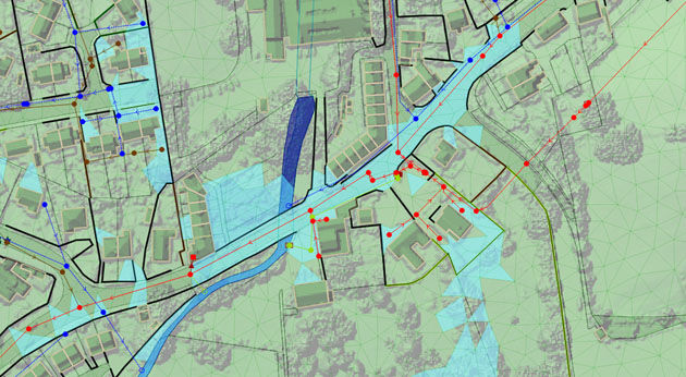
1st June 2017
Bluesky Laser Mapping Helps Create Flood Alleviation Model for Yorkshire Water31st May 2017
exactEarth Launches Global Real-Time Vessel Tracking Service
15th May 2017
1Spatial releases dates for exciting FME World Tour, courses, webinars

27th March 2017
Bluesky Launches New Online Resource for Geographic Information of Ireland20th March 2017
Bluesky to 3D Laser Map Environmental Features in Ireland
17th February 2017
Biggest Collection of Arctic Elevation Data Yet
.jpg)
24th January 2017
Bluesky Announces 2017 Flying Plans for Ireland
20th December 2016
Geosoft introduce IP and resistivity inversion in VOXI Earth Modelling23rd November 2016
Qatar Rail applies Maptek Eureka software to geological investigations