SSTL Announces NovaSAR-1 Data Deal with the Philippines
8th November 2019
SSTL Announces NovaSAR-1 Data Deal with the PhilippinesNews as it happens! Keep in touch with the latest developments in business and technology in the regions or worldwide.
8th November 2019
SSTL Announces NovaSAR-1 Data Deal with the Philippines
8th November 2019
Trimble Clarity Now Offered as Web Application for Point Clouds and 3D Models
8th November 2019
Registration opens for Oceanology International 2020 at ExCeL London in March.jpg)
8th November 2019
London Build 2019: Show Preview Available for Download7th November 2019
Colin Bray re-elected President of EuroGeographics7th November 2019
Garmin expands approval for the GFC 500 autopilot
7th November 2019
Cesium Takes City Visualizations Into the 3rd Dimension
7th November 2019
Terra Drone conducts 160m chimney inspection at thermal power plant in Japan6th November 2019
Fugro to support Hong Kong International Airport expansion
6th November 2019
Hydropower Power Congress Central Asia and Caspian
6th November 2019
New Trimble R12 GNSS Receiver Boosts Surveying Performance
6th November 2019
Verified Photomontages Achieves Best Accuracy with Spectra Geospatial SP805th November 2019
Virginia Tech Uses GeoSLAM Mobile Scanner5th November 2019
New global CEO for technology innovator Maptek5th November 2019
Top Survey Application, “GIS Surveyor” Going Premium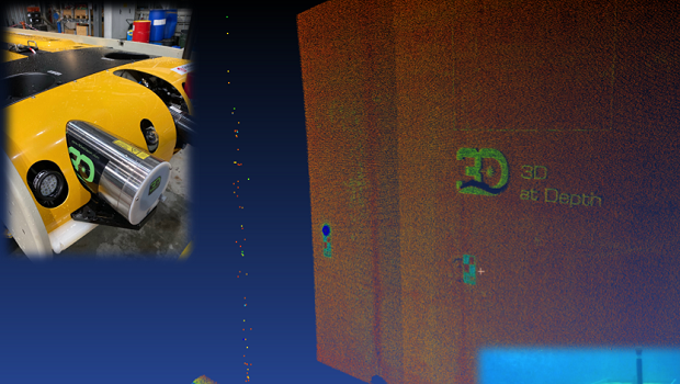
4th November 2019
3D at Depth Demonstrates Asset Integrity Solution for Life of Field Digital Twin Capability
4th November 2019
A2Z, Agrowing, and SolSpec win Pitch the Press at Commercial UAV Expo Americas 2019
4th November 2019
UK BIM Framework publish two new documents
4th November 2019
AirMap Brings UTM Services to Enterprises with Drone Operations Center
1st November 2019
Schneider Electric Announces ArcFM Editor 11.1.1
1st November 2019
UAVOS and Polynesian Exploration up to Creating Autonomous Solution for 3D Mapping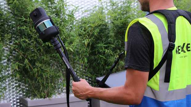
1st November 2019
The Handheld 3D Mapping System with High-res 5K Images