
Terra Drone India partners with Canadian CAD/GIS market leader Geo-Plus
3rd December 2019
Terra Drone India partners with Canadian CAD/GIS market leader Geo-PlusNews as it happens! Keep in touch with the latest developments in business and technology in the regions or worldwide.
3rd December 2019
Terra Drone India partners with Canadian CAD/GIS market leader Geo-Plus
3rd December 2019
Parrot announces new SDK Partner Program for ANAFI drone platform
3rd December 2019
Pointfuse and Autodesk Platinum Partner U.S. CAD Announce Partnership2nd December 2019
Costain and Createc develop technology set to revolutionise nuclear decommissioning2nd December 2019
PTV Group merges its transportation and logistics companies in France
2nd December 2019
Satellite Images of Bridge Collapse on A6 Torino Highway
29th November 2019
Drone mapping takes off in Malawi with Pix4D & UNICEF29th November 2019
EuroSDR Crowdsourcing Workshop (16 & 17 January 2020)
28th November 2019
GeoSeer Releases Licensed Database of Spatial Web Services28th November 2019
EUROSENSE expands its mapping capabilities
28th November 2019
FREQUENTIS and A1 to make drone flights safer28th November 2019
Transforming Underground Survey Business with BigChange Mobile Apps
28th November 2019
Bluesky Launches MetroVista 3D City Mapping Service in US
27th November 2019
Richardson & Starling expands Ctrack Fleet Telematics Solutions
27th November 2019
Entrepreneur raises £250k for GIS platform inspired by Olympics26th November 2019
Garmin announces global collaboration with World Central Kitchen
26th November 2019
Delivering robust solutions to ports and harbours in the UK and overseas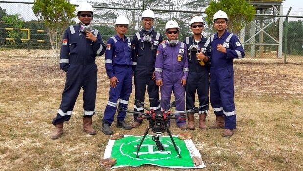
26th November 2019
Terra Drone Indonesia Performs Flare Stack Inspections for Chevron25th November 2019
Bluesky National Tree Map Reveals Islington’s Tree Cover25th November 2019
Airbus’ Golden Jubilee for Skynet secure satellite communications