
Digitalisation and the question of “where?”
20th June 2018
Digitalisation and the question of “where?”20th June 2018
Digitalisation and the question of “where?”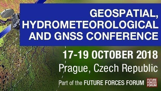
20th June 2018
Join Geospatial, Hydrometeorological and GNSS Conference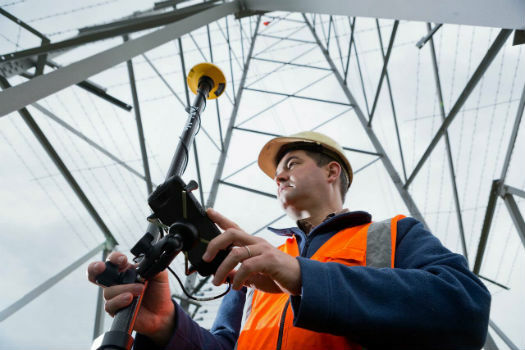
20th June 2018
RIEGL to Attend and Present at the 19th Annual JALBTCX20th June 2018
Topcon releases new edition of MAGNET software suite
19th June 2018
Participation in Citizen Science Interoperability Experiment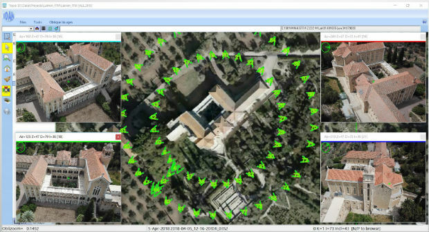
19th June 2018
ObliMapper Transforming Drone Imagery into Actionable Visual Intelligence19th June 2018
PCI Geomatics Attend 39th Annual Canadian Symposium on Remote Sensing19th June 2018
Call for Proposals - ISPRS Scientific Initiatives 2019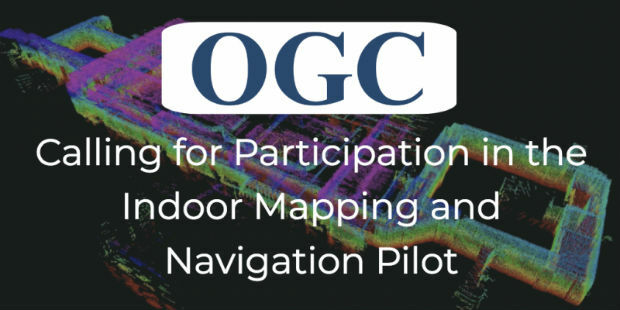
19th June 2018
OGC Calls for Participation in its Indoor Mapping and Navigation Pilot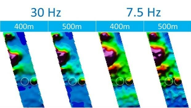
18th June 2018
CGG’s Helitem Shatters AEM Low-Frequency Barrier18th June 2018
We are pleased to announce the GRASS GIS 7.4.1 release18th June 2018
Inaugural European Drone Summit in Frankfurt16th June 2018
Expanded Focus on Drones in Public Safety at InterDrone16th June 2018
Third 2018 URISA GIS Leadership Academy Announced15th June 2018
Bentley Systems Named 2018 Microsoft CityNext Partner of the Year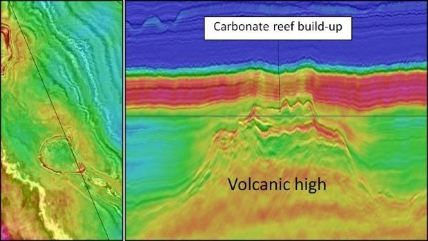
15th June 2018
CGG Delivers Final PSTM Products for Dunquin Multi-Client Survey15th June 2018
Hexagon introduces HxGN MineOperate UG Pro for Miners15th June 2018
PDF3D's Global Expansion Continues with IDI Collaboration in Japan15th June 2018
New Light Technologies and Boundless Announce Strategic Partnership
15th June 2018
FIFA World Cup 2018 Stadiums As Seen From Space
15th June 2018
GSSI Showcases and Demonstrates World Leading GPR Systems in Switzerland
15th June 2018
GAF to provide consulting services in Mozambique
14th June 2018
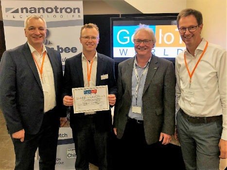
Nanotron wins Geo IOT World award for indoor location and proximity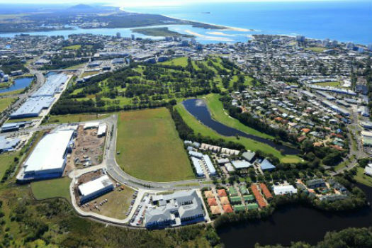
14th June 2018
Sunshine Coast Council and Pitney Bowes Develop Smart City Results
14th June 2018
Hexagon's Mining division launches streamlined product portfolio
12th June 2018
Sercel Extends Capability of 508XT Seismic Acquisition System
12th June 2018
Headwall Integrates Hyperspectral and LiDAR Aboard UAV Platforms
12th June 2018
SimActive Software for Precision Agriculture in Brazil
11th June 2018
Intelligent Telematics Targets Sales Growth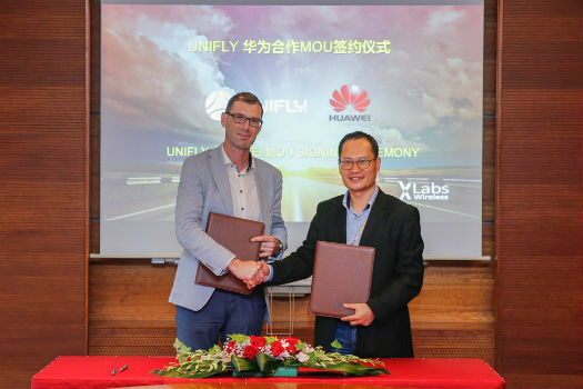
11th June 2018
Huawei and Unifly Collaborate to Identify and Track Drone Flights10th June 2018
AP-Flyer is the Latest Sponsor of UAV Technology Conference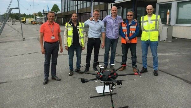
8th June 2018
Unifly and CanardDrones show real capabilities in Finland8th June 2018
Sofradir and ULIS undergo structural reorganization
8th June 2018
Pix4D launches its first fully dedicated product for agriculture7th June 2018
Airbus and U.S. Air Force Commemorate 25yrs of Eagle Vision Program
7th June 2018
OGC Invites you to the Disasters CDS Workshop at the NOAA Auditorium7th June 2018
Going Deeper Underground – Can We Build An Underground Map Of The UK?
7th June 2018
NAKANIHON and RIEGL to Give Joint Presentation
7th June 2018
Rezatec join forces with specialist contractor, Detection Services7th June 2018
Airbus is showcasing an array of innovative products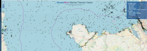
7th June 2018
OceanWise awarded GIS Marine Data contract for the Scottish Government7th June 2018
Hexagon’s Geospatial Division to Unveil 5D Location Intelligence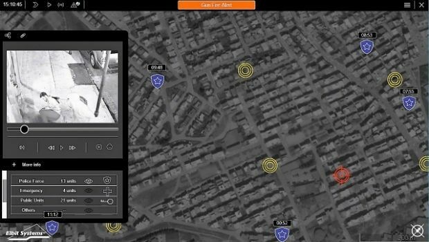
7th June 2018
Elbit Systems Launches MAY, a Wide-area Acoustic-based Situational Awareness Solution
6th June 2018
2018 World Football Championship stadiums seen from space