
DFS takes leading position in the UTM world by investing in Unifly
14th March 2019
DFS takes leading position in the UTM world by investing in Unifly
14th March 2019
DFS takes leading position in the UTM world by investing in Unifly13th March 2019
The country’s most detailed map of roads and footways unveiled
13th March 2019
Introducing the senseFly eBee X with MicaSense RedEdge-MX13th March 2019
PIX4D announces first user conference in Denver, Colorado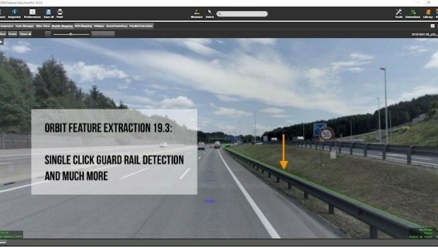
13th March 2019
Orbit GT releases version 19.3 of its 3D Mapping portfolio
12th March 2019
Fugro Strengthens Integrated Uxo Services For Offshore Renewables In Europe12th March 2019
Oracle is Associate Sponsor at Geospatial World Forum 201912th March 2019
Berlin Airport Now Provides Mobile Wayfinding To Guide Travelers!
12th March 2019
Golden Software Releases Grapher 14 with Enhanced Plotting Functions12th March 2019
World’s first cross-border emergency communication network11th March 2019
Garmin® earns best supplier award from Embraer for the tenth time
11th March 2019
Award for BIM Enabler/Consultant of the Year11th March 2019
Rotorcraft Asia (RCA) 2019 and Unmanned Systems Asia (UMSA) 201911th March 2019
OceanWise, in collaboration with Marico Marine,8th March 2019
12th International Symposium on Digital Earth8th March 2019
Bentley Systems is Associate Sponsor at Geospatial World Forum 2019
8th March 2019
Terra Drone's First Global Summit Attended by over 20 Countries
7th March 2019
FREQUENTIS contributes to Mission Critical Services Standard testing7th March 2019
Esri Awards Schneider Electric for Exceptional Achievement7th March 2019
Esri to participate in Buffalo Civic Innovation Eco Challenge7th March 2019
Orbit GT and Comsof to present at FTTH Conference 2019, Amsterdam.
7th March 2019
Flexpoint® Long Range Laser Modules - For Use Over Distances up to 200m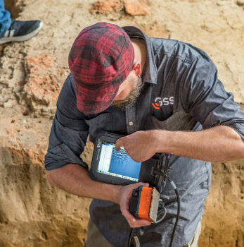
7th March 2019
GSSI Collaborates with Jamestown Rediscovery Foundation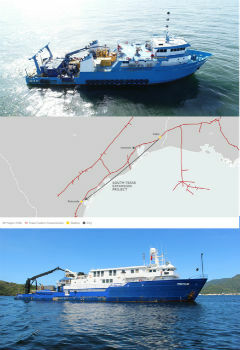
7th March 2019
Tdi-Brooks International Completes Texas Colt Offshore Pipeline Route Investigation
7th March 2019
GSSI Announces New Sales Professional for Western Canada6th March 2019
Hexagon and Frequentis Partner for Integrated Control Room Solutions
6th March 2019
Satellite Imagery confirms India missed target in Pakistan airstrike6th March 2019
ERM Advanced Telematics launches easy to install UBI products6th March 2019
Juniper Systems Limited Reports Growth and Expansion throughout EMEA6th March 2019
Several Must-Hear Speakers Added to the GEOINT 2019 Agenda
5th March 2019
Dennis Hirota is Titans of Technology Hall of Fame Recipient!5th March 2019
GeoSpock strikes commercial partnership with Smart Cambridge5th March 2019
GeoSpock strikes commercial partnership with Smart Cambridge5th March 2019
Elbit Systems Awarded a Contract to Provide Combat Suites5th March 2019
Garmin® expands aviation database coverage and capabilities in Australia5th March 2019
Cityworks Recognized for Exceptional Partnerships at Esri Partner Conference4th March 2019
Exceptional Achievement at Partner Conference
4th March 2019
Airbus, Naval Group and Rohde & Schwarz wins contract
3rd March 2019
Ocean Careers 2019 Launches Inspiring Programme2nd March 2019
Sensor Solutions International Conference 2019
2nd March 2019
Digital Water Works, Inc. Receives Strategic Investment from Bentley Systems