Arithmetica’s Pointfuse V2 to Power Point Cloud Conversion in Arena4D
6th October 2016
Arithmetica’s Pointfuse V2 to Power Point Cloud Conversion in Arena4DTerrestrial and airborne laser (LiDAR) scanners for the collection of 3D point cloud data; software for processing and visualising point clouds and creating 3D models, and use cases for laser scanning
This topic covers the science, the hardware, and the software used to capture, process and apply 3D point cloud data. As well as airborne and terrestrial (tripod-based, vehicle-mounted and handheld) laser (LiDAR) scanners, the topic includes the proprietary and Open Source software employed to process point clouds and create 3D models. It also covers the many and varied uses for 3D laser scanning: topographic mapping, bathymetric mapping, utility mapping, engineering surveying, agriculture, forestry, geology, architecture, industrial facilities, cultural heritage, asset management and construction, collision avoidance in autonomous and semi-autonomous vehicles, and environmental modelling
6th October 2016
Arithmetica’s Pointfuse V2 to Power Point Cloud Conversion in Arena4D5th October 2016
Central Alliance purchases first of its kind Mobile Mapping System4th October 2016
Find out if your project profit margins beat the industry average4th October 2016
Webinar: Manage Vegetation Encroachment and Utility Assets28th September 2016
Bluesky’s Aerial Thermal Surveys Helps Enfield Identify Illegal Dwellings
7th September 2016
StreetMapper helps to power growth for AAM in India7th September 2016
Bluesky Publishes First Online 3D Maps of Isle of Man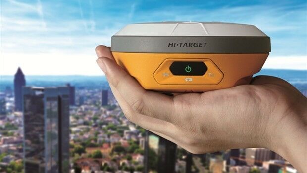
26th August 2016
Hi-Target Europe successfully launched new products in Czech18th August 2016
Laser scan coordinate system tools released in Maptek I-Site Studio
4th August 2016
Bluesky aerial laser maps reveal Battle of the Somme secrets for TV show2nd August 2016
AirGon LLC Revolutionizes Drone Data Extraction
28th July 2016
Bluesky Geospatial Joins Ireland’s Growing Geographic Information Industry
8th July 2016
Patrol+® a flying success with survey completed for National Grid
5th July 2016
Leica Geosystems announces world’s first fused airborne sensor
16th June 2016
Leica Geosystems expands LiDAR capabilities in ALS80 airborne sensor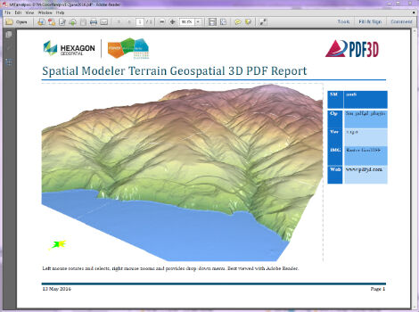
13th June 2016
PDF3D Releases 3D Geospatial PDF Plugin for ERDAS IMAGINE
9th June 2016
Bluesky’s 3D Laser Maps Inform BIM Projects
7th June 2016
Bluesky Appoints Dr Simon Schuffert to Lead Software Innovation
1st June 2016
Fugro to play Key Role in Norway's Coastal Highway Improvement Programme30th May 2016
YellowScan LiDAR for Drone 2016: User Conference
16th May 2016
LizardTech Launches Express Server 9.5 at GEOINT 2016 Symposium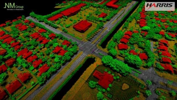
12th May 2016
NM Group collaborate with Harris Corporation
9th May 2016
Arithmetica Reveals Latest Tech at Museums and Heritage Show
5th May 2016
Aerial Mapping Company Bluesky Announces Expansion
4th May 2016
eyesMap3D: The most accurate and powerful 3D photo modeling software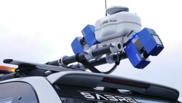

15th April 2016
Arithmetica reveals 360 imaging and 3D laser modeling tech at Forensics Europe
15th April 2016
Renishaw welcomes Measutronics Corporation to its distributor network13th April 2016
Leica Geosystems and Spheron-VR collaborate
6th April 2016
Arithmetica to Launch Pointfuse V2 at SPAR 3D 2016
4th April 2016
Orbit GT launches Mobile Mapping Feature Extraction Bundle1st April 2016
OGC and ASTM International to Jointly Develop Standards and More

21st January 2016
INTERGEO: supporting Hamburg’s Smart City quest


7th January 2016
INTERGEO: the global hub for Geo business