
Global Mapper LiDAR Module v18.1 Now Available
1st March 2017
Global Mapper LiDAR Module v18.1 Now Available1st March 2017
Global Mapper LiDAR Module v18.1 Now Available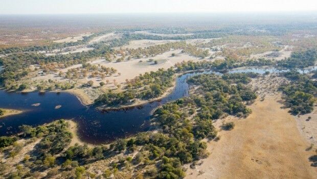
28th February 2017
Botswana Geoscience Portal serves up 2000 downloads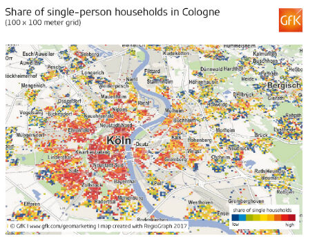
28th February 2017
Share of single-person households in Cologne
28th February 2017
GeoSLAM Growth Continues With Two Senior Appointments
28th February 2017
Leveraging 3D modeling and printing skills as a service27th February 2017
2017 version of Mobile Coverage Explorer Released26th February 2017
MacDonald Dettwiler Buying DigitalGlobe for $2.4 Billion24th February 2017
Aeryon SkyRanger sUAS Successfully Completes BVLOS Flight Test24th February 2017
LizardTech Releases MrSID Generation 4 Decode SDK Version 9.5.4
24th February 2017
Why desktop is essential for drone mapping in agriculture23rd February 2017
Luminent Solutions for PHMSA Pipeline Safety and Regulatory Compliance

22nd February 2017
EU Peacekeepers Choose Globalstar-enabled SafeFleet
22nd February 2017
GAUSS+LÖRCHER: New BARTHAUER training partner in southern Germany
22nd February 2017
Gritter Tracker coming to the rescue for snowed-in Scots22nd February 2017
AddressBase Toolkit for Mapinfo Released By Aligned Assets22nd February 2017
Global Mapper 18.1 Released with Improved 3D Viewing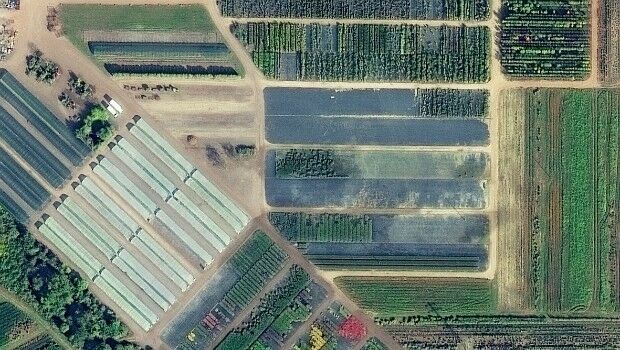
22nd February 2017
European Space Imaging main provider of VHR satellite imagery to EC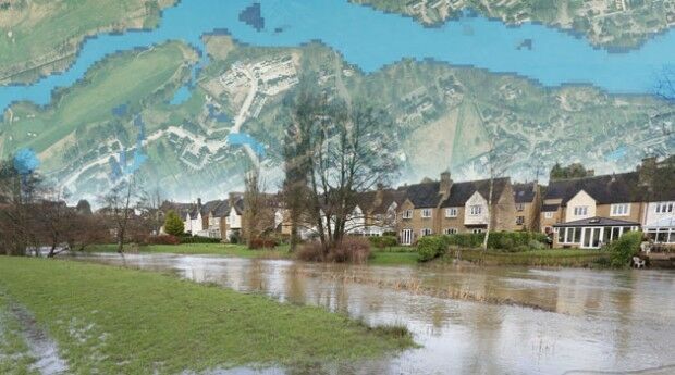
21st February 2017
Bluesky Announces New Online Flood Risk Map of the UK21st February 2017
GfK study on product-line purchasing power in Poland20th February 2017
K2 Geospatial launches the latest version of JMap
20th February 2017
Business Geografic - new mapping software innovation program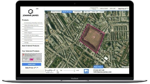
20th February 2017
There’s a new girl in town: Joanna James18th February 2017
EdgeData and Harris Corporation Collaboration
17th February 2017
Biggest Collection of Arctic Elevation Data Yet
16th February 2017
LuxCarta for Global IoT Network Deployment Geodata Requirements
16th February 2017
CGG Completes Industry-First FalconPlus Survey for Bapco
16th February 2017
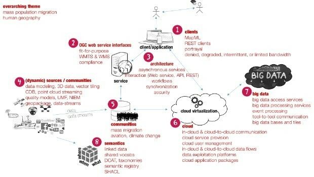
Data and services for Testbed 13’s mass migration scenario16th February 2017
Advanced Groundwater Technologies Joins PCI Reseller Partner Network
15th February 2017
Three reasons golf courses are the next drone mapping territory15th February 2017
Djibouti adopts what3words as national postal addressing system15th February 2017
Golden's new 2D and 3D Mapping, Modeling, and Analysis Software
15th February 2017
Fast Company's Top 10 Most Innovative Companies in Data Science

14th February 2017
VicRoads Builds for the Future with Yotta’s Horizons Software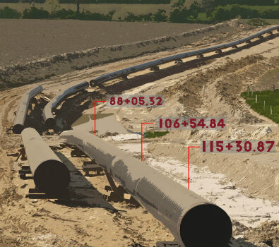
14th February 2017
Exprodat Offers ArcGIS Pipeline Referencing Implementation Services
14th February 2017
Indonesian Electric Power Company Chooses SuperGIS Desktop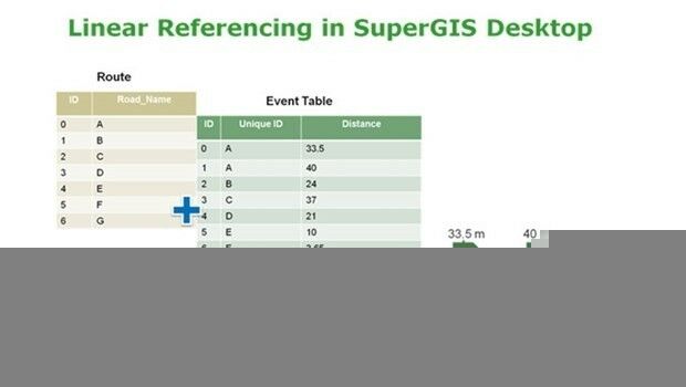
14th February 2017
SuperGIS Desktop Will Have Linear Referencing Soon
13th February 2017
Esri Partners Honored at Esri FedGIS Conference13th February 2017
OGC invites expertise on underground maps and models13th February 2017
URISA's GIS Hall of Fame Nominations Process Opens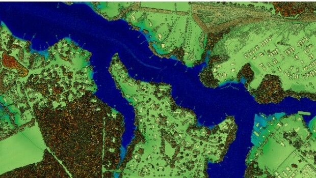
13th February 2017
New Leica SPL100 brings up to 10x more efficiency to airborne LiDAR mapping
11th February 2017
Esri FedGIS Conference Showcases Cutting-Edge Technology