
Lithuanian Survey Experts Takes Delivery Of Siteco Road-Scanner
24th August 2016
Lithuanian Survey Experts Takes Delivery Of Siteco Road-Scanner24th August 2016
Lithuanian Survey Experts Takes Delivery Of Siteco Road-Scanner23rd August 2016
HERMES® 450 soars during the North Dakota UAS Field Day22nd August 2016
Stesalit Systems Ltd supplies GPS PDA to Odisha Forestry Department18th August 2016
Septentrio Supplies to Oregon Department of Transport
18th August 2016
senseFly & Air Nav Pro join forces to reduce mid-air collisions12th August 2016
PCI Geomatics Releases Geomatica 2016 Service Pack 1

10th August 2016
Barrow Upon Soar Rail Closure Prompts Monitoring Calls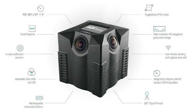
10th August 2016
iSTAR 360 degree Measurement Module integrated by imaging companies

6th August 2016
Point Greys New Spinnaker SDK Leverages GenICam3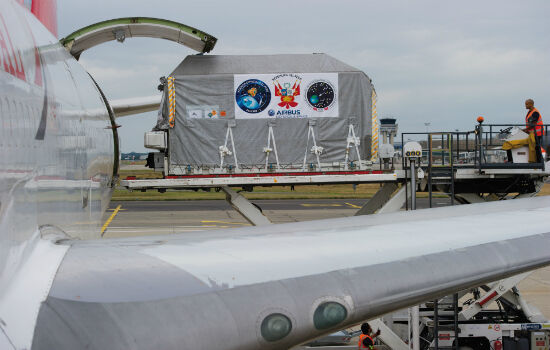
6th August 2016
PerúSAT-1 satellite is now on its way to Kourou launch site
6th August 2016
New Blackfly S - the Latest Imaging Technology in Compact Housing
6th August 2016
Collect Field Data with High Accuracy - Supergeo X Hi-Target
5th August 2016
160 Commercial Drone Companies Showcase UAV Technology at InterDrone5th August 2016
what3words Addresses Rio’s Summer of Sport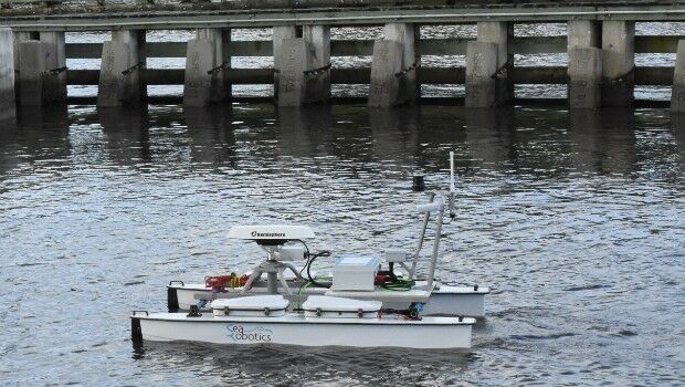
4th August 2016
SeaRobotics Delivers Unmanned Surface Vehicle2nd August 2016
Orbit GT and Soluciones Geoinformaticas, sign Reseller Agreement2nd August 2016
AirGon LLC Revolutionizes Drone Data Extraction2nd August 2016
Geneq's announcement of iSXBlue receivers compatibility2nd August 2016
Pix4D Elevates Agriculture Software to Desktop & Cloud Solution
1st August 2016
The Truth About Drones in Mapping and Surveying
29th July 2016
Fugro Partners With Electricity Transmission System Operator Elia29th July 2016
Trent Stromberg joins Avenza Systems as Business Development Manager
28th July 2016
SuperPad Assists the French Geotechnical Surveying Firm, Fondasol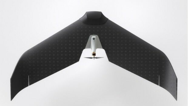
27th July 2016
Lehmann Aviation redefines mapping drones with brand-new L-A Series_(1).jpg)
27th July 2016
Airbus Defence and Space Launches “One Tasking”
27th July 2016
Sokkia receivers to be used for Latvian forest management
27th July 2016
Fugro Begins Seabed Investigation At Wylfa Newydd Nuclear Power Site25th July 2016
A look around the UAS boom industry at interaerial SOLUTIONS
22nd July 2016
Apply to Geovation now to secure funding for your GeoTech start-up22nd July 2016
Van Deliveries Growth Highlights Need for Flexible Road Safety Systems
21st July 2016
Airbus to operate Heron 1 drones for Germany also in Mali20th July 2016
Airbus Defence and Space Launches “One Tasking”
19th July 2016
SSTL expands LEO platform capability with VESTA nanosatellite19th July 2016
Masternaut launches fuel module to improve compliance and cut costs19th July 2016
Garmin announces new enhancements to the G500/G600
18th July 2016
Fugro Commences Offshore Geotechnical Contract For ONGC India
18th July 2016
QuestUAV Provides Own PPK Solution For Q-200 Surveyor UAV18th July 2016
NM Group awarded contract to deliver transmission powerline survey