
Data Capture
Don't miss a beat, sign up to our newsletter

Leica Geosystems’ new 3D imaging laser scanner now available
6th June 2017
Leica Geosystems’ new 3D imaging laser scanner now available
SimActive Optimizes Vineyard Performance with Drones
6th June 2017
SimActive Optimizes Vineyard Performance with Drones.jpg)
Elbit Awarded Contract to Develop Panoramic Cockpit Display Units
6th June 2017
Elbit Awarded Contract to Develop Panoramic Cockpit Display Units
viaEuropa with Ordnance Survey base maps now on Tableau
5th June 2017
viaEuropa with Ordnance Survey base maps now on Tableau
Boost in Performance from the Galileo Constellation
3rd June 2017
Boost in Performance from the Galileo Constellation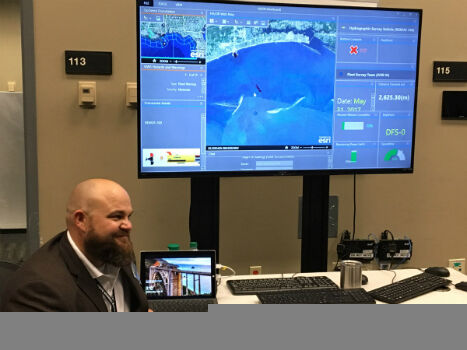
Faster and Safer Operations to Navy Missions
2nd June 2017
Faster and Safer Operations to Navy Missions
ENERGIC OD: New Important Results In The Apps’ Development
2nd June 2017
ENERGIC OD: New Important Results In The Apps’ Development
Bentley Systems to Present at BIM4Water Summer Reception in London UK
2nd June 2017
Bentley Systems to Present at BIM4Water Summer Reception in London UK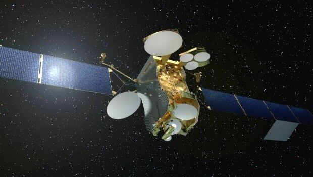
First high power all-electric satellite launched by Ariane 5
2nd June 2017
First high power all-electric satellite launched by Ariane 5
Paul Forster: Martek Marine hire Head of UAV Operations
2nd June 2017
Paul Forster: Martek Marine hire Head of UAV Operations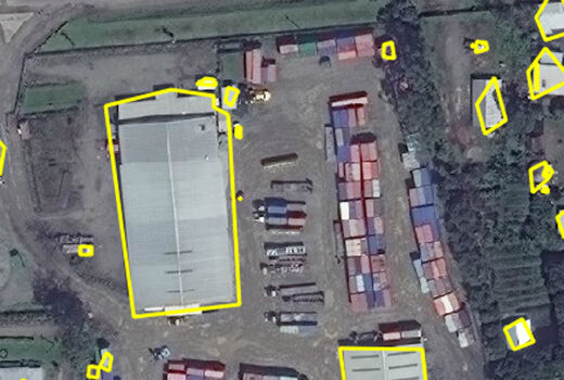
Automated Feature Identification in Machine Learning Trials
1st June 2017
Automated Feature Identification in Machine Learning Trials
exactEarth Broadens Small Vessel Tracking Offering
1st June 2017
exactEarth Broadens Small Vessel Tracking Offering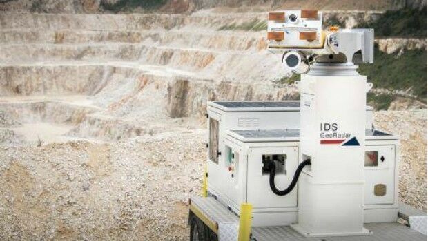
IDS GeoRadar unveils next generation radar technology
1st June 2017
IDS GeoRadar unveils next generation radar technology
COPTRZ Release First UK Drone Market Intelligence Report
1st June 2017
COPTRZ Release First UK Drone Market Intelligence Report

Mapmaker AND releases first High Definition Autonomous Vehicle Maps
31st May 2017
Mapmaker AND releases first High Definition Autonomous Vehicle Maps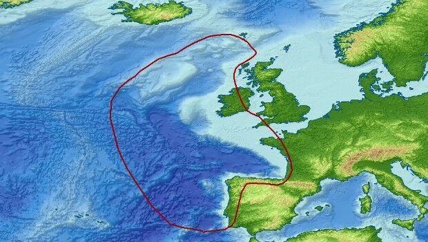
Getech Brings Greater Insight to Both Sides of the North Atlantic
31st May 2017
Getech Brings Greater Insight to Both Sides of the North Atlantic
SpaceKnow with access to “One Atlas” for development of new analytics
31st May 2017
SpaceKnow with access to “One Atlas” for development of new analytics
IRS data now available free of charge to scientific users
31st May 2017
IRS data now available free of charge to scientific users
WorldView-4 satellite imagery in 30cm resolution
31st May 2017
WorldView-4 satellite imagery in 30cm resolution
Road Safety is as Important as Track Safety
31st May 2017
Road Safety is as Important as Track Safety
exactEarth Launches Global Real-Time Vessel Tracking Service
31st May 2017
exactEarth Launches Global Real-Time Vessel Tracking Service
Airbus Defence and Space launches “Global Earth Observation Challenge”
30th May 2017
Airbus Defence and Space launches “Global Earth Observation Challenge”
Plans For Europe’s First Commercial Video Satellite Constellation
30th May 2017
Plans For Europe’s First Commercial Video Satellite Constellation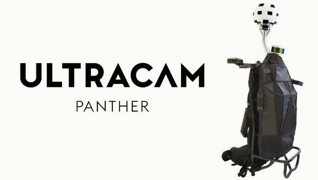
Portable UltraCam Panther Offers High-Quality Imagery, Video and LiDAR
30th May 2017
Portable UltraCam Panther Offers High-Quality Imagery, Video and LiDAR.jpg)
Topcon Brings Future of Surveying to Geo Business 2017
27th May 2017
Topcon Brings Future of Surveying to Geo Business 2017
Airbus and Scanex to feed Russia’s most popular search engine Yandex
26th May 2017
Airbus and Scanex to feed Russia’s most popular search engine Yandex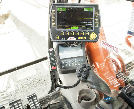
Leica iCON excavate systems now support SVAB MACS control system
25th May 2017
Leica iCON excavate systems now support SVAB MACS control system
New Features of SuperSurv 10 that You Cannot Ignore
23rd May 2017
New Features of SuperSurv 10 that You Cannot Ignore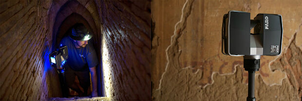
CyArk and FARO partner to save heritage in 3D
23rd May 2017
CyArk and FARO partner to save heritage in 3D

Consultancy Supports Large Scale Developments In Amsterdam
19th May 2017
Consultancy Supports Large Scale Developments In Amsterdam
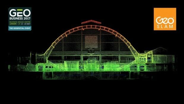

GeoSLAM Expands Far East Operations With New Distributors
18th May 2017
GeoSLAM Expands Far East Operations With New Distributors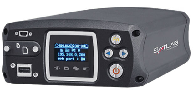
Satlab announces SLX-1 Multi-application Receiver Mobile Upgrade
18th May 2017
Satlab announces SLX-1 Multi-application Receiver Mobile Upgrade
Opel / Vauxhall and Masternaut announce exclusive partnership
18th May 2017
Opel / Vauxhall and Masternaut announce exclusive partnership

Garmin® Head-up Display (GHD) system for integrated flight decks
18th May 2017
Garmin® Head-up Display (GHD) system for integrated flight decks
Ministry of Public Works of Indonesia Selects SuperSurv
17th May 2017
Ministry of Public Works of Indonesia Selects SuperSurv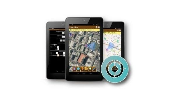
Latest SuperSurv 3.3 Offers More than Bug Fixes
17th May 2017
Latest SuperSurv 3.3 Offers More than Bug Fixes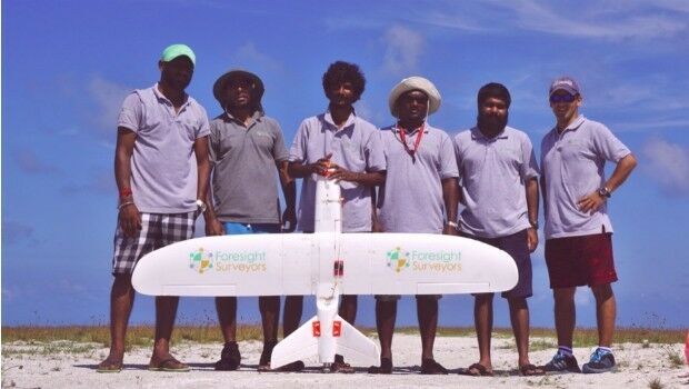
Aeromapper Talon Surveys A Whole Maldives Island In A Single Flight
17th May 2017
Aeromapper Talon Surveys A Whole Maldives Island In A Single Flight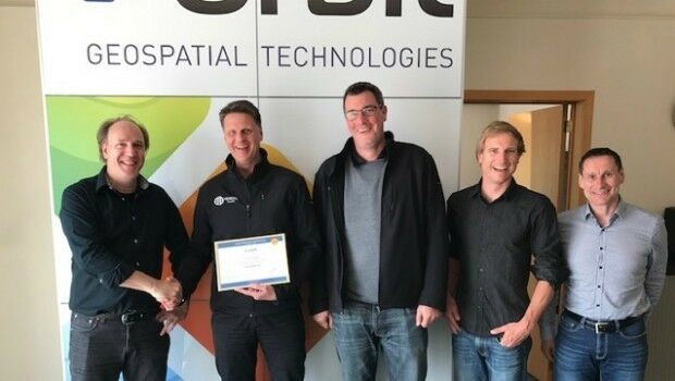
Orbit GT and Vexcel Imaging, Austria update Gold Reseller status
17th May 2017
Orbit GT and Vexcel Imaging, Austria update Gold Reseller status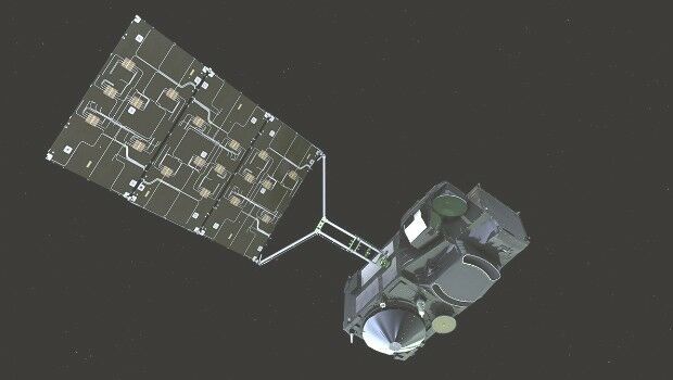
EUMETSAT to host information day on crucial data access procurement
16th May 2017
EUMETSAT to host information day on crucial data access procurement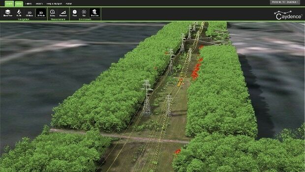
NM Group assist Hydro One to develop LiDAR strate
16th May 2017
NM Group assist Hydro One to develop LiDAR strate