
Environmental Data Collection & the Need for Speed
21st April 2017
Environmental Data Collection & the Need for SpeedTechnologies that provide tracking and navigational functions for unmanned, autonomous and semi-autonomous vehicles on land, at sea and in the air, and use cases on their practical deployment
This topic covers the technologies that provide tracking and navigational functions for unmanned vehicles of all types, on land, at sea and in the air. These technologies include satellite-based navigation (GNSS) receivers, Inertial Navigation Systems (INS), Acoustic Positioning Systems (APS) and other sensors for situational awareness (radars, Lidars, optical and infrared cameras, ultrasonic, etc). Use cases for the deployment of these technologies in unmanned vehicles embraces land surveying, construction and urban planning, underwater exploration and asset management, archaeological and heritage studies, environmental monitoring, conservation, utility surveys, insurance risk surveys, built infrastructure surveys and inspection, defence applications, open cast mining, forestry and agriculture, traffic management, emergency services, search and rescue, humanitarian support, disease control and healthcare, merchandise delivery and weather forecasting
21st April 2017
Environmental Data Collection & the Need for Speed18th April 2017
Trumbull Unmanned Using SimActive for Emergency Response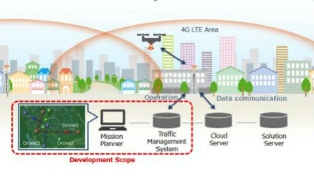
14th April 2017
KDDI and Terra Drone announce the invention of “4G LTE control system
12th April 2017
Vertical Images: from film making to inspection10th April 2017
Terra Drone’s Innovations take off at Brisbane’s Myriad Festival
30th March 2017
RoboBusiness Europe and TUS Expo, 19-21 April 201727th March 2017
PrecisionPoint Hires sUAS Pilot to Enhance 3D Reality Capture Services
24th March 2017
5 Valuable Lessons Learned About Drones in Construction
23rd March 2017
Stand and Deliver! Could parcel drones trigger the Highwayman's return
21st March 2017
5 GOOD REASONS to follow Pix4D on Social Media

16th March 2017
Why desktop is essential for drone mapping in agriculture
15th March 2017
Drones Save Almost One Life Per Week on Average
13th March 2017
InterDrone Acquired by Emerald Expositions LLC10th March 2017
DFS and Unifly cooperate on the development of drone app
8th March 2017
Thales joins forces with Unifly to facilitate drone use
8th March 2017
Centrik Moves Into South Africa With Premier Aviation8th March 2017
Reality modelling software bundled with UAS software solutions
3rd March 2017
How do I choose the right image-capture settings for 3D models?
28th February 2017
Leveraging 3D modeling and printing skills as a service24th February 2017
Aeryon SkyRanger sUAS Successfully Completes BVLOS Flight Test
24th February 2017
Specialist Infrared Payload Course for Drone Operators is a UK First
23rd February 2017
AirMap and senseFly Partner to Advance Safety for Commercial Drones
23rd February 2017
New Enterprise Tracks Headline InterDrone 2017 Call For Speakers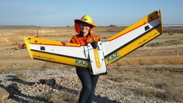
22nd February 2017
QuestUAV – Drone Girls versus Drone Boys
21st February 2017
UAV's help U.S. Military Boost Demand for Satellite Communication18th February 2017
EdgeData and Harris Corporation Collaboration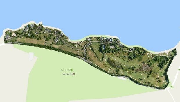
15th February 2017
Three reasons golf courses are the next drone mapping territory10th February 2017
Commercial Drone Opportunities & Regulation across Europe in 2017
8th February 2017
Commercial UAV Expo Europe Announces Early Backers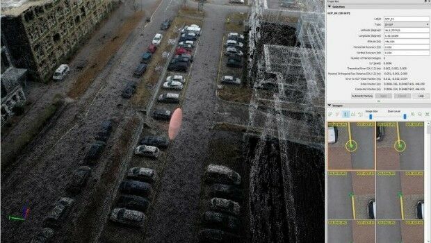
8th February 2017
Achieving best accuracy with error ellipsoid in Pix4Dmapper rayCloud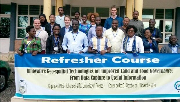
2nd February 2017
Rwanda forges forward in drone mapping use
31st January 2017
New supported devices, flight missions, and mission settings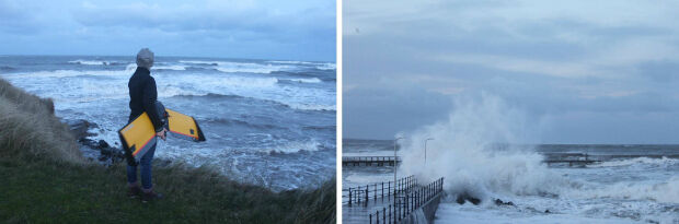
31st January 2017
A Case Study on Long-Term Erosion Mapping in Northeast England

25th January 2017
Abstract Submissions Invited for GIS-Pro 2017 in Jacksonville, Florida
25th January 2017
Pix4D speaks at UN Panel on Food Security17th January 2017
SimActive Used for Coastal Erosion Assessment with UAVs16th January 2017
The key to flying drones safely is education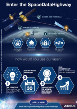
12th January 2017
Airbus Launches “Enter the SpaceDataHighway” Challenge.jpg)
11th January 2017
Conversion Drone Training for EuroUSC Students on BNUC-S Course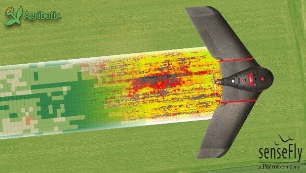

6th January 2017
Sky’s the limit for DJI and HERE’s global drone mapping partnership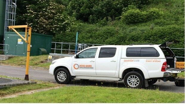
5th January 2017
Ross-Shire Engineering Selects Ctrack to Improve Fleet Abilities