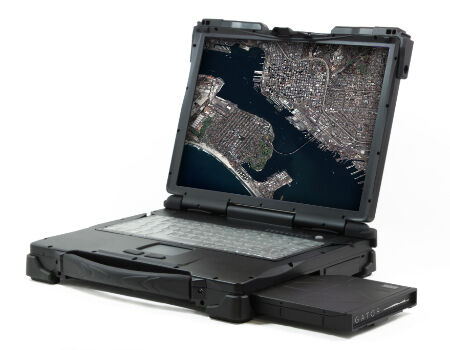
Airbus Defense and Space Partners with AMREL
24th June 2016
Airbus Defense and Space Partners with AMRELNews as it happens! Keep in touch with the latest developments in business and technology in the regions or worldwide.
24th June 2016
Airbus Defense and Space Partners with AMREL
24th June 2016
Septentrio to Spotlight Drone and Terrestrial GNSS Solutions
23rd June 2016
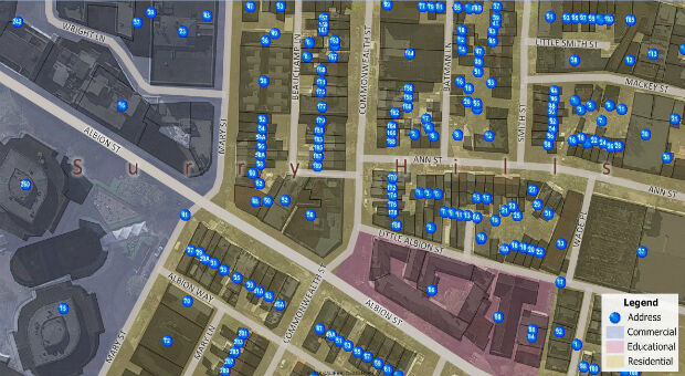
Maptitude Now Has 14+ Million Australian Address Points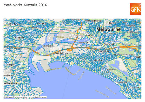
23rd June 2016
GfK releases new geodata for Australia and New Zealand23rd June 2016
CompassDrone™ Your One-Stop-Shop for Drone Based Remote Sensing23rd June 2016
1Spatial Solves Data Problems at Esri User Conference
23rd June 2016
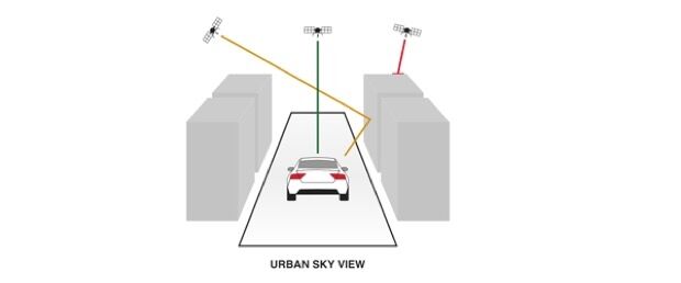
u-blox Untethered Dead Reckoning technology
23rd June 2016
ATrack Announces Strategic Partnership with PodsystemM2M
23rd June 2016
Bluesky Aerial Images Reveal Britain's Hidden Land for Mapmakers22nd June 2016
Esri's Federal Small Business Program Grows at Rapid Pace
22nd June 2016
CAPIGI GeoAgri 2016: “Insightful, exciting, state-of-the-art”22nd June 2016
GSSI Announces Flexible, Configurable Ground Penetrating Radar System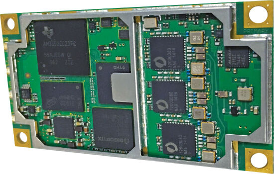
22nd June 2016
Hemisphere GNSS Announces New Eclipse Positioning OEM Boards22nd June 2016
Airbus Defense and Space and 3v Geomatics Partner for TerraSARX"
22nd June 2016
Cadcorp’s fire service resource planning tool is even more realistic22nd June 2016
Icaros Releases 4.2.2 of OneButton™ UAS Image Processing Software
22nd June 2016
PTV Transport Consult is one of Germany’s best consulting companies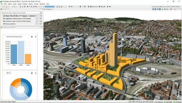
22nd June 2016
Build Smart 3D Cities in Minutes with Game-Changing Esri CityEngine
22nd June 2016
Andrea Wulf to Lead Keynote Address at the 2016 Esri User Conference