
Pix4D announces Pix4Dmatic: accurate, faster photogrammetry on a larger scale
24th September 2020
Pix4D announces Pix4Dmatic: accurate, faster photogrammetry on a larger scaleNews as it happens! Keep in touch with the latest developments in business and technology in the regions or worldwide.
24th September 2020
Pix4D announces Pix4Dmatic: accurate, faster photogrammetry on a larger scale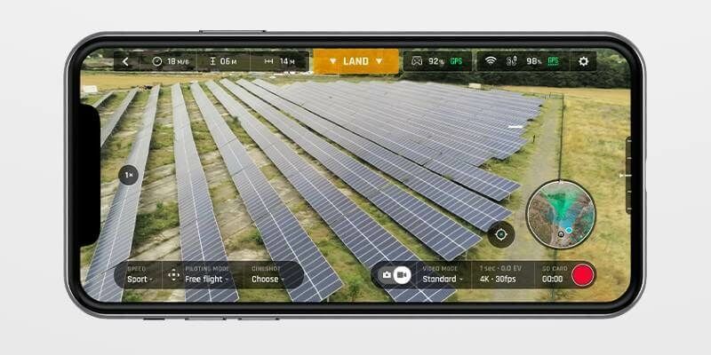
24th September 2020
Independent Security Audit Confirms Privacy and Security Benefits of Parrot FreeFlight 6 App
24th September 2020
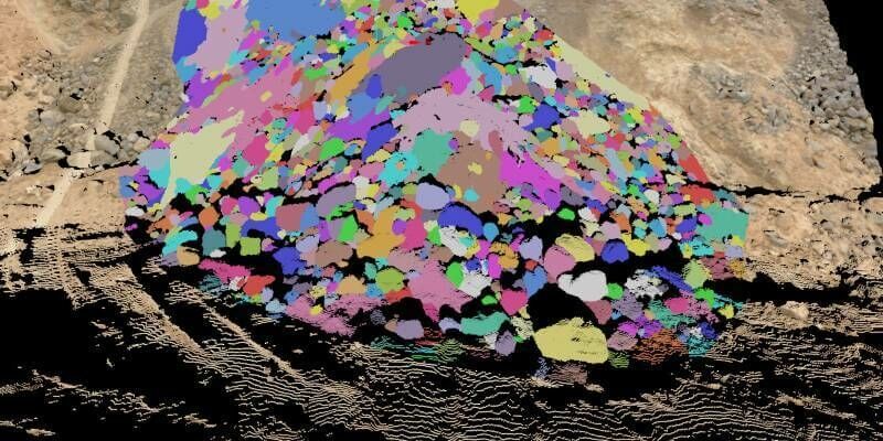
Fragmentation analysis leads updates in Maptek PointStudio 2020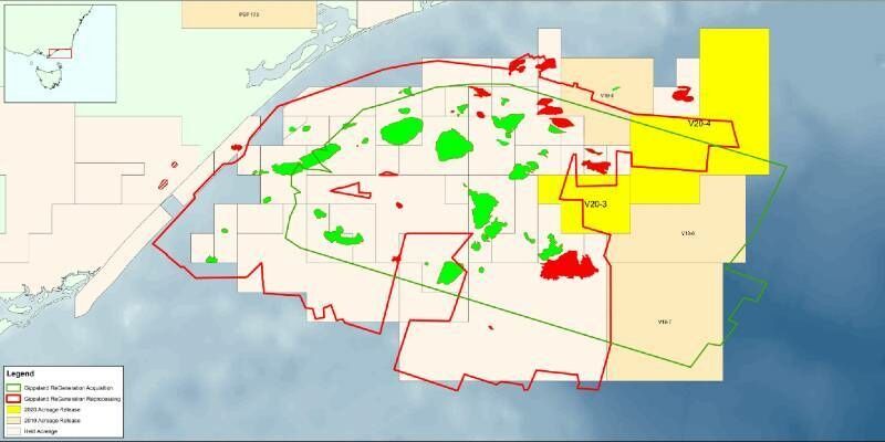
23rd September 2020
CGG’s Fast-Track Data from Basin-Wide Gippsland 3D Survey Supports Australia’s Acreage Release
23rd September 2020
Hunter Water signs 3-year subscription to monitor Grahamstown Dam using Rezatec’s Geospatial AI Dam Monitoring product
23rd September 2020
MGISS Scores Accreditation Hat-trick for Cloud Software and Workplace Wellbeing
23rd September 2020
Satellite Imagery Specialist 4 Earth Intelligence Appoints Managing Director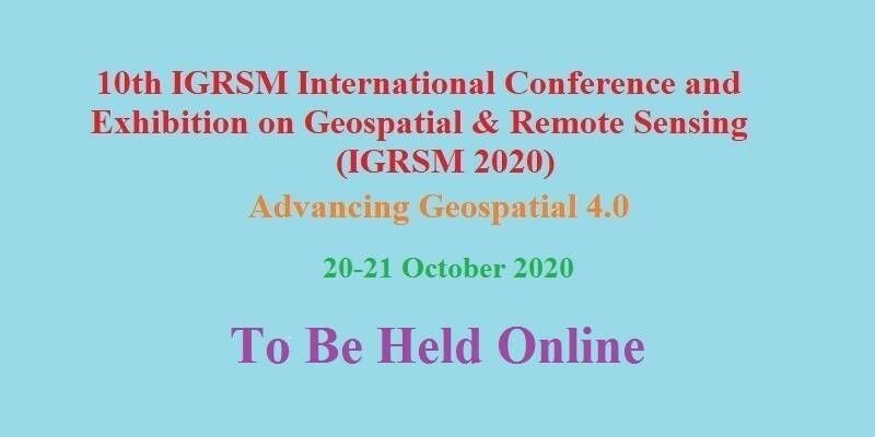
22nd September 2020
10th IGRSM International Conference and Exhibition on Geospatial & Remote Sensing (IGRSM 2020)
22nd September 2020
Airbus selected for ESA’s new polar ice and snow topography mission
22nd September 2020
Airbus reveals new zero-emission concept aircraft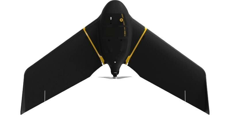
22nd September 2020
Scaling New Safety Heights with Fixed-Wing Drone Technology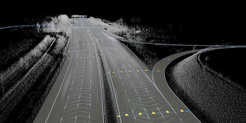
21st September 2020
HERE offers developers and data scientists direct access to rich geospatial data
21st September 2020
The British Merchants Federation joins the UK BIM Alliance Affiliate Programme
21st September 2020
European Association of Aerial Surveying Industries Gather Virtually for First AGM

18th September 2020
RiCAST: Artificial Intelligence: A Geospatial Revolution
18th September 2020
East View Geospatial Partners with AllSource Analysis to Offer Finished Geospatial Intelligence
18th September 2020
Bluesky 3D Building Models Provide Sense of Place for London Design Agency
18th September 2020
Are you a market leader in IoT? Showcase your successful use cases in the 2020 IoT Global Awards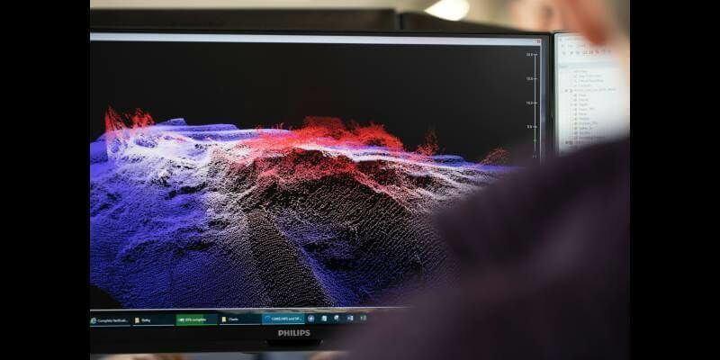
17th September 2020
Admiralty Marine Innovation Programme to support the development of the Blue Economy
17th September 2020
Pix4D and SAP start a joint innovation project for the 3D inspection of transmission masts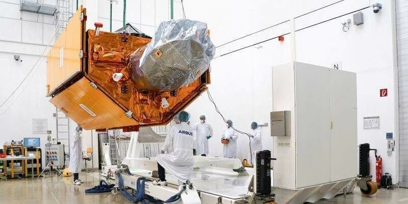
17th September 2020
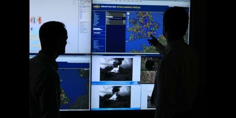
New national intelligence portal launched to track criminal gangs