
News
News as it happens! Keep in touch with the latest developments in business and technology in the regions or worldwide.

GeoSLAM launches new solution to optimise construction progress tracking
7th July 2021
GeoSLAM launches new solution to optimise construction progress trackingGMV supplies the ground segment of Hispasat’s new generation of satellites
6th July 2021
GMV supplies the ground segment of Hispasat’s new generation of satellitesExprodat Meets Industry Challenges with Unconventionals Analyst 2.1 for ArcGIS Pro
6th July 2021
Exprodat Meets Industry Challenges with Unconventionals Analyst 2.1 for ArcGIS Pro
Topcon Positioning GB management systems accredited to ISO9001:2015
6th July 2021
Topcon Positioning GB management systems accredited to ISO9001:2015Asia’s one of the biggest geospatial expo, Smart GEO Expo 2021 is ready to meet you On/ Offline Hybrid!
5th July 2021
Asia’s one of the biggest geospatial expo, Smart GEO Expo 2021 is ready to meet you On/ Offline Hybrid!
OceanTech Program 2021(OT 2021) pulls over 1,000 delegates to Zhoushan to surf challenging waves of Ocean Technology
5th July 2021
OceanTech Program 2021(OT 2021) pulls over 1,000 delegates to Zhoushan to surf challenging waves of Ocean TechnologyThree HawkEye 360 Formation-Flying Microsatellites Built by Space Flight Laboratory (SFL) Successfully Launched
5th July 2021
Three HawkEye 360 Formation-Flying Microsatellites Built by Space Flight Laboratory (SFL) Successfully Launched
PhaseOne - How Digital-Twins of Hydro-power Dams support Plant Operations
2nd July 2021
PhaseOne - How Digital-Twins of Hydro-power Dams support Plant OperationsSateliot is leading the first in-orbit demonstration of 5G NB-IoT nanosatellite to extend coverage for mobile operators
2nd July 2021
Sateliot is leading the first in-orbit demonstration of 5G NB-IoT nanosatellite to extend coverage for mobile operators
Cobham SATCOM enhances critical radio communications offering for the global maritime industry through new SAILOR 7222 VHF DSC Class A
2nd July 2021
Cobham SATCOM enhances critical radio communications offering for the global maritime industry through new SAILOR 7222 VHF DSC Class A
Public Comment sought on draft Zarr Storage Specification 2.0 OGC Community Standard
2nd July 2021
Public Comment sought on draft Zarr Storage Specification 2.0 OGC Community Standard
Eos Positioning Systems announces the Eos Bridge, which makes almost any instrument iOS compatible
1st July 2021
Eos Positioning Systems announces the Eos Bridge, which makes almost any instrument iOS compatibleUP42 Teams with HEAD Aerospace to Bring Diverse Image Data to Geospatial Marketplace, Expanding Applications in Multiple Sectors
1st July 2021
UP42 Teams with HEAD Aerospace to Bring Diverse Image Data to Geospatial Marketplace, Expanding Applications in Multiple Sectors
Parrot unveils ANAFI Ai: The first 4G connected robotic UAV
1st July 2021
Parrot unveils ANAFI Ai: The first 4G connected robotic UAV
Septentrio announces partnership with XenomatiX
1st July 2021
Septentrio announces partnership with XenomatiX
u-blox presents Bluetooth AoA explorer kits for high precision indoor positioning
30th June 2021
u-blox presents Bluetooth AoA explorer kits for high precision indoor positioning
1Spatial’s flagship conference returns to London for fifth year
30th June 2021
1Spatial’s flagship conference returns to London for fifth year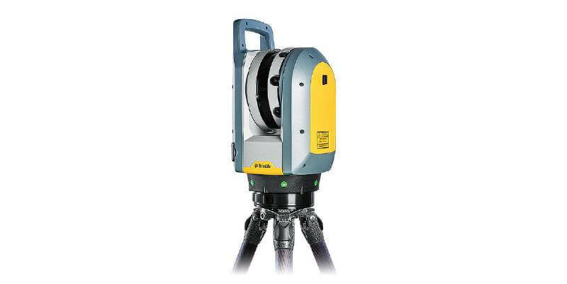
Trimble X7 and Perspective 3D Scanning Solution Garners Three International Design Awards
30th June 2021
Trimble X7 and Perspective 3D Scanning Solution Garners Three International Design AwardsSilicon Sensing showcases new, space-focused inertial measurement products at Space-Com
29th June 2021
Silicon Sensing showcases new, space-focused inertial measurement products at Space-Com
1Spatial Announced as Esri User Conference 2021 Premium Exhibitor
29th June 2021
1Spatial Announced as Esri User Conference 2021 Premium Exhibitor
Staffordshire Fire and Rescue Service combines GIS with workload modelling and risk analysis
29th June 2021
Staffordshire Fire and Rescue Service combines GIS with workload modelling and risk analysisUCL Virus Watch Study tracks location of volunteers to help understand behaviour during Covid-19 pandemic
29th June 2021
UCL Virus Watch Study tracks location of volunteers to help understand behaviour during Covid-19 pandemic
OGC considering CoverageJSON as community standard; seeks public comment
28th June 2021
OGC considering CoverageJSON as community standard; seeks public comment