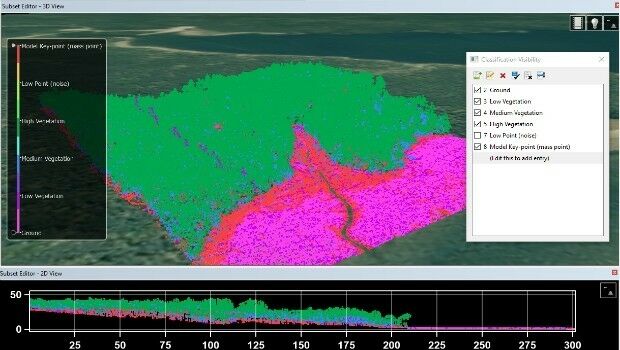
Teledyne CARIS Releases New Version of Bathy DataBASE
10th August 2017
Teledyne CARIS Releases New Version of Bathy DataBASE
10th August 2017
Teledyne CARIS Releases New Version of Bathy DataBASE9th August 2017
Web Mapper in SuperGIS Server 10- Building Web GIS without Coding9th August 2017
Upcoming SuperGIS Webinar- Web-based 3D Cadastral Mapping9th August 2017
Strategic Education Alliance Agreement with Stellenbosch University8th August 2017
Esri and Smart Dubai Sign Enterprise Agreement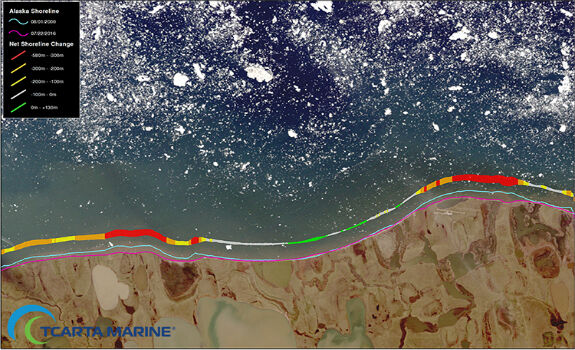
8th August 2017
TCarta Marine Changes the Way Dynamic Environments are Managed7th August 2017
Orbit GT and ViaTech, Norway, sign Reseller Agreement7th August 2017
CGG Launches Gippsland ReGeneration reprocessing project in Australia
4th August 2017
3DR Site Scan processing now powered by Pix4D3rd August 2017
Efficient Management of Large Process Facilities3rd August 2017
Orbit GT updates 3D Mapping Cloud with Oblique Imagery Support3rd August 2017
Speakers to Highlight the 2017 National GIS in Transit Conference
2nd August 2017
Sharing Data with the Support for Cloud Storage in SuperPad 10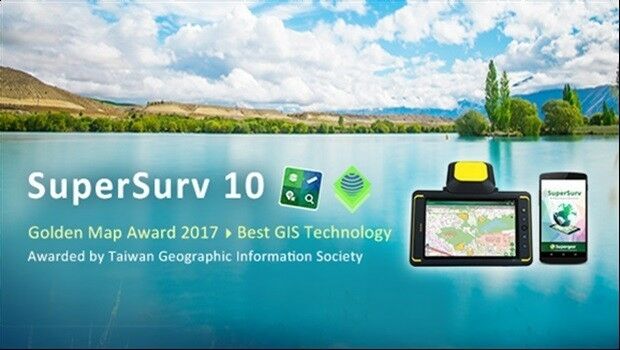
2nd August 2017
Brive City Uses SuperSurv to Update Topographic Maps2nd August 2017
Skyline Software Systems Releases Skylineglobe Server V7.02nd August 2017
Unique designs on Wallasea Island have been approved2nd August 2017
Astun Technology Announces Open Source Training Course Schedule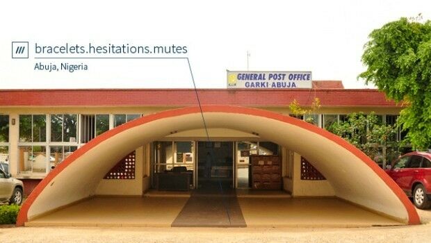
2nd August 2017
Nigeria, Africa’s largest economy, adopts 3 word addresses
2nd August 2017
GAF AG Signs Distribution Partnership with Planet1st August 2017
PDF3D Release PV+ 5.4 Visualization & Publishing Update1st August 2017
Geovation Programme now open to location and land disruptors
31st July 2017
Skyline Software Systems Releases Terraexplorer for Web V7.029th July 2017
Free Point of Interest Data by Type for Use with Maptitude28th July 2017
New subscription plans for Oasis montaj suite of geoscience software28th July 2017
BP Honored at 2017 Esri International User Conference
27th July 2017
MicaSense Atlas is now integrated with Pix4D desktop software
27th July 2017
SuperSurv Selected for Road Data Collection in Meurthe-et-Moselle, France27th July 2017
Upgraded Extensions of SuperGIS Desktop Provide More Insights27th July 2017
Orbit GT selected as one of 20 most promising geospatial companies27th July 2017
OGC announces Leidos’ upgrade to Principal Membership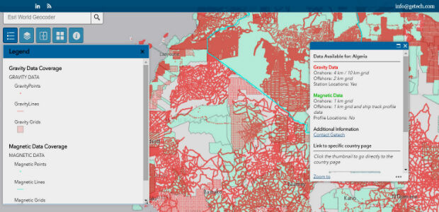
27th July 2017
Explore the World’s Geology with Getech’s Interactive Maps27th July 2017
Bluesky Aerial Photography Helps Yorkshire Water Keep an Eye on Assets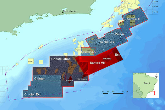
26th July 2017
CGG Extends Santos VII Multi-Client Survey26th July 2017
DroneMapper Chooses Global Mapper for UAV Imagery Processing26th July 2017
PCI Geomatics to Celebrate 35 years in Business25th July 2017
Shaping the future of spatial data management and analytics22nd July 2017
Cityworks Congratulates 2017 SAG Award Winners22nd July 2017
Brainnwave Expands in Geo with Quarry One Eleven21st July 2017
Interactive digital map of African political violence developed20th July 2017
LizardTech and Extensis Optimize Digital Asset Management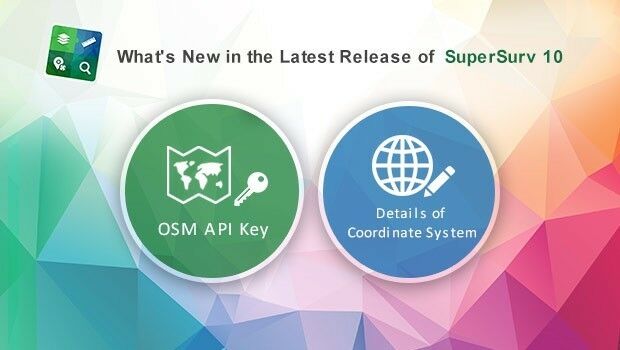
19th July 2017
What's New in the Latest Release of Award-Winning SuperSurv 10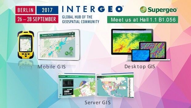
19th July 2017
Supergeo to Showcase the Latest GIS Products at INTERGEO 201719th July 2017
Partners in Innovation – HM Land Registry and Ordnance Survey