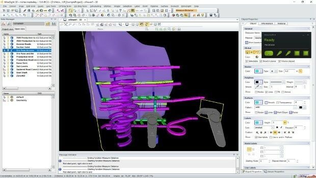
Hexagon adds virtual reality to improved mine planning solution
28th June 2018
Hexagon adds virtual reality to improved mine planning solutionOGC seeks public comment on Part 1 of the Features and Geometries
28th June 2018
OGC seeks public comment on Part 1 of the Features and GeometriesGIS partnership strengthens disaster management in Southeast Asia
28th June 2018
GIS partnership strengthens disaster management in Southeast Asia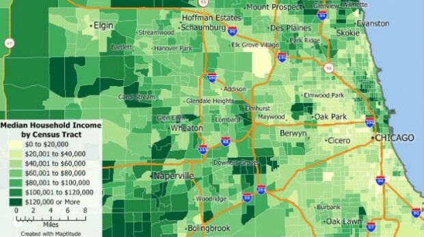

Juniper Unmanned Named 2018 Colorado Company
27th June 2018
Juniper Unmanned Named 2018 Colorado Company.jpg)
Trimble’s New Tunnel Solutions Streamline Workflows
27th June 2018
Trimble’s New Tunnel Solutions Streamline Workflows
OGC seeks public comment on Tile Matrix Set Candidate Standard
26th June 2018
OGC seeks public comment on Tile Matrix Set Candidate Standard
OpenPlant CONNECT Edition Deploys Bentley’s Innovative iModelHub
26th June 2018
OpenPlant CONNECT Edition Deploys Bentley’s Innovative iModelHub
New app enables employers to instantly locate staff in event of terror attack
26th June 2018
New app enables employers to instantly locate staff in event of terror attack
Women Presidents’ Organization Welcomes Blakelee Mills As Newest Member
26th June 2018
Women Presidents’ Organization Welcomes Blakelee Mills As Newest Member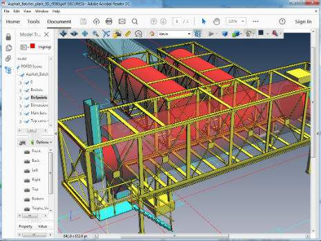
PDF3D Version 2.16 Focuses on CAD, CAE, Panoramic 360 and Engineering
26th June 2018
PDF3D Version 2.16 Focuses on CAD, CAE, Panoramic 360 and EngineeringthinkWhere In Pole Positions with of 8 Years of Quality Certification
26th June 2018
thinkWhere In Pole Positions with of 8 Years of Quality Certification
KOREC launches Trimble’s GEDO IMS to key players in the UK rail industry
25th June 2018
KOREC launches Trimble’s GEDO IMS to key players in the UK rail industryAirbus and Planet join forces to bring new geospatial products to market
25th June 2018
Airbus and Planet join forces to bring new geospatial products to marketGEOMAKANI 2018 “3rd Geospatial Technologies Conference”
25th June 2018
GEOMAKANI 2018 “3rd Geospatial Technologies Conference”
Free Business Location Data for Use with Maptitude 2018
23rd June 2018
Free Business Location Data for Use with Maptitude 2018
GeoPlace and JAG(UK) help councils cut driver disruption
22nd June 2018
GeoPlace and JAG(UK) help councils cut driver disruption
Esri User Conference Highlights Where Mapping Technology Is Headed Next
22nd June 2018
Esri User Conference Highlights Where Mapping Technology Is Headed Next
Safe Software renews FME Certification for 1Spatial's Mary O'Brien
22nd June 2018
Safe Software renews FME Certification for 1Spatial's Mary O'Briencon terra and GEO Jobe announce partnership
22nd June 2018
con terra and GEO Jobe announce partnershipSafe Software renews FME Certification for 1Spatial’s Mary O’Brien
21st June 2018
Safe Software renews FME Certification for 1Spatial’s Mary O’Brien
Bentley Systems Acquires Synchro Software to Extend Digital Workflows
21st June 2018
Bentley Systems Acquires Synchro Software to Extend Digital Workflows
Ordnance Survey appoints Philippa Hird as Non-Executive Director
20th June 2018
Ordnance Survey appoints Philippa Hird as Non-Executive Director
Digitalisation and the question of “where?”
20th June 2018
Digitalisation and the question of “where?”
RIEGL to Attend and Present at the 19th Annual JALBTCX
20th June 2018
RIEGL to Attend and Present at the 19th Annual JALBTCX
Topcon releases new edition of MAGNET software suite
20th June 2018
Topcon releases new edition of MAGNET software suiteParticipation in Citizen Science Interoperability Experiment
19th June 2018
Participation in Citizen Science Interoperability Experiment
ObliMapper Transforming Drone Imagery into Actionable Visual Intelligence
19th June 2018
ObliMapper Transforming Drone Imagery into Actionable Visual Intelligence
PCI Geomatics Attend 39th Annual Canadian Symposium on Remote Sensing
19th June 2018
PCI Geomatics Attend 39th Annual Canadian Symposium on Remote SensingOGC Calls for Participation in its Indoor Mapping and Navigation Pilot
19th June 2018
OGC Calls for Participation in its Indoor Mapping and Navigation PilotCGG’s Helitem Shatters AEM Low-Frequency Barrier
18th June 2018
CGG’s Helitem Shatters AEM Low-Frequency Barrier
We are pleased to announce the GRASS GIS 7.4.1 release
18th June 2018
We are pleased to announce the GRASS GIS 7.4.1 release
Third 2018 URISA GIS Leadership Academy Announced
16th June 2018
Third 2018 URISA GIS Leadership Academy Announced
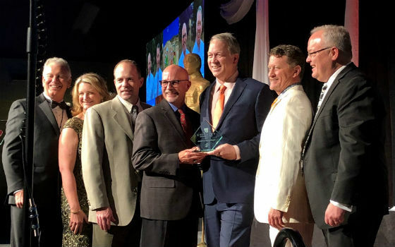
Bentley Systems Named 2018 Microsoft CityNext Partner of the Year
15th June 2018
Bentley Systems Named 2018 Microsoft CityNext Partner of the YearCGG Delivers Final PSTM Products for Dunquin Multi-Client Survey
15th June 2018
CGG Delivers Final PSTM Products for Dunquin Multi-Client Survey
PDF3D's Global Expansion Continues with IDI Collaboration in Japan
15th June 2018
PDF3D's Global Expansion Continues with IDI Collaboration in Japan
New Light Technologies and Boundless Announce Strategic Partnership
15th June 2018
New Light Technologies and Boundless Announce Strategic PartnershipGAF to provide consulting services in Mozambique
15th June 2018
GAF to provide consulting services in MozambiqueSun Moon Lake National Scenic Area Administration offers a mobile tour guide app in Shueili Che-Chen
15th June 2018
Sun Moon Lake National Scenic Area Administration offers a mobile tour guide app in Shueili Che-Chen

Mansfield District Council looks to Cadcorp web mapping to reduce GIS maintenance overheads
14th June 2018
Mansfield District Council looks to Cadcorp web mapping to reduce GIS maintenance overheadsNanotron wins Geo IOT World award for indoor location and proximity
14th June 2018
Nanotron wins Geo IOT World award for indoor location and proximity